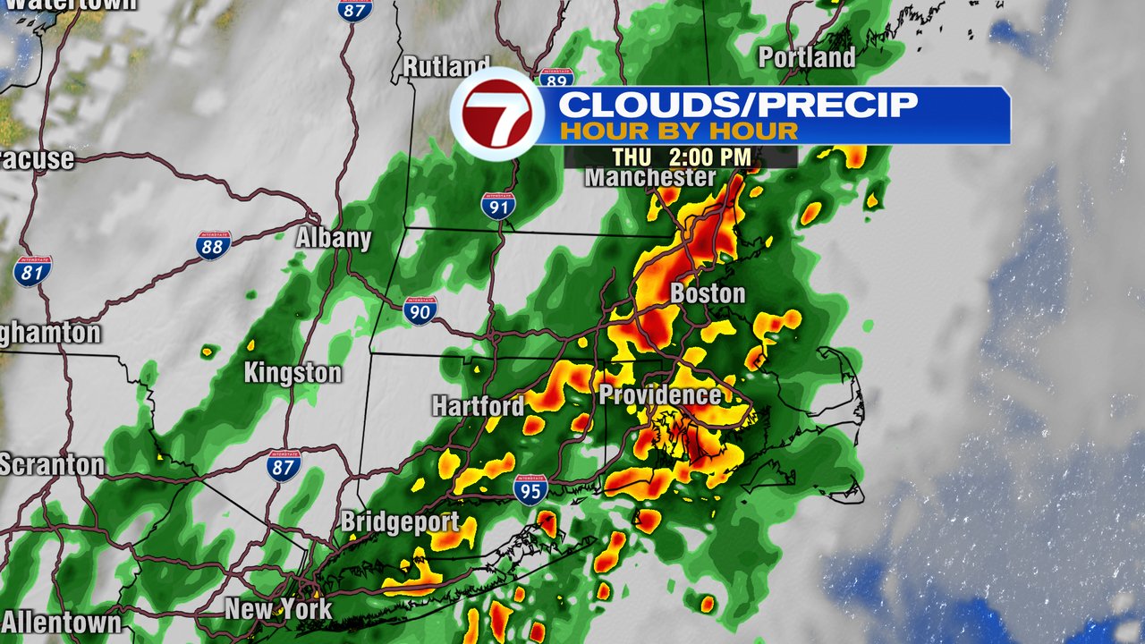
Waking up to wet weather this morning as scattered showers and storms rumble through with tropical downpours. The showers and storms early this morning push offshore mid to late morning, allowing for some lulls in the rain.
However, midday, through the afternoon and into the evening, more showers and storms reignite and that’ll cause concern for localized street flooding and even an isolated severe thunderstorm. As some of the tropical downpours line up and run over the same areas for an hour or two, a quick 1-3″ of rain fall, creating the opportunity for street flooding and poor drainage flooding in the typical flood prone spots.
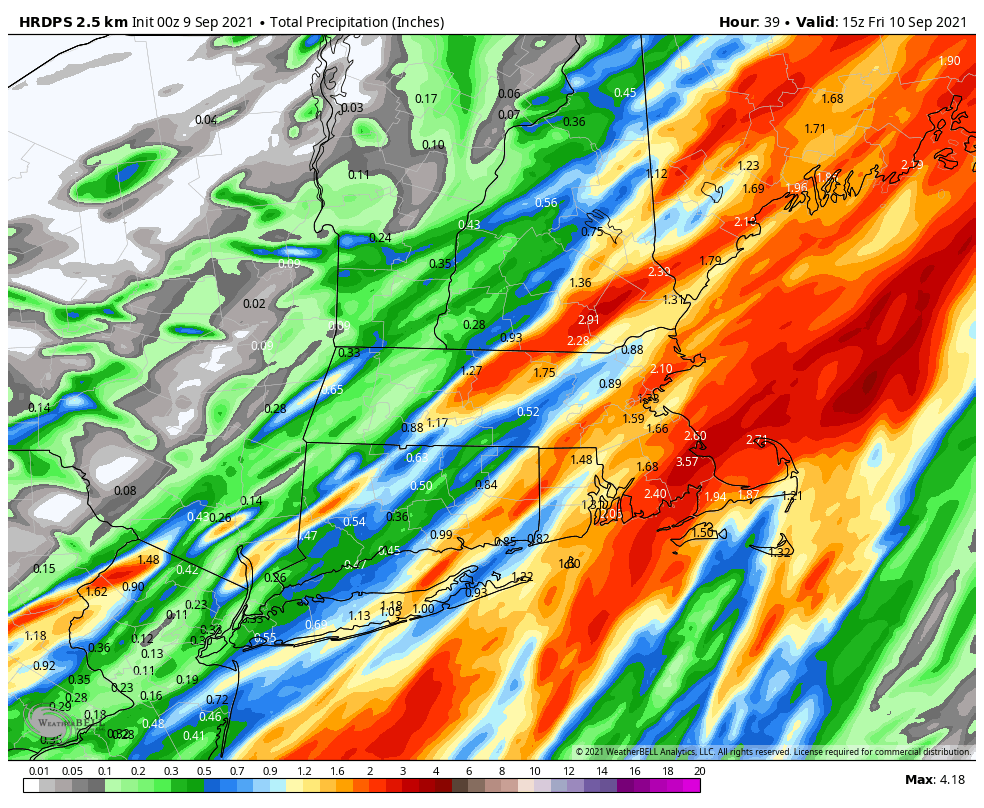
Below is an example of the rain expected through the evening. Generally 1-3″ fall, areas that see the heaviest won’t exactly match up with the model below, but does give a general idea of what to expect across Southern New England.
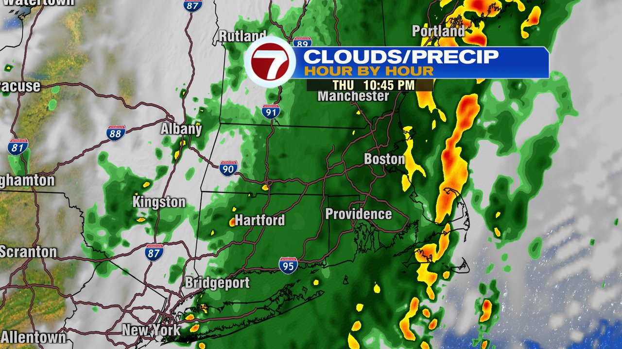
Showers and storms linger through this evening as the rain waits until afternoon midnight to taper off. As rain tapers off, humidity lowers and will continue to slide down through tomorrow.
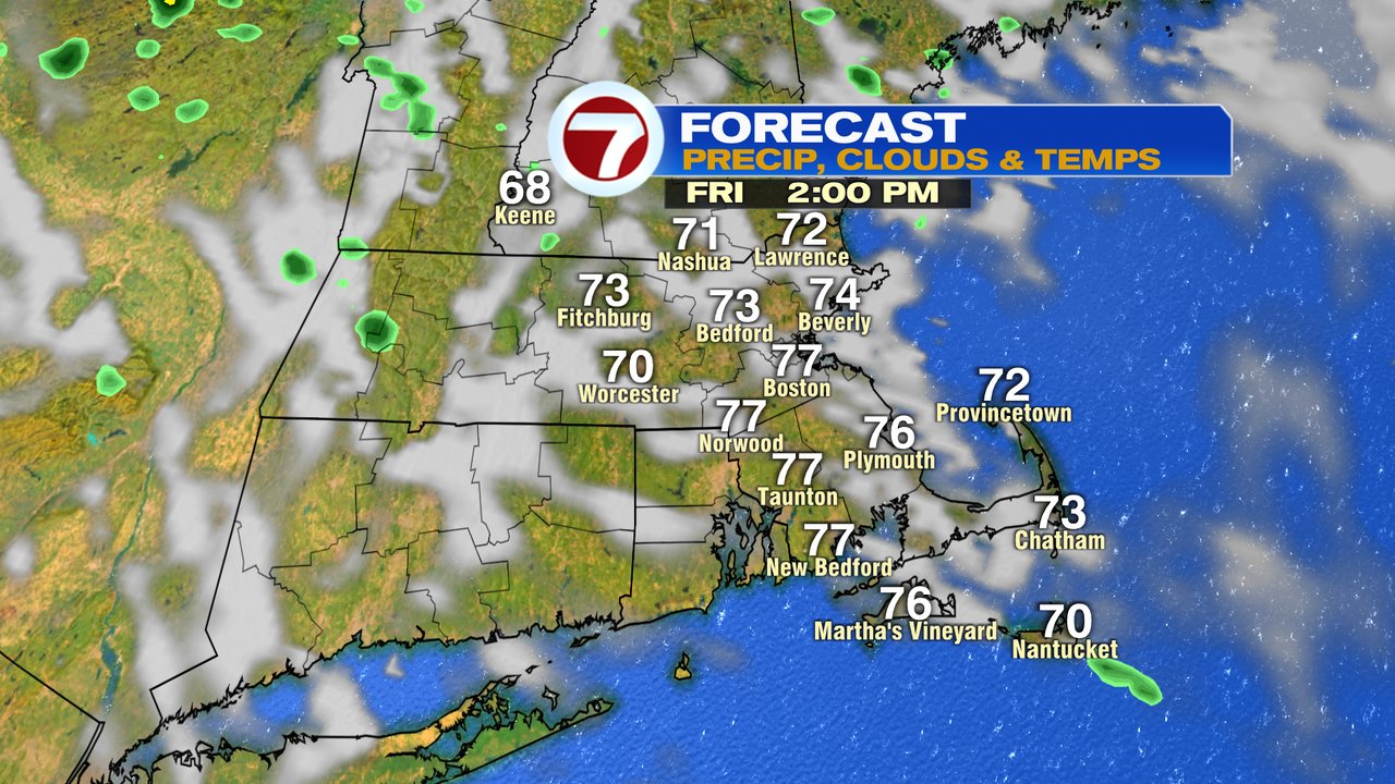
Overall, Friday is solid with a mix of sun and clouds and temps in the mid to upper 70s. Although a spot shower can’t be ruled out, they’ll be few and far between and brief. Bottom line, much of your Friday is dry and great fire pit weather settles in Friday – Saturday as low humidity wins out. Saturday looks awesome, top 10 day, just like last Saturday.
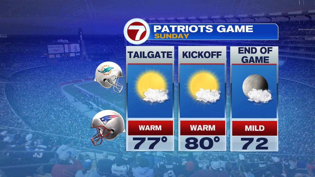
Sunday looks good too. Warmer, a bit more humid with temps in the low 80s. Go Pats!