Hot and humid for your Saturday with highs stretching into the upper 80s ahead of a cold front that will trigger some strong thunderstorms later this afternoon.
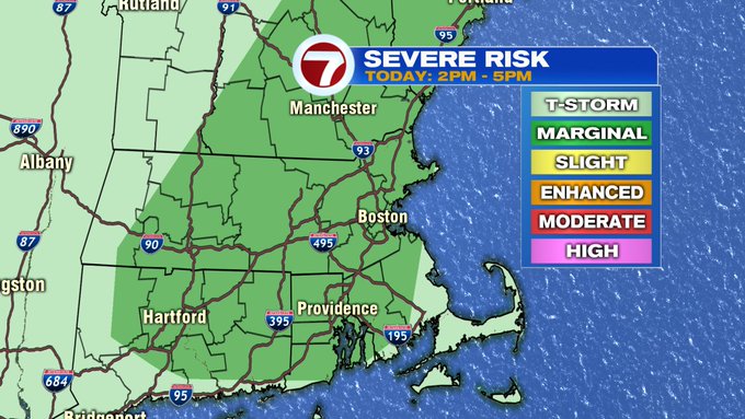
Between 2pm and 5pm is the best chance for the thunderstorms to bubble up so be sure to be weather aware during your Saturday afternoon outdoor plans.


If your afternoon plans take you to the coast today, the rip current risk has been elevated to moderate.

The main threats with the thunderstorms this afternoon will be strong winds, lightning, along with small hail.
A few lingering showers ahead of sunset, then we’ll see a clearing of the skies overnight. Lows slide back into the upper 50s as humidity continues to fade.
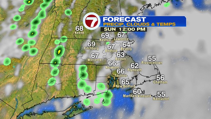
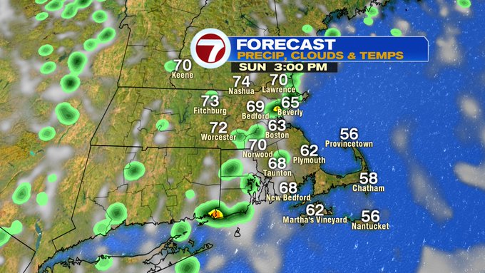
Sunday features more seasonable and more comfortable conditions with dewpoints around 50 and highs in the low 70s. A few afternoon sprinkles cannot be ruled out, but overall, the bulk of the day is dry.

The lower dewpoints stick around to start off the work week with Monday and Tuesday bringing mainly sunny skies, lower humidity and highs into the upper 70s to low 80s both days.


The clouds begin to increase mid to late week with a few showers possible late Thursday night into Friday, otherwise, mainly dry conditions prevail for most of next week.

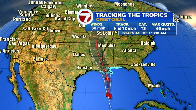
As for a tropical update: Tropical Storm Cristobal gained strength overnight over the warm waters of the Gulf of Mexico. Cristobal is expected to advance northward, towards the Gulf Coast, over the next 24 hours. Storm surge and tropical storm force winds will likely arrive early Sunday morning along the Louisiana, Mississippi and Alabama coasts. Cristobal will then advance inland and continue to weaken through early next week.