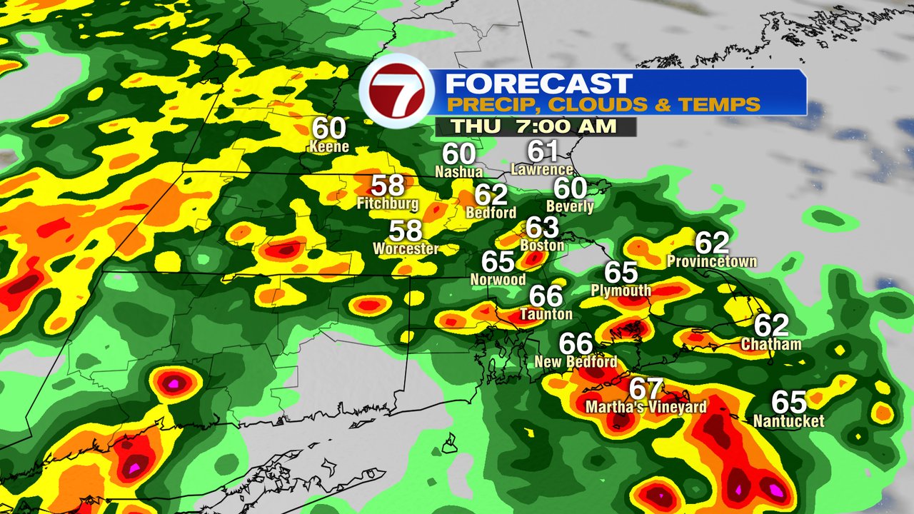
More soaking rains are inbound for the morning commute, with the most widespread showers and storms between 6-10am. After 10am, we’ll start to see breaks of sun moving in from west to east, but there will still be enough instability and moisture left to fire off a few isolated thunderstorms.
Downpours this morning will be capable of producing over an 1″ of rain in a short amount of time, where the heaviest rain falls. For sure, it’ll be a stormy morning commute overall, so allow for some extra time to get to your destination.
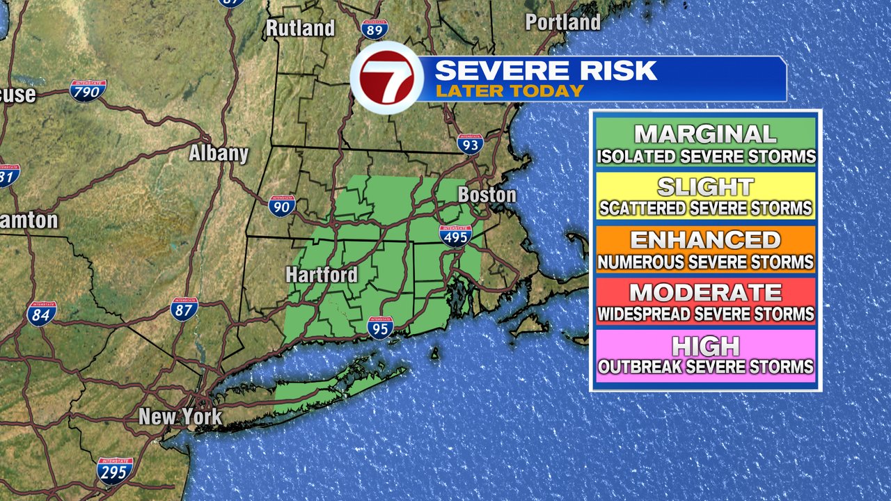
While the highest risk from these storms today is localized downpours creating street flooding/poor drainage area flooding, an isolated severe thunderstorm can’t be ruled out. There’s a lot of wind just above the surface, so isolated damaging gusts are possible. Low risk too of some rotation in these storms. We’ll keep a close eye on the radar.

We dry out tonight and lower humidity. That’ll set the stage for a great looking Friday with highs near 80, some sunshine and humidity in check.
The weekend looks seasonable, temps in the 70s. At this point, it looks like most of the rain will avoid southern New England and any shower late Saturday would be isolated. Monday features a better chance for showers.