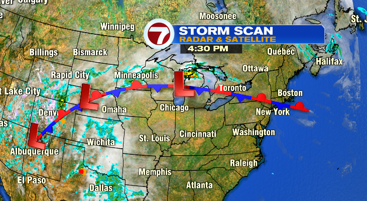
A stubborn stationary front will be our weather story for the next 3 days. That front will have two main impacts for us: temperatures and rain chances.
Temperatures:
The front is the dividing line between the warm and cool air. You can see that here on the national temperature map. It’s easy to find the front.
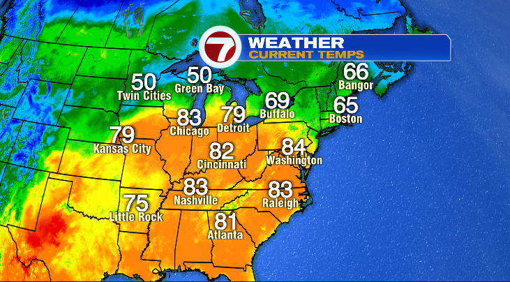
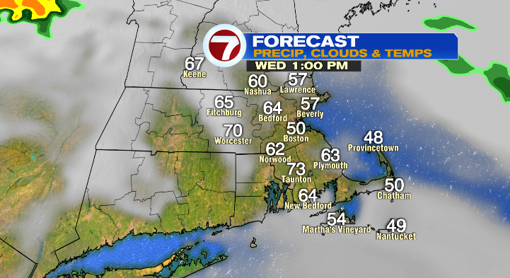
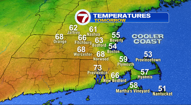
As that front tries ever so hard to push into New England tomorrow it will drag some warm air with it… for some of us. Warmest temperatures will be south and west of Boston and cooler temperatures north of the city and on the coastline.
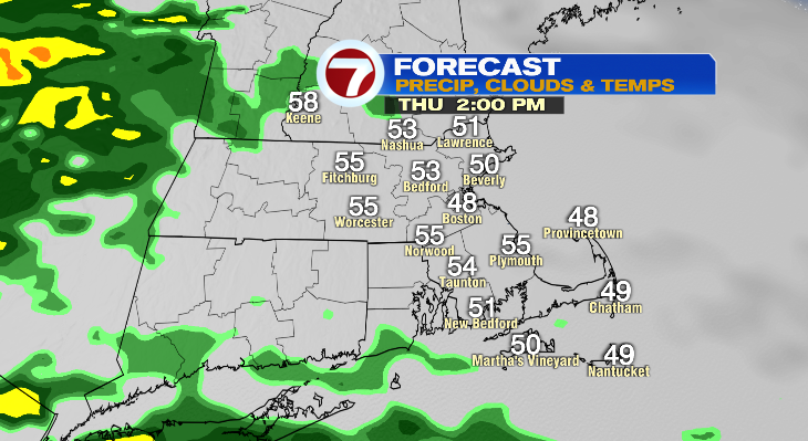
Rain Chances:
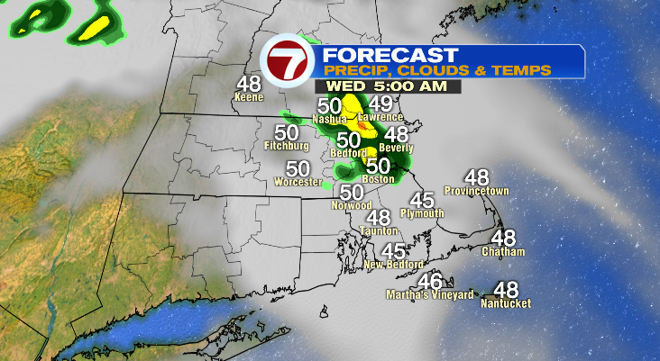
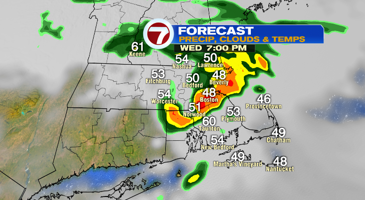
Wednesday, Thursday, and Friday will all feature rain chances. The wettest of the days will be Friday. And if you have outdoor plans Wednesday or Thursday, they’re far from washouts. We’ll get a few showers early Wednesday with most of the day being dry. A second push of showers and maybe a rumble of thunder will slide through in the evening.
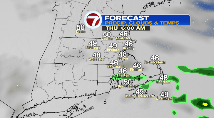
Thursday is cloudy and starts dry outside of a sprinkle. Light rain returns Thursday afternoon once again.