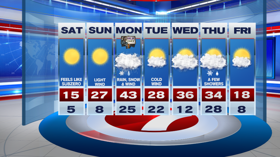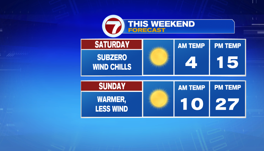
7Weather- We’ll have subzero wind chills today, but it won’t be as cold to end the weekend on Sunday. Up next we’re looking as rain/snow and wind Sunday night into Monday.
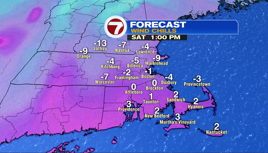
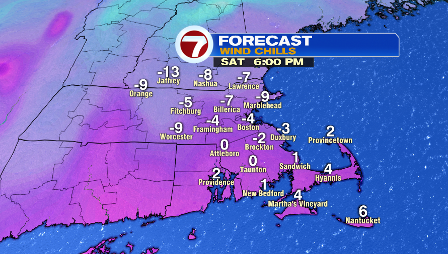
Let’s start with the rest of today. We’ll continue to have clear skies and feels like temperatures improve at least a little bit into the afternoon. Grab all the of layers if you have dinner plans this evening. Wind chills will be at -5º to -10º.
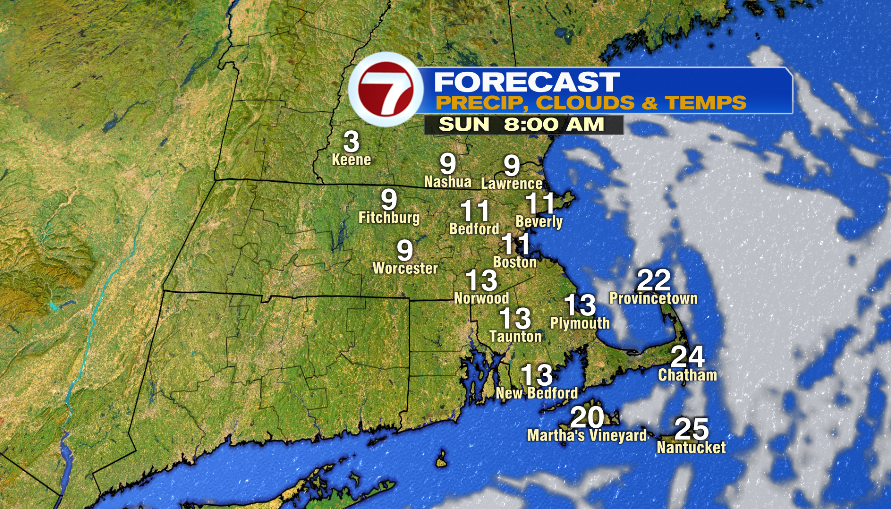
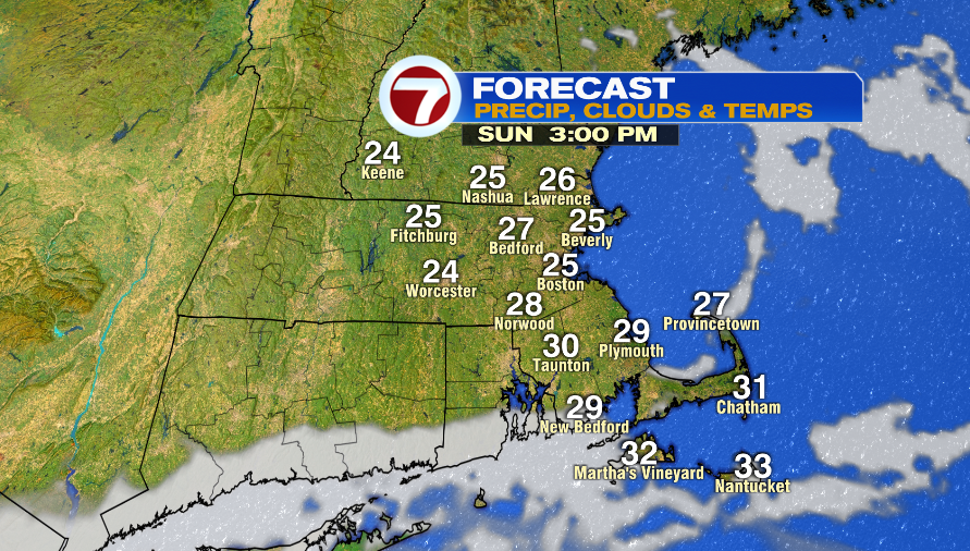
Sunday is the pick of the weekend! Yes, it starts cold in the single digits and teens, but we get into the mid and upper 20s in the afternoon.
The key to the 20s “not feeling so bad” is not having any wind around, and that’ll be the case tomorrow afternoon.
MESSY MIX SUNDAY NIGHT – MONDAY MORNING:
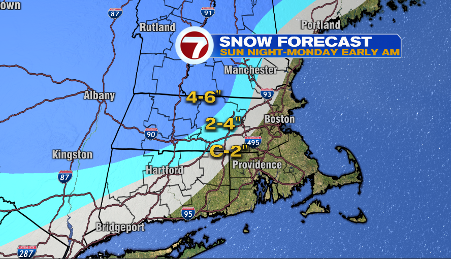
Snow Forecast:
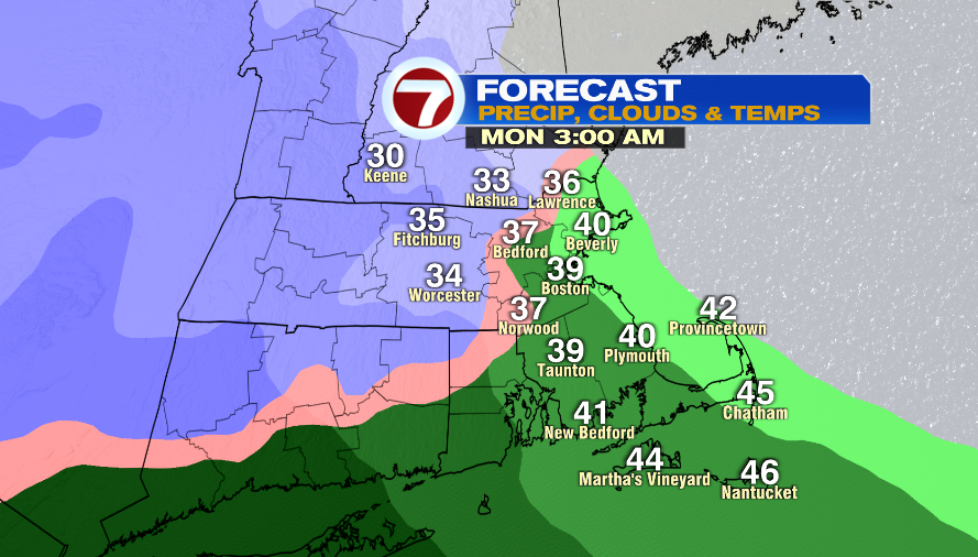
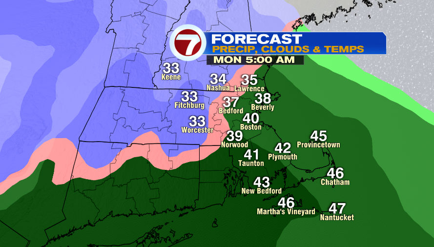
This snow will fall from 2-7AM Monday. We’ll see a changeover to a wintry mix, and then eventually rain. If you’re not up early enough you might miss these snow totals with the rain washing out some of the accumulation.
- Coating -2″: Areas north and west of 128 and inside of I-495. Some locations in this range: Methuen, Billerica, Stow, Ashland, Northbridge, Douglas
- 2-4″ (light blue): Parts of Worcester & Middlesex Counties. Some locations in this range: Nashua, Pepperell, Sterling, Worcester, Southbridge
- 4-6″ (darker blue): Northern Worcester County and parts of Cheshire & Hillsboro Counties. Some locations: Keene, Garner, Barre, Athol
Timeline:
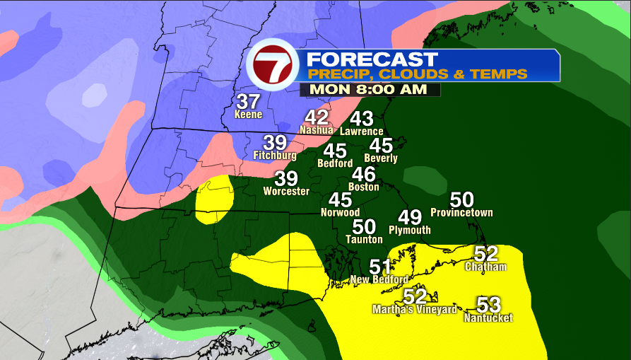
Areas inside of I-495 will get a quick burst of snow, and then the precipitation quickly changes to rain.
Northern/central Worcester County and northwest Middlesex County & Cheshire and Hillsboro Counties will have about 4 hours of snow before the changeover to a wintry mix.
- First flakes: 12-2AM
- Heaviest snow (NW of I-495): 3-7AM
- Changeover to Wintry Mix/Rain: 6-9AM
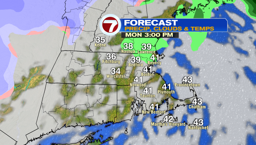
- Moving out: 11AM-1PM
- Some clearing possible before sunset
Wind:
It’s a fast-moving storm, but it’s a strong system with some wind engery.
The North Shore, South Shore, and the Cape and the Islands will get strong winds between 5AM – Noon Monday. This could lead to isolated power outages.
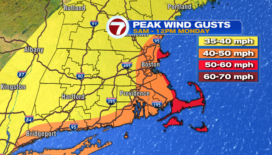
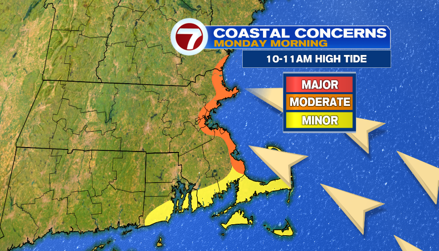
There will be a persistent, strong, southeast wind Sunday night into Monday morning. This could lead to minor to perhaps moderate coastal flooding during high tide at 10-11AM Monday morning.
We’ll have a cold wind Tuesday that will make it feel like the teens in the afternoon. We go back to the mid 30s on Wednesday and Thursday with lots of clouds around. There is also a chance of a few showers on Thursday.