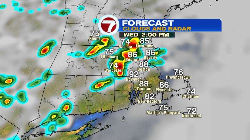
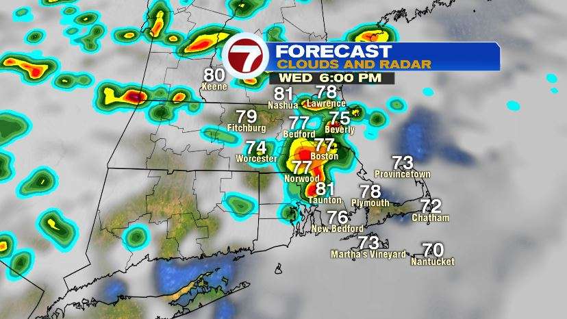
Today was our last day of heat without the humidity. In fact the humidity will be returning as soon as tonight, so it might be a good idea to turn on the AC tonight and close up the windows. As the humidity increases, it’s adding a ton of moisture to the atmosphere. That means when storms spark tomorrow afternoon and evening, they’ll move through in the form of downpours.
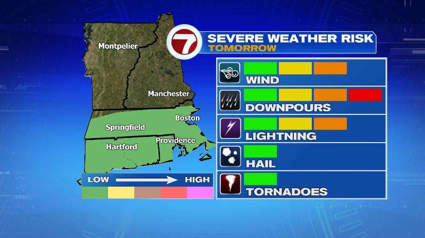
The severe risk is low with these storms, but it’s not zero. In fact these storms can be traced back as the remnants of Barry which made landfall in Louisiana on Saturday. The showers, storms, and downpours will continue on and off from Wednesday afternoon all the way through Thursday. Below is a timeline of the showers, but it shouldn’t really be taken at face value. The storms and downpours will be scattered and that’s the take away. Along with the general time frame storms will be in the area.
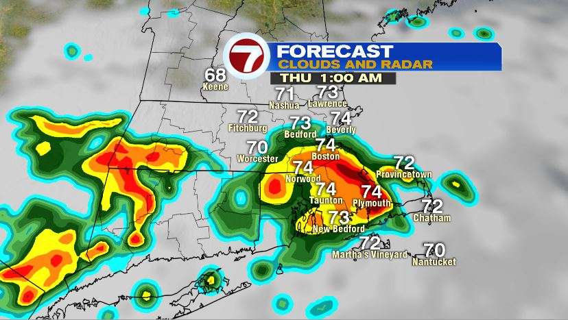
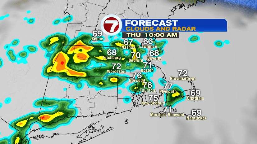
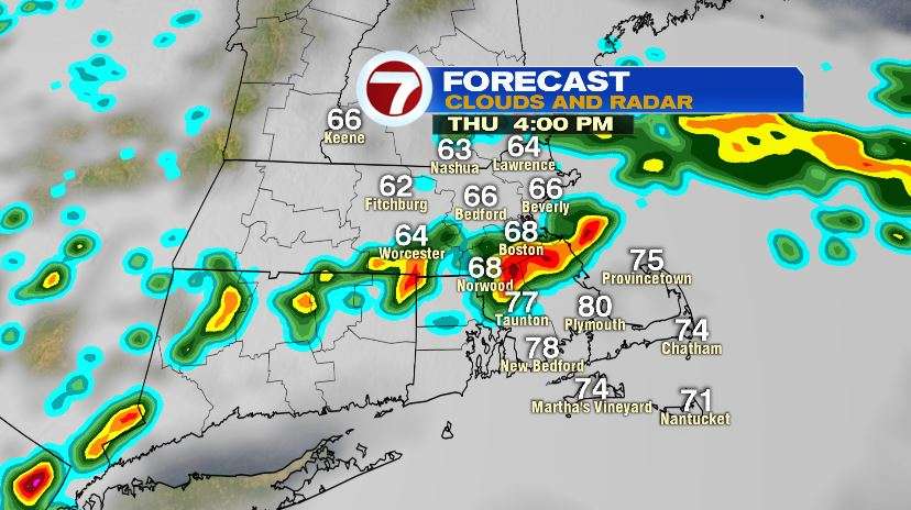
Once the showers move out, it’s all about the heat. We’ll return to the 90s by Friday and continue with mid to upper 90s through the weekend. The difference between this heat and the rest of this month, the humidity will accompany it. For most of July we’ve had a “dry heat”. Not the case this weekend. The humidity will take the 90s and make it feel like the triple digits both Saturday and Sunday! In fact I think some records will be challenged both Saturday and Sunday. Below are some of the standing records for a few communities around the area.
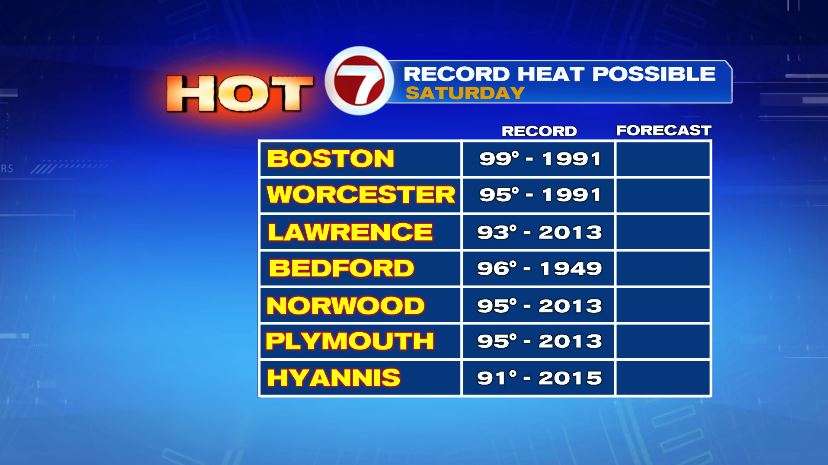
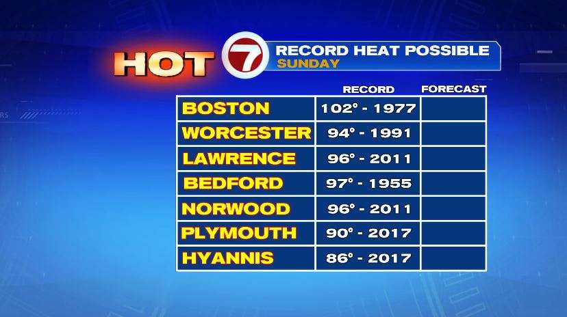
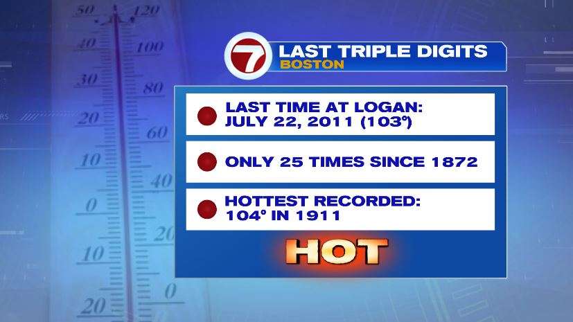
Saturday especially, I wouldn’t be shocked to see an actual air temperature hit 100 for interior spots like Norwood, Bedford, and the Merrimack Valley. Boston at Logan might be stuck in the upper 90s with the cooling effect from the Ocean. BUT, if Logan were to record an air temperature of 100 degrees, it would be in rare company. It’s only happened 25 times since temperature records began back in 1872.