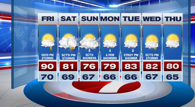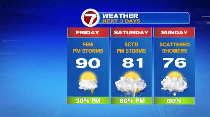
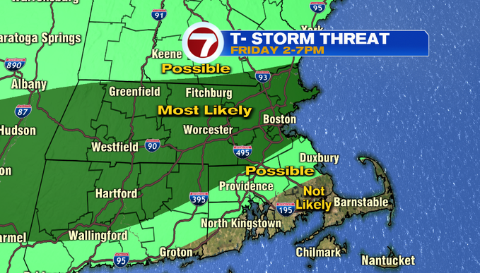
The humidity coupled up with the 90-degree heat will be with us to round out the week. Not only are we tracking the heat and the humidity, but an isolated threat for afternoon thunderstorms. These won’t be widespread, but they will pop up northwest around 2pm, then move southeast towards the North Shore and Boston between 5-7pm and fizzle out ahead of sunset.


However, lets not forget that we did see the sunshine today with highs stretching to the upper 80s to around 90 inland, cooler at the coast due to some patchy fog and an onshore breeze. Tonight, we’ll see partly cloudy skies with overnight lows into the upper 60s to low 70s.
Tomorrow, the onshore breeze will not be a factor for our coastal locations as we’ll have a southwest breeze from 10 to 15 mph keeping the seabreeze out. This means highs will stretch to around 90 even to Boston ahead of the thunderstorm threat into the afternoon. It’s not a washout, but just be weather aware for your outdoor afternoon plans.

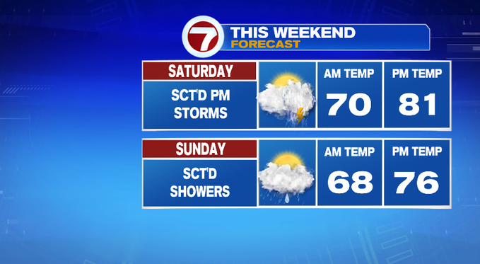
For the weekend, we have a low pressure trailing a cold front that will throw shower and storm chances our way.
For Saturday, it will be an afternoon thunderstorm threat while Sunday looks to be scattered showers. Sunday will be slightly cooler than Saturday, but both days will be muggy.
Next week also features shower chances, but not widespread or tropical downpours. These will be passing showers/storms Monday afternoon, Tuesday afternoon, as well as Wednesday afternoon. Thursday looks to break that pattern under partly cloudy skies and highs around 80°.