What a day we had yesterday! Highs reached the mid 70s to lower 80s with sun-filled skies and low humidity. Today, we’ll add another several degrees while keeping mostly sunny skies. Although dew points do drift up into the low 50s, humidity will still be at pleasant levels. In addition, a 10-18mph breeze will help make in a comfortably warm day.

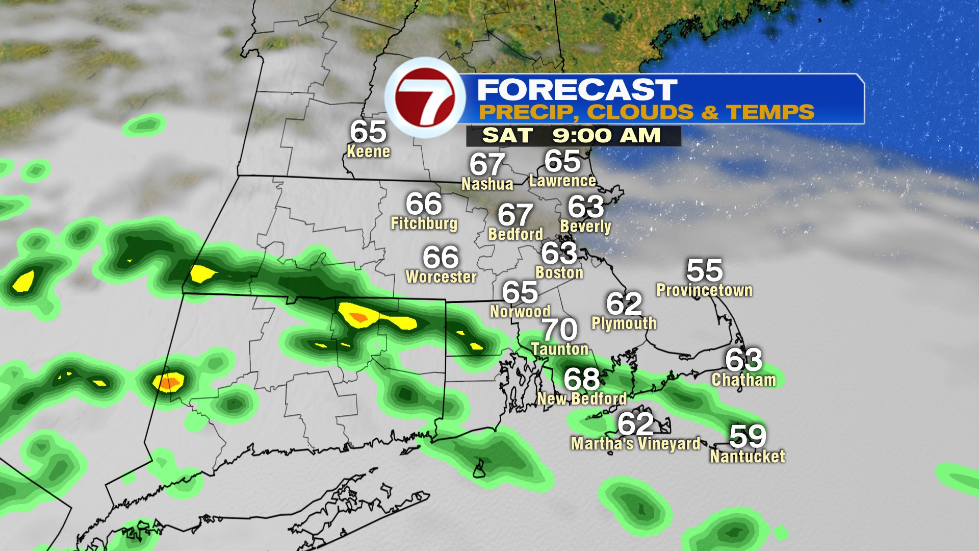
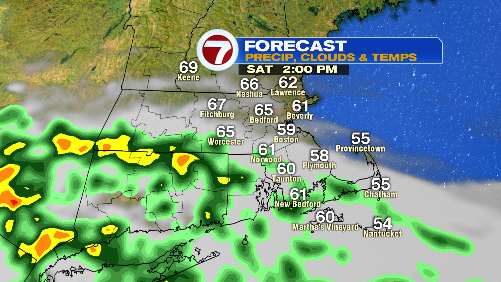
The weekend forecast does turn much cooler, and we’ll also track a few showers tomorrow. The highest risk for a few isolated showers near and south of the Mass Pike will be in the morning. The farther south you go, the higher the risk of those showers being more widespread and lingering through midday. CT, RI and towns south of Route 44 in SE Mass, look to have the best chance of a gloomier day with clouds and showers winning out. Across northern Mass and Southern NH, sunshine returns in the afternoon as temps hold in the 60s there, but fall into the 50s along the coast, and through Southeast Mass.
Sunday turns brighter, but stays cool as highs hold in the 50s at the coast, and warm into the 60s inland. Monday turns cloudy to partly sunny with highs 65-70 inland and hold 55-60 at the coast. We’ll shake off the cooler air next week and head into the upper 70s Tuesday and 80s for the rest of the week.