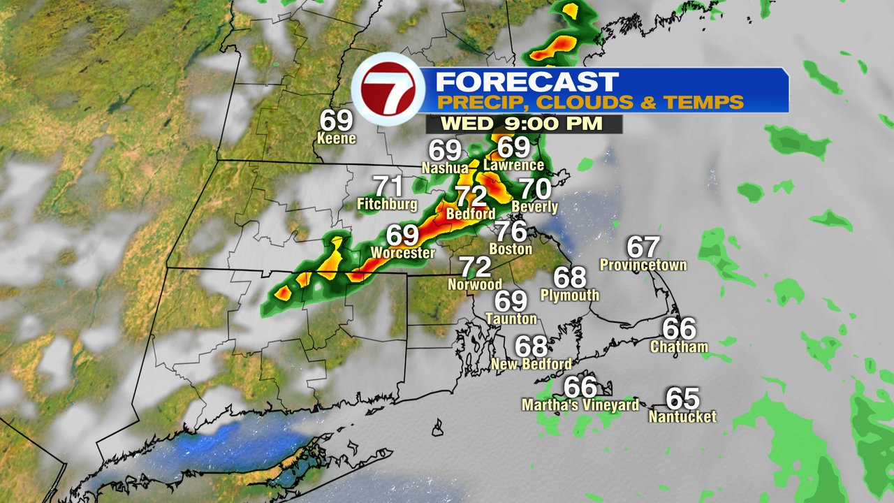
A cool and cloudy pattern for sure the last couple of days held afternoon temps near 70 degrees for many. While it appears to be a repeat pattern early this Wednesday morning, we will start to see changes this afternoon as some sun breaks back out.
Before we get there, locally dense fog is an issue this morning with visibility reduced under a quarter mile at times for many communities in central and eastern Mass. A dense fog advisory is in place through 10am.
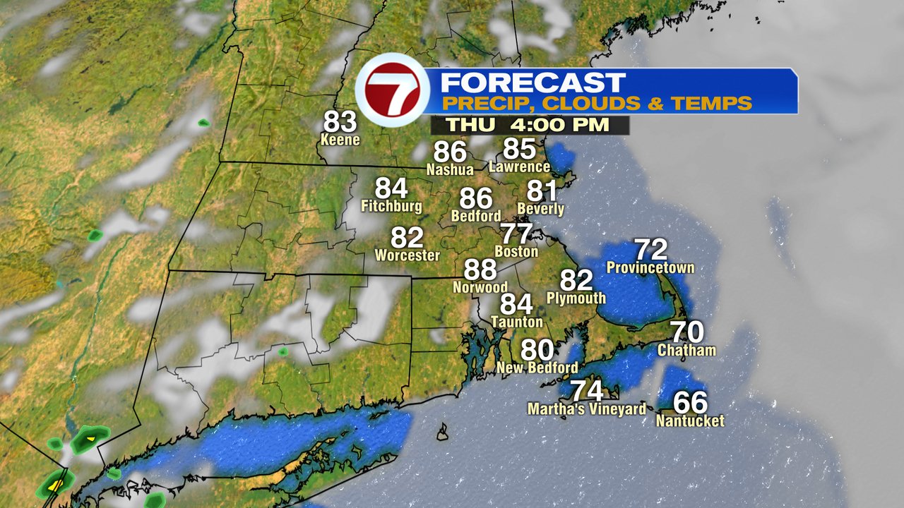
The fog and clouds break for some sunshine this afternoon and as it does, temps warm up into the lower 80s and dew points jump into the 70s. A warm and humid afternoon for sure as that returning sunshine makes for a summery feel to the air again. With the warmth and humidity, a round of scattered storms fires up late in the day as thunderstorms move from northwest to southeast from 5-10pm. A few of the late-day storms could be severe west of 495, so we’ll keep an eye on that for the potential of damaging wind gusts.


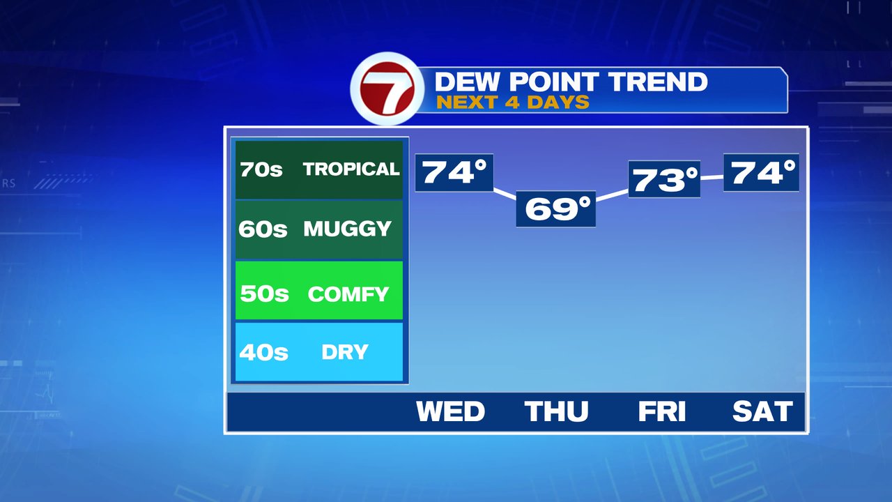
Dew points rise into the 70s today and stay high over the next several days, especially after all the rain we’ve had recently, There will be a lot of water vapor in the air.
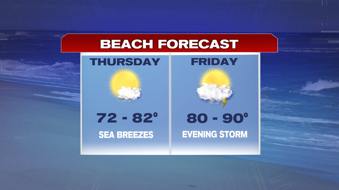
We do bring in a couple good beach days tomorrow and Friday. Any thunder threat won’t be until late-day Friday, leaving most beach hours dry as temps head up into the 80s to near 90. It be cooler at the coast tomorrow however, as sea breezes hold temps in the 70s to near 80.
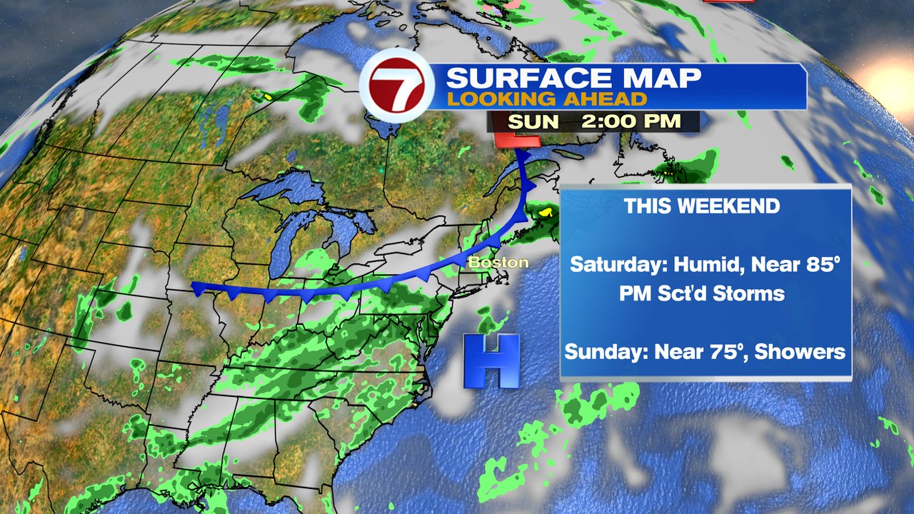
Scattered storms return Saturday and scattered showers linger Sunday.