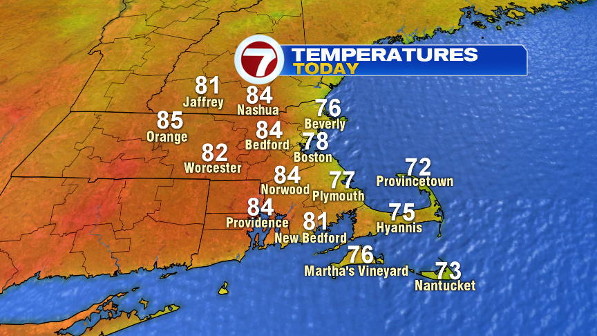
What a finish to the weekend yesterday with sun-filled skies and highs running into the mid 80s with low humidity. This morning, we pick up right where we left off as sunny skies and low humidity greet us this morning. The difference maker today will be the wind direction. The breeze turns east this afternoon, and that’s when the temps at the coast go from the upper 70s, back into the upper 60s to near 70. Inland, highs run in the lower to middle 80s. The humidity remains in check through the day.
The humidity rises tomorrow but with lots of clouds and wet weather moving in will limit temps to near 70 during the afternoon. Showers arrive near the end of the morning commute and the heaviest rain potential is mid to late afternoon as embedded thunderstorms with localized downpours are possible. Rain tapers off in the early evening hours, but may hold on just long enough to delay the start of the Sox game.


Mid to late week, the warmth builds in with temps away from the coast well into the 80s. In fact, a few towns may nudge 90 Thursday and Friday, at least across the interior. Any pop-up shower or storm is limited/isolated in nature mid to late week, although a better chance for scattered storms develops Saturday late afternoon. Scattered storms will likely hang on Sunday too.
