

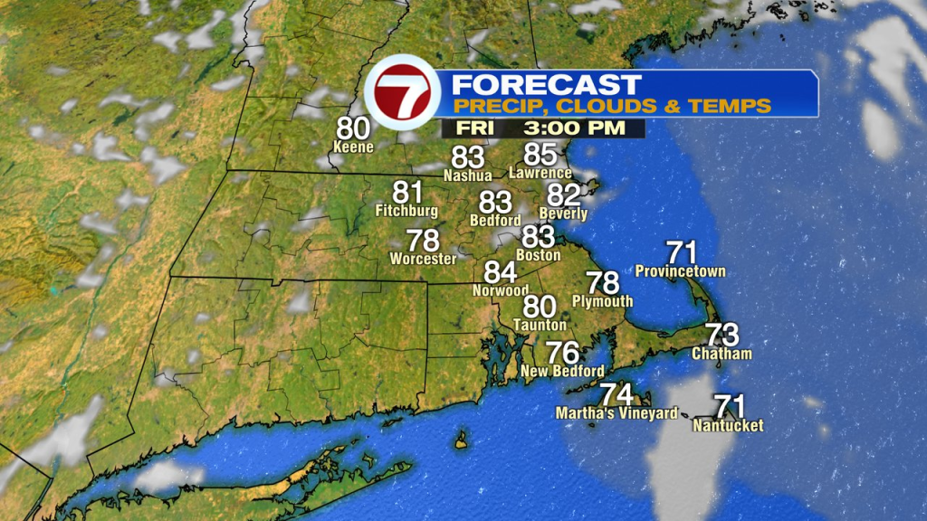
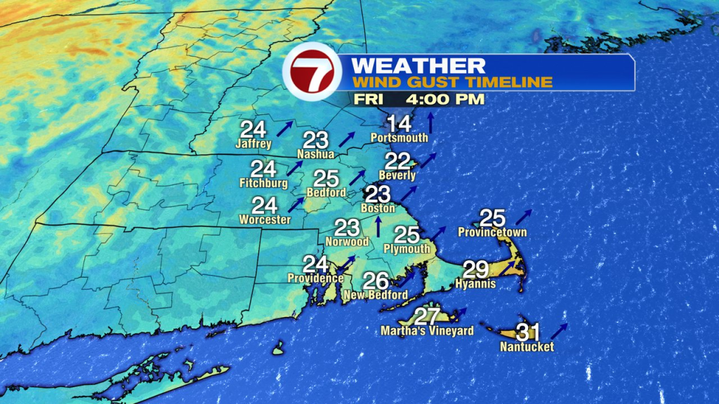
A batch of early morning showers dropped some wet weather across the area, but most of those showers dry up by 8am. Mid to late morning, the sun breaks out and sends temps soaring into the low to mid 80s. The breeze picks up out of the south too, gusting 20-30mph.
It’ll be a mild night tonight with lows in the 60s to near 70. Muggy too.
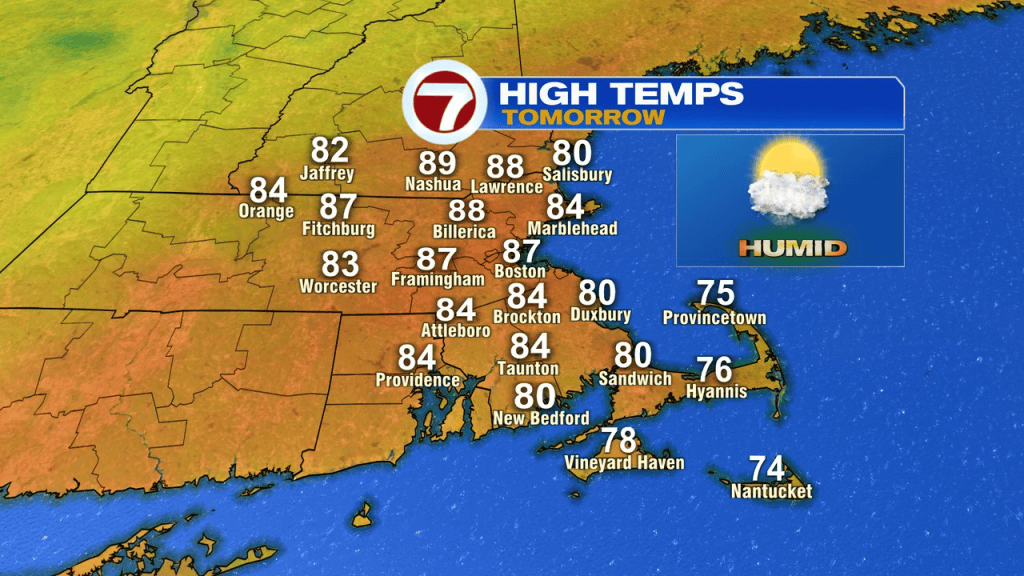
The breeze is busy tomorrow out of the southwest again as any patchy low clouds break for some sun. Temps launch into the mid to upper 80s away from the south coast. We’ll be on the look-out tomorrow afternoon for storms to develop too. Mid to late afternoon storms near and northwest of 495 will be locally strong to severe with damaging wind gusts and downpours. The storms will tend to fade in intensity as they near the coast early in the evening.
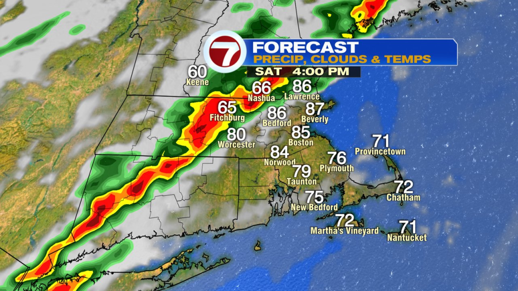
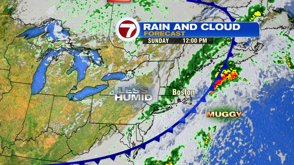
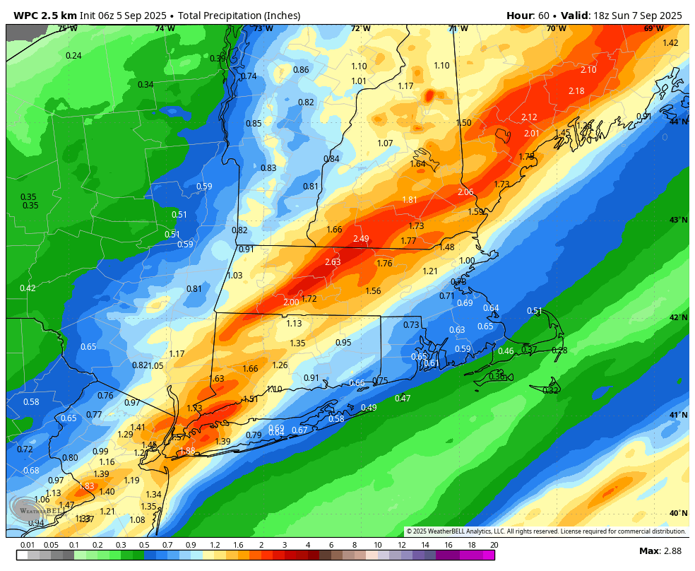
Sunday, we’re behind the cold front, so it’ll be much cooler. However, a lot of clouds linger and the chance for showers still exists. The highest rain totals through the weekend favor where the heaviest storms set up tomorrow afternoon/evening.
Next week, we’re back to September cruise control. Low humidity, sunshine and high in the 70s are back. Overnight lows fade back into the 40s and 50s.