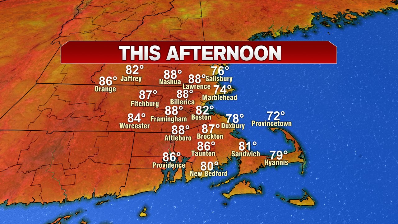
It took a while yesterday, but as the sunshine gradually broke out from west to east, temps did warm up well into the 80s away from the coast. Today, we’ll have a similar feel to the air, just add a few more degrees. That’ll put highs in the mid to upper 80s inland and mid 70s to low 80s at the coast.
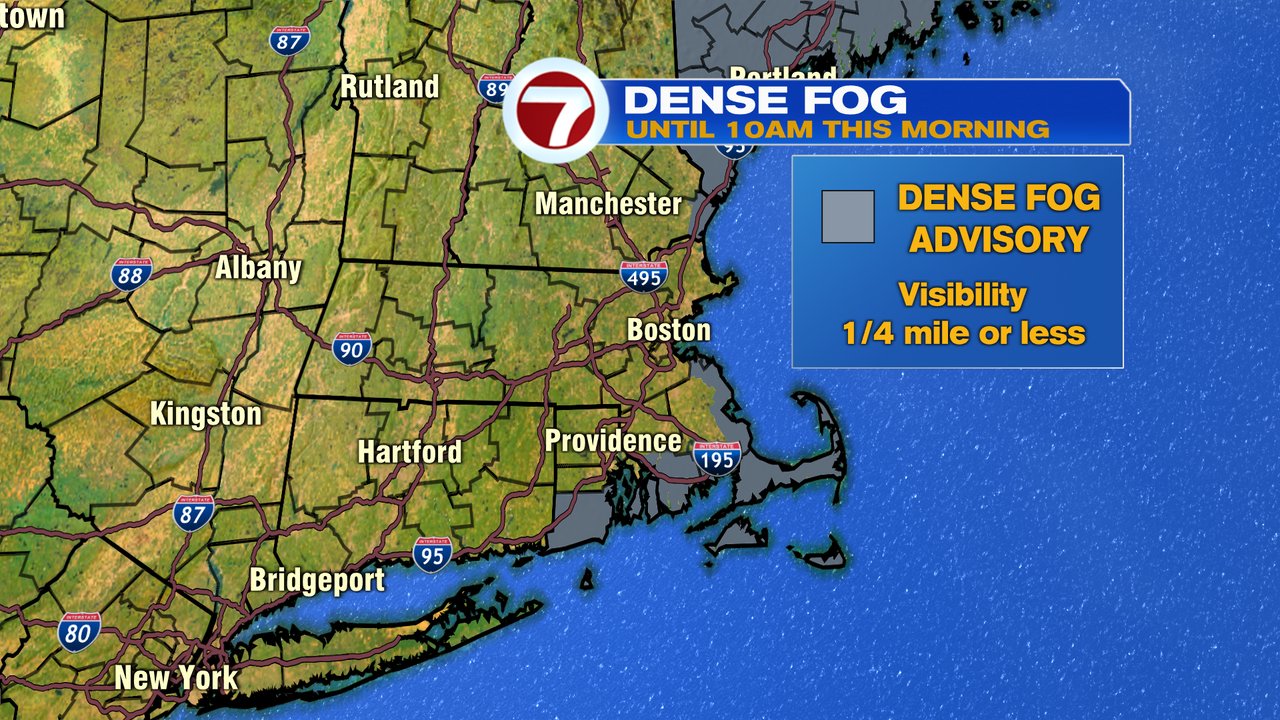
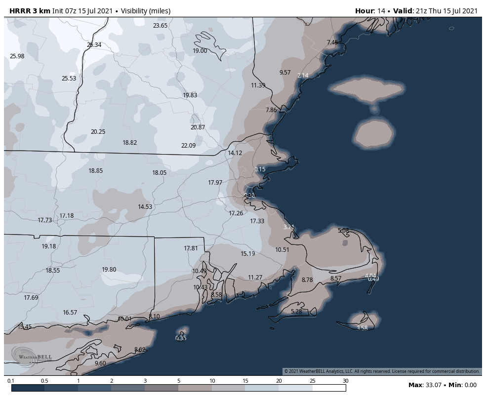
Before we get there though, we do have some locally dense fog this morning across Southeast and Northeast Mass. While patchy fog burns off quickly inland, it’ll take longer along the coast. Even there, some sunshine is likely by midday. One fly in the ointment to the beach forecast today will be the marine layer/fog bank offshore. As breezes turn onshore, there could be some low clouds and fog that are in and out around Boston and the North Shore/Cape Ann this afternoon. Temps at the coast will be cooler too, mid 70s to near 80 vs the mid to upper 80s inland. No thunder threat today.
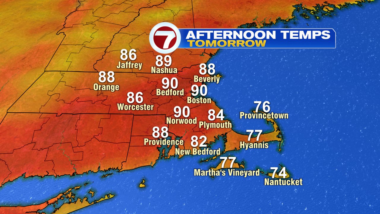
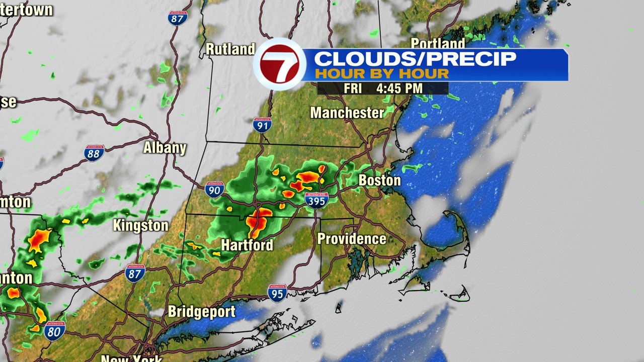
A few scattered storms return tomorrow afternoon as high heat and humidity combine to make it feel uncomfortable at times. Highs top off around 90. Localized downpours and gusty winds will be the main threat as we watch for localized flash flooding since the ground is saturated.
The weekend features some scattered storms Saturday afternoon and some linger showers that are in and out on Sunday as well.