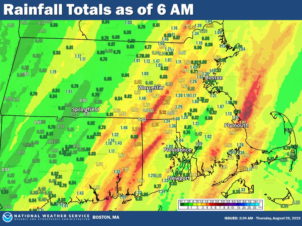
Lingering showers across the Cape and Islands end this morning as sunshine returns from west to east. While the rain yesterday afternoon and last night did cause localized street flooding and slow downs on the roads, it was a mainly beneficial rain as most lawns and gardens got doused with 1-3″ of rain.
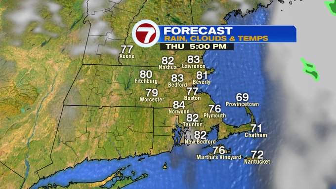
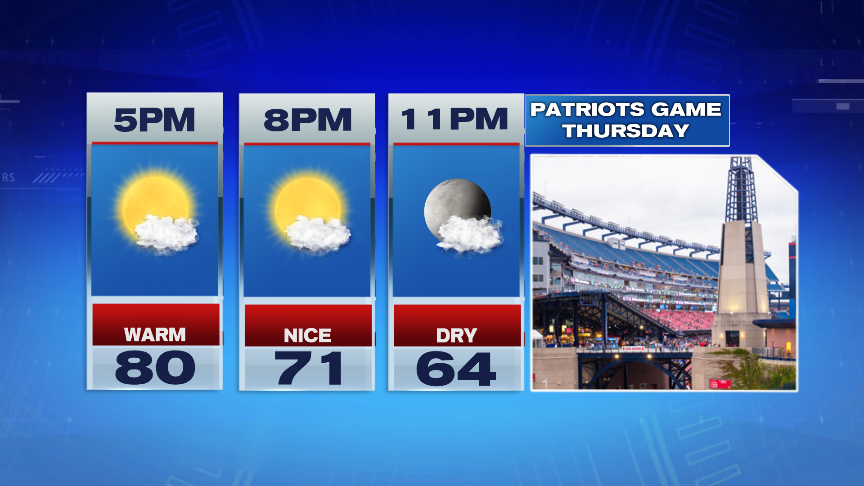
As the sunshine breaks out later today, highs will jump back into the lower 80s as humidity drops off a bit too. Overall, a nice late summer afternoon is ahead of us and a great evening to take in some football at Gillette!
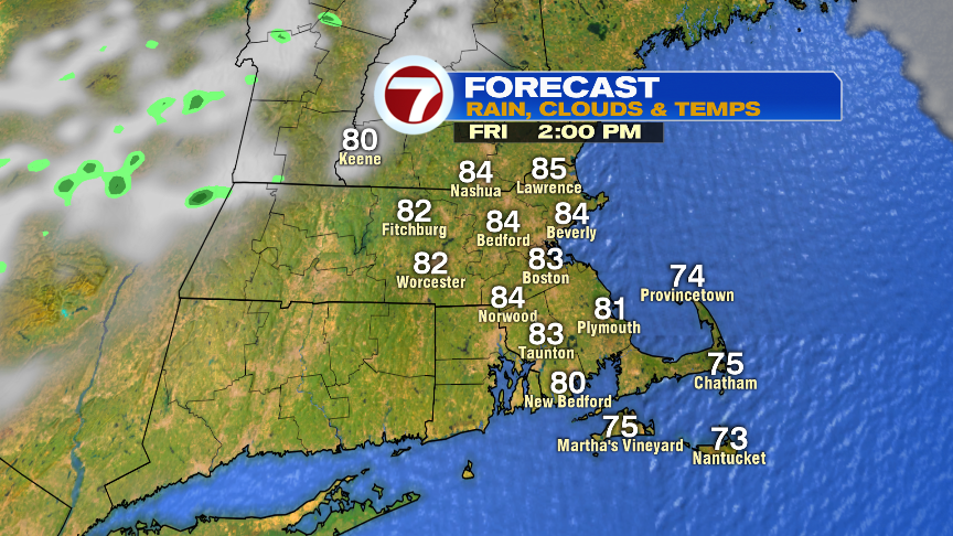
Tomorrow looks good too as summer sun wins out, temps jump into the mid 80s and we’re dry through late afternoon. After 6pm, there may be a passing shower northwest of Boston as a cool front drops in, but much of the evening will be quiet too.
The weekend temps drop into the upper 70s Saturday with mostly sunny skies, low 70s on Sunday with thickening clouds, then 70s with a few showers on Labor Day.
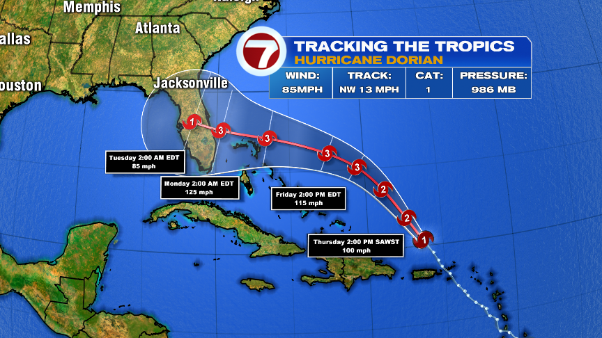
Over the weekend, Hurricane Dorian will approach Florida, perhaps as a major hurricane (cat 3 or higher). We’re still a couple days away from narrowing in on location of landfall, but all eyes in the Southeast will be keeping tabs on Dorian closely. We’ll keep you updated on air and online too.