Something special about that spring sunshine and when it goes away, even for a day, is such a buzzkill. Thankfully, the sun is set to return for the next couple of days! Check out the weather map for Wednesday…
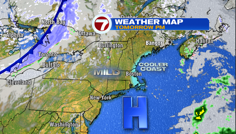
High Pressure FTW! Now, with that High pressure close by it means a few things…mostly sunny skies…..light winds…and the likelihood of a sea breeze to engage during the afternoon hours.
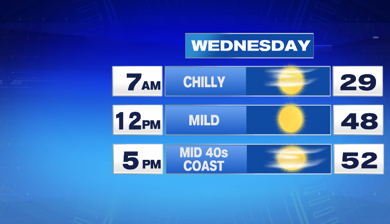
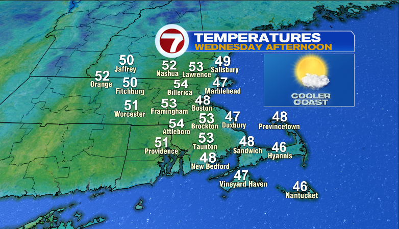
A chilly start to the day with temps bouncing up close to 50 by lunchtime but during the afternoon is when we’ll see the sea breeze do its seabreezy things…

Overall, a great early spring day. Now, take a second look at that weather map. Notice the cold front on the left side of the image. That’s sadly a late season arctic front that will usher in much colder temps for Thursday…as seen here on the 3-day forecast:
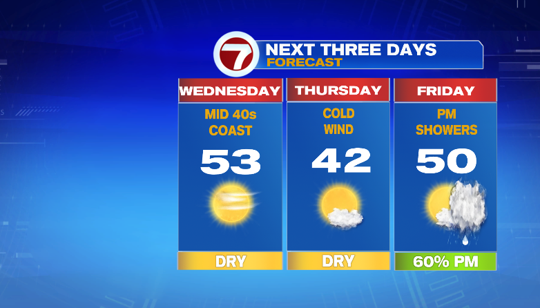
A cold, gusty breeze will be huffing & puffing for the morning and early afternoon hours making it feel even colder. thankfully, these late season arctic fronts are 1-hit wonders (Toni Basil-“Mickey” anyone?) and our temps are right back to normal by Friday. Unfortunately, the coldest day of the next week happens to coincide with the Red Sox Home Opener…
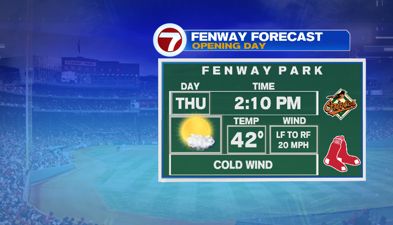
Quite cold for baseball but if you layer like you’re going to the Pats, you’ll be fine! At least that sun will shine!
~JR