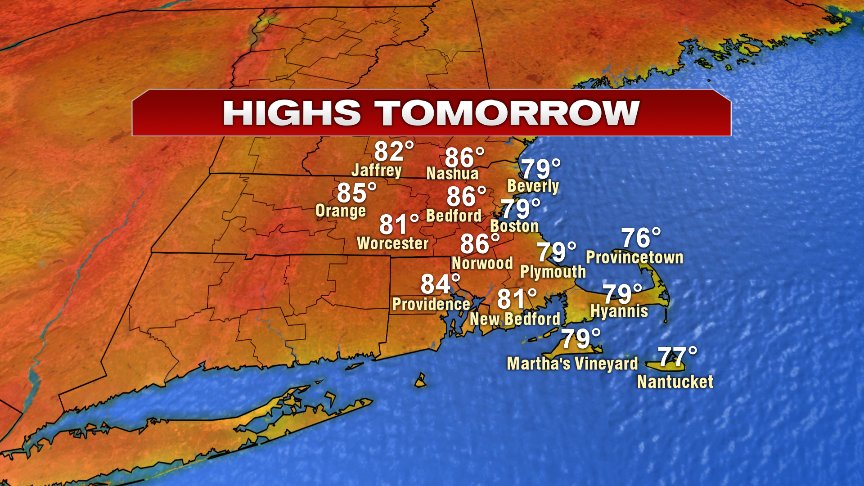
The weather winner streak continues today and tomorrow with fantastically low humidity and tons of sunshine prevail. Despite the cool starts, temps warm up nicely both today and tomorrow as highs head for the mid to upper 70s at the coast today with sea breezes to lower 80s inland.

Tomorrow afternoon, we add a few more degrees after starting the morning off again in the mid 50s and 60s, coolest in the burbs.
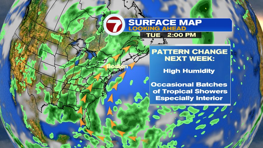
Humidity remains in check the next few days, but will spike up Saturday night and Sunday. It stays tropical-like through much of next week.

In addition to the humidity spike up Saturday night, we’ll also see an area of low pressure zip up the east coast, throwing us a punch of tropical like downpours, thunderstorms and gusty winds Saturday night and early Sunday. Right now, the timing of the worst weather appears to after midnight, through dawn Sunday AM. We’ll watch the potential of localized downpours/street flooding issues and a few storms producing strong wind gusts then. Thereafter, expect Sunday to feature clouds, breaks of sun and an occasional downpour or two possible with highs in the low 80s.

Sky high humidity lasts through next week with occasional downpours possible. As the Atlantic ridge flexes it’s muscles, it’s possible that on a few days next week, the highest rain chances stay across the deep interior of New England, yielding mainly dry, yet humid days for us. When fronts/disturbances do slide in, they will be capable of producing downpours. Something worth watching next week and we’ll time out day to day specifics as we get closer.
Enjoy the nice weather over the next few days.
@clamberton7 – twitter