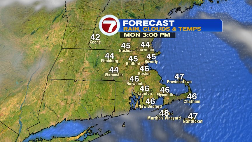
First off… A big THANK YOU to all who have served this country. As we observe Veteran’s Day, the weather will work our just fine as sunshine warms us up from the 20s this morning, into the mid to upper 40s this afternoon. Sure a bit chilly, but certainly a whole lot better than what parts of the 7 day forecast has to offer.
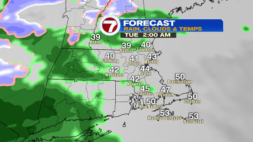
Clouds thicken up this evening as showers break out afternoon midnight. There may be a bit of sleet/flakes in the mix across the Worcester Hills initially, but for the most part, this next storm is a rain-maker for us.
Rain will be steady, and locally heavy, tomorrow morning, through midday. Most of us pick up another 1.0-1.5″ of rain before it’s all said and done. While rivers and streams are close to bankfull, this amount shouldn’t prompt too many issues other than some minor flooding.
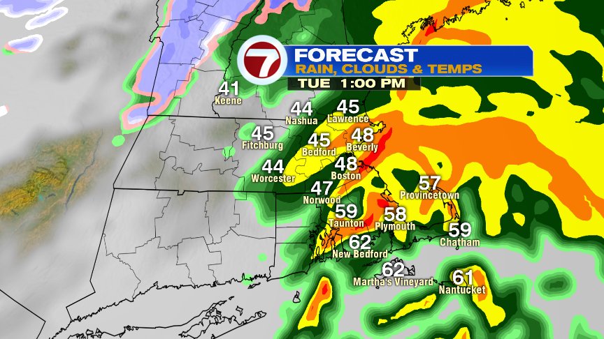

Winds tomorrow will be strongest where it is warmest, and that’ll be across Southeast Mass, where gusts 40-50mph are possible across the Cape and Islands. Winds on Wednesday will be strong for all of us, promoting wind chills staying in the upper teens to mid 20s as highs only recover into the 30s.


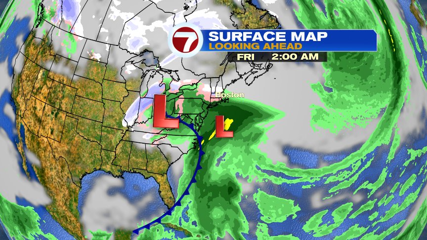
The coldest air of the season will be entrenched across New England Wednesday and Thursday, and if the wave of low pressure to our south is strong enough and tracks just to our southeast, it’ll allow for a period of snow/mixed precip across our area late Thursday night and early Friday. The best chance to see that snow will be away from the coastline. If the tracks is over Southern New England, then it’s a cold rain for most areas. Something to certainly watch!
Enjoy the sunshine today.
@clamberton7 -twitter