While it’s nice to see dry air to kick off this Wednesday morning, the tranquil weather won’t last long as we track snow, ice and rain moving in tonight. That means we trade in the sunglasses for the need for windshield wipers for tomorrow morning’s commute, with slick travel likely northwest of Boston where snow/ice hang on the longest. In fact, a winter weather advisory is posted for overnight tonight, through tomorrow morning for locations in purple on the graphic below.

Snow and sleet break out after midnight and change to rain from southeast to northwest during the predawn hours. Still, with several hours of snow/sleet, I do expect slick conditions for the morning commute, especially the first half of the commute across the interior.
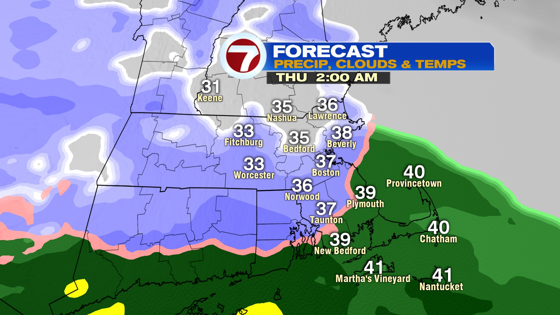

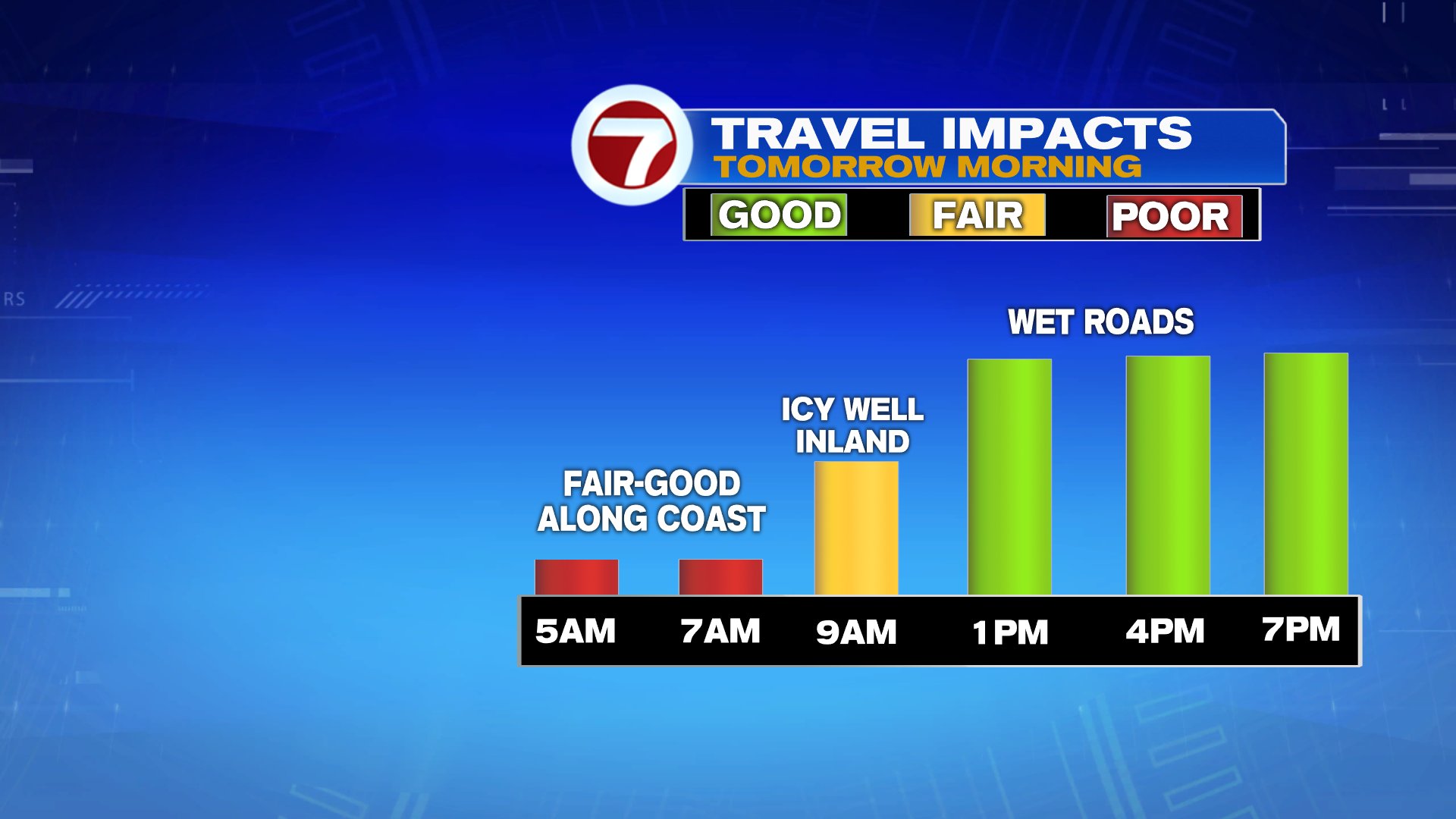
While snow totals won’t be impressive, as we saw last week, it doesn’t take a lot of snow and ice to slow down the commute. Expect the best chance for a couple of inches to be northwest of I-95 tomorrow morning.

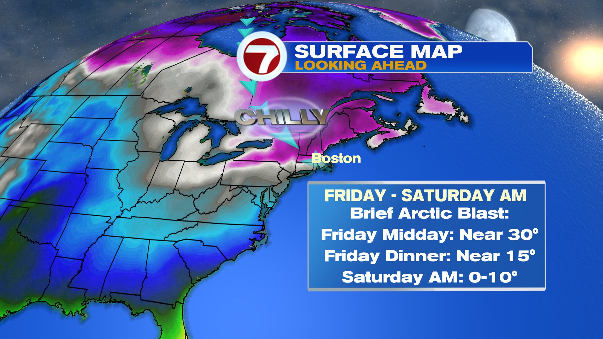
Behind this system, the cold air comes charging in for 24-36 hours as date night Friday night will be a chilly one. By Sunday afternoon, we’re right back into the 40s, so the arctic air is once again short-lived.