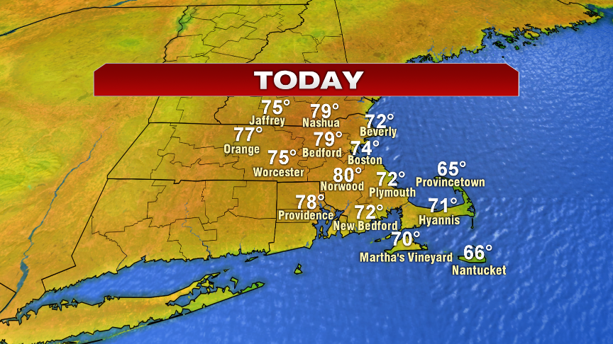
We’re waking up to a fresh start today with a ton of sun and a crisp airmass in place thanks to low humidity that has moved in from Canada. Just like this past weekend, the chill this morning will be short-lived as sunny skies warm us up quickly, to the low 70s at the coast and to 75-80 inland. Low humidity and sun prevails through the day.
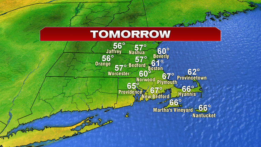
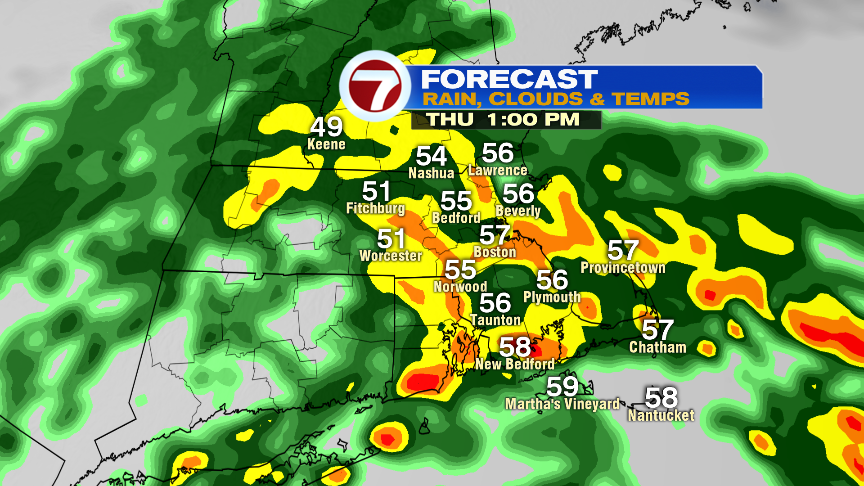
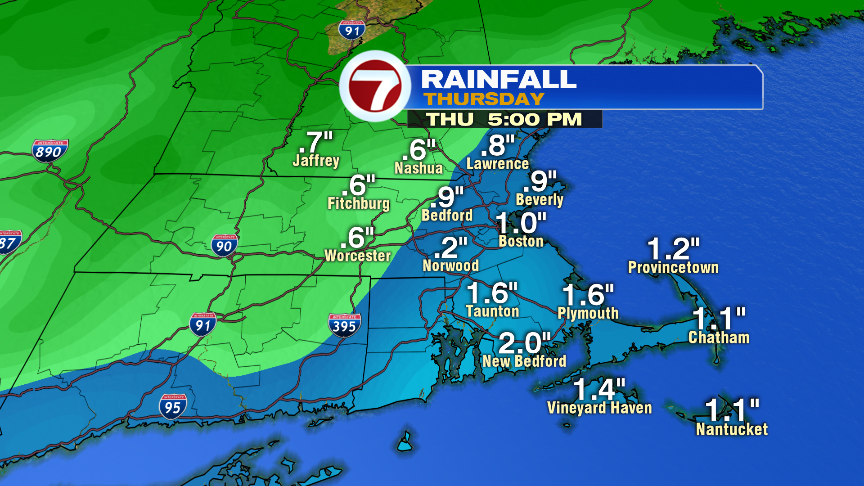
Tomorrow, it’ll be a completely different ball game as an area of low pressure tracks up the coast and produces rain and embedded downpours across the area. Rain will be heaviest from 10am – 4pm with the most drenching downpours likely across Southeast Mass. Even after 4pm, lingering scattered showers will persist into the evening. Rain totals will average 0.50-1.00″ from Boston, northwest and 1-2″ across Southeast Mass. Temps will struggle too, near 60 or cooler northwest of Boston to the 65-70 range across Southeast Mass.
Friday, we’ll see improvements as just a few isolated midday showers are leftover with highs running in the mid 60s in the Worcester Hills to the mid 70s across Southeast Mass. Saturday is great, near 80 with sun and clouds and low humidity. A few scattered showers hang with us Father’s Day, but it doesn’t look like a washout.
Enjoy today and Go Bruins!!!!!!!!!!!!!!!