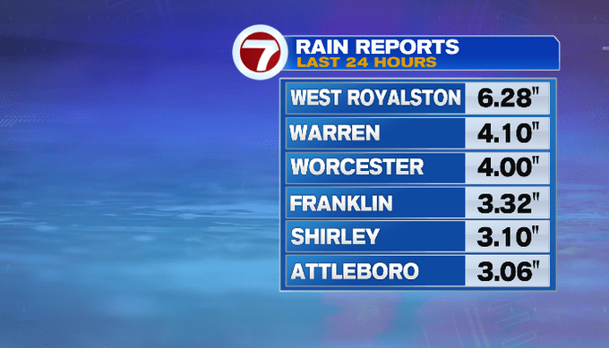
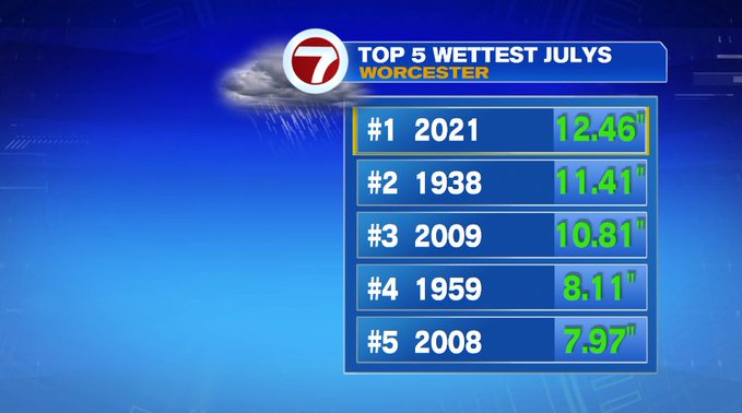
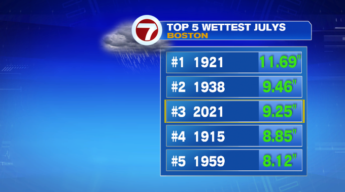
We saw severe thunderstorms yesterday and torrential downpours overnight into early this morning, dumping several inches of rainfall to parts of the region leading to localized flooding. We also broke the record for wettest Julys for Worcester, Boston’s monthly total for the month so far is in third.
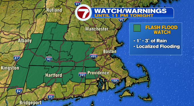
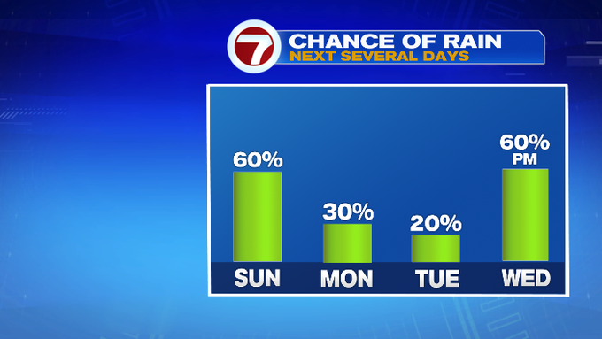
With more rain on the way through the afternoon, the Flash Flood Watch remains in effect for areas west of 495 until 11PM, mainly due to the amount of rain we saw yesterday and any additional rainfall could be the tipping point for street flooding and for local streams.
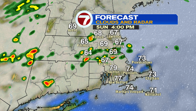
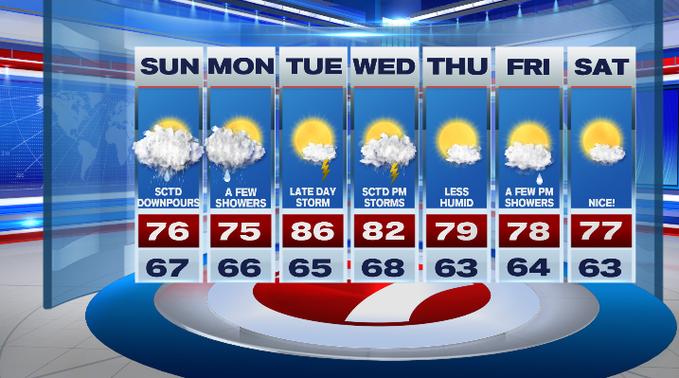
It will be humid for your Sunday coupled up with highs into the upper 70s southeast, low 70s northwest.
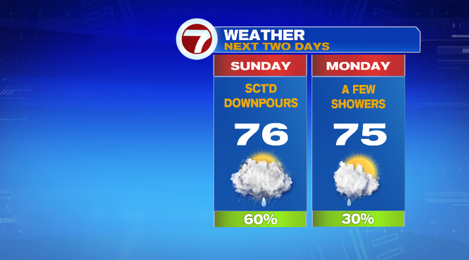
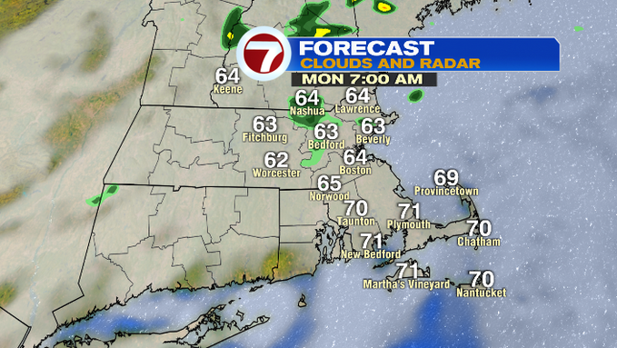
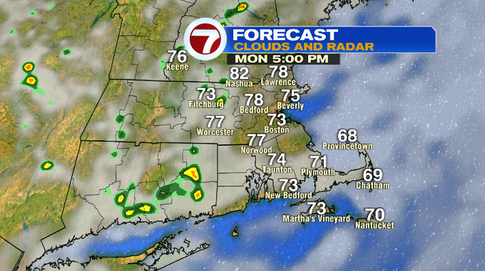
A few showers are possible Monday, but not nearly as heavy as what we’ve dealt with over the last 24 hours. Highs on Monday will be in the 70s.
The sunshine returns for the bulk of our Tuesday, however a late day thunderstorm cannot be ruled out.
Wednesday brings scattered afternoon thunderstorms as a front swings in.
This front clears the region for Thursday, ushering in sunshine and lower humidity (making it the pick of the work week).
Friday has a few showers in the afternoon, but these should clear out for next weekend with next Saturday looking much nicer than this weekend with highs in the upper 70s under mostly sunny skies.