7Weather – A lot of sun is back for Saturday! We lose the clouds but gain a gusty breeze. Today is the better day to get outside as clouds will be on the increase tomorrow with rain later in the day, Sunday.
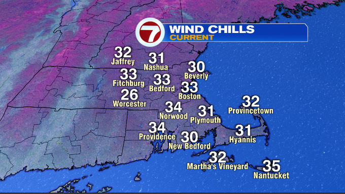
It will feel chillier as you get out the door. Temperatures are running about 5-10 degrees cooler this morning with most of us near 40, thanks to mainly clear skies. Add in a steady WNW breeze 10-15 mph and it feels like the upper 20s to low 30s.
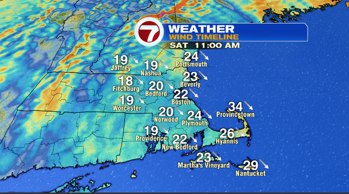
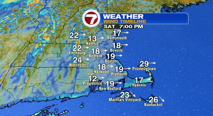
The system that brought some light showers to our area yesterday exited and is off to our northeast, while a high sits to our southwest. This setup will cause the wind to whip around this morning. It’ll lose its strength later in the day. We’ll see plenty of sunshine so have your sunglasses with you. Highs will be in the upper 40s/near 50. Here’s our Saturday wind gust timeline below. You can see the overall trend is a decreasing breeze.
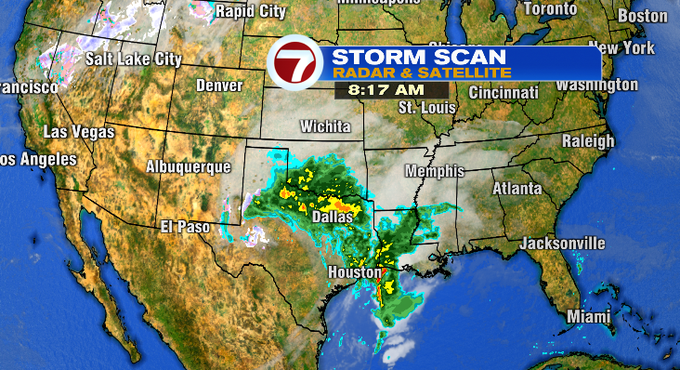
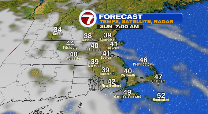
A storm that brought snow to New Mexico and Texas, will continue its track toward us. It arrives by the middle of the day on Sunday and will just bring us rain.
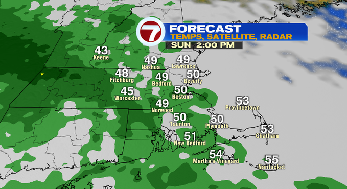
Here’s what we’re thinking for the timing of the rain. The morning starts off dry, so take advantage of those hours. The showers start off light after 12 pm. Rain will become steadier with some downpours at times into the evening.
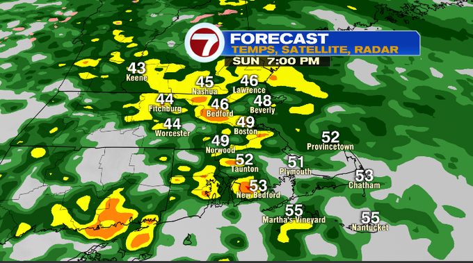
As of now, it still looks like the rain will be out of here by the Monday morning commute. There could be an isolated afternoon shower. Monday is more about the wind again! Tuesday will start off cold, we’ll have less wind and more sun. Another cold front arrives late Wednesday into Thursday. Right now, this one looks like a better rain producer that will also bring some strong winds.
Have a great weekend!
-MH