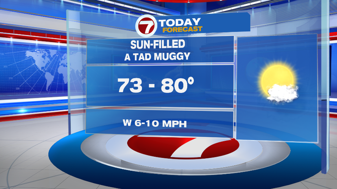
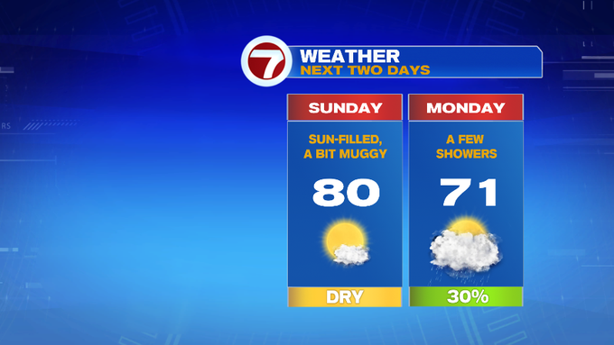
A much quieter day in the weather department for Sunday since we’re tracking more sunshine and highs returning back into the upper 70s to low 80s (looks like summer wants to hold on a little bit longer).
Tonight, a few more clouds stroll in after midnight, otherwise partly cloudy with lows only slipping back into the low to mid 50s in the suburbs, low 60s along the immediate coast.
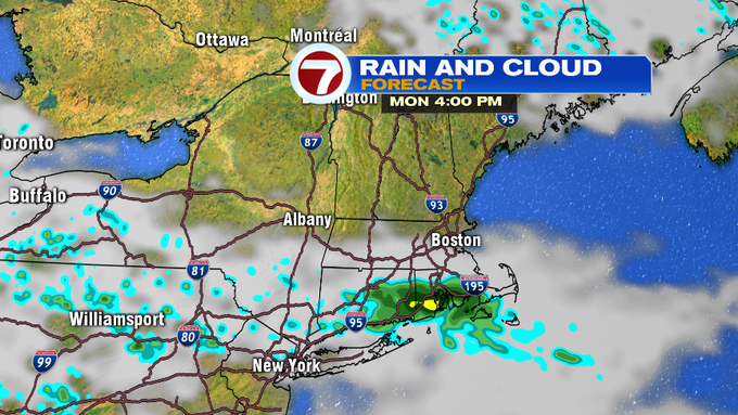
Monday starts off dry, then we have a chance for a few showers by late morning and into the early afternoon.
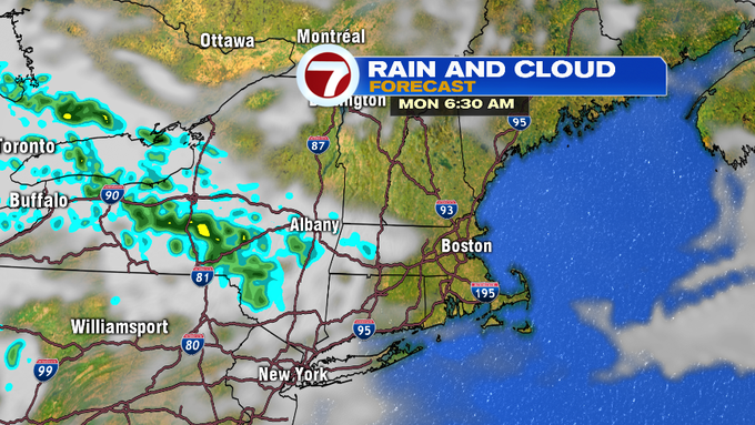
These look to remain along and south of the Pike as a disturbance moves in from the Great Lakes Region. Otherwise, clouds will also thicken into the afternoon, making for a cooler Monday with highs only into the low 70s.

Both Tuesday and Wednesday bring back the sunshine, but also bring back fall-like temperatures. Highs both days will stay in the mid to upper 60s.
A warm-up returns by Friday with highs around 80, slightly cooler at the coast due to a seabreeze. Onshore breezes stick around for Saturday, but farther inland, highs will be stretching into the low 80s under partly cloudy skies.

We’re also keeping an eye on the tropics. The latest with Tropical Storm Humberto on this Sunday morning brings Humberto up to a Cat. 1 Hurricane overnight tonight still out to sea, parallel to the NE coast of Florida and just north of the Bahamas.
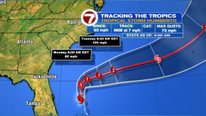
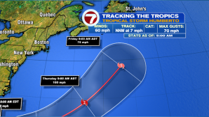
Humberto makes an eastward turn towards Bermuda, and is expected to strengthen to a Cat. 2 Hurricane by early Tuesday. This track is much farther south and away from New England, however, we could see some swells and some rip current risks by midweek, otherwise at this point, our weather does not look to be impacted by this storm.