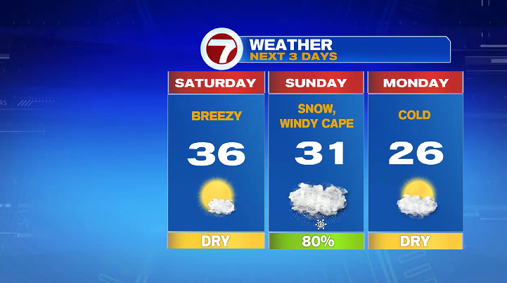
7Weather- The weekend starts dry and sunny, and then we end it with snow on Super Bowl Sunday.
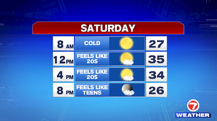
Saturday is definitely the pick of the weekend. The morning is cold with temperatures in the mid and upper 20s. We will keep sunshine around all day with highs in the mid 30s. A chilly breeze will make it feel like the 20s in the afternoon, and like the teens in the evening.
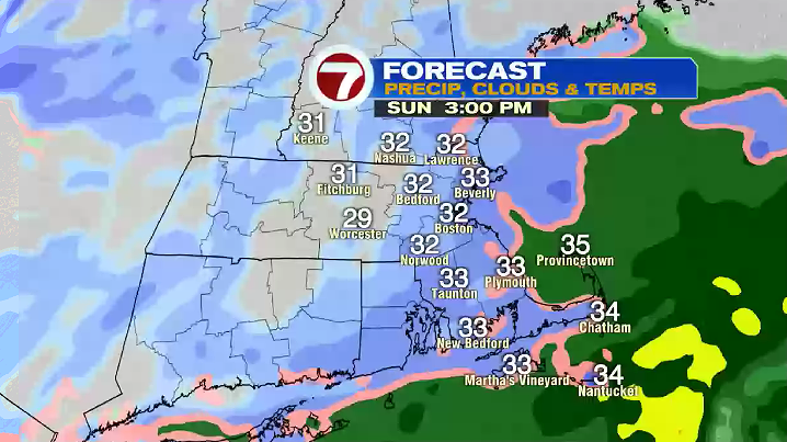
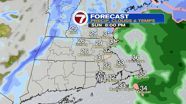
Light snow starts in southeast Massachusetts between 9-11 AM Sunday. Snow continues to lift north throughout mid-day, but the steadiest/heaviest snow will remain south of the Pike. Snow starts to wind down around sunset, and ends between 6-7 PM.
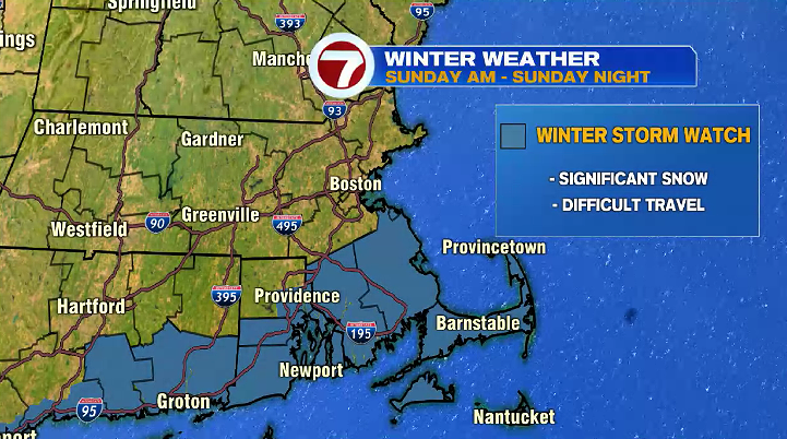
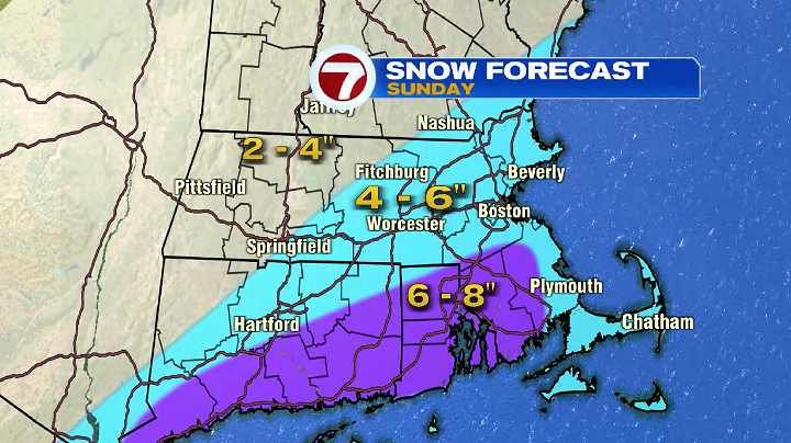
A Winter Storm Watch is in effect for Bristol and Plymouth Counties, and for the Cape & the Islands from Sunday morning until Sunday night. Travel will be very difficult by Sunday afternoon and evening for these areas.
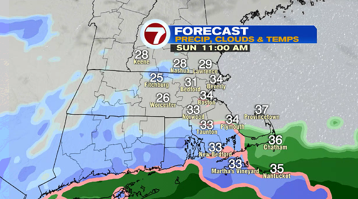
With the heaviest snow staying south, the higher accumulations of snow will be away from the coast in Plymouth County, and all of Bristol County with 6-8″ possible. Expect 4-6″ of snow for the Cape & the Islands, up into the South Shore, for areas along and inside of I-495, and most of Worcester County.
We’ll have to keep a close eye on how far north the snow cover will extend, but for now it does look likely that it the 4-6″ band includes most of our area. The best time to get everything ready for Super Bowl Sunday will be on Saturday, or very early Sunday morning.
After this system moves out, colder air moves in. Monday is dry, partly sunny, and below average with highs in the mid 20s.