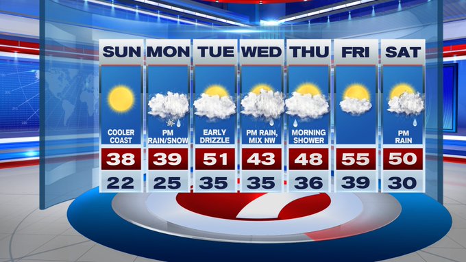
It was a cold start to our Sunday, with temperatures in the upper teens to 20s, under a clear sky and subtle breeze. This afternoon, under sun-filled skies, temperatures only rebound back into the upper 30s with an onshore breeze that develops, keeping temperatures slightly cooler at the coast. Plus, the wind chills will be in the upper 20s through most of the day, so it’s one of those days where you need to bundle up (and don’t let that sunshine fool you).

As for Monday, we start off dry as clouds thicken ahead of the coastal low that will bring accumulating snow inland, rain at the coast. As for timing, the first flakes fly in central MA and southern NH by mid-afternoon (around 2pm). By 5PM, we start to notice some moderate snow falling (and likely starting to stick) for the higher terrain and for Worcester Co., western MA and southern VT and NH. Along the 495-corridor, expect a wintry mix around dinner time before changing back to just plain rain, while the 95-corridor and areas southeast remain just rain for this event.

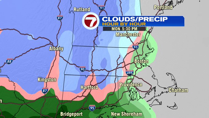
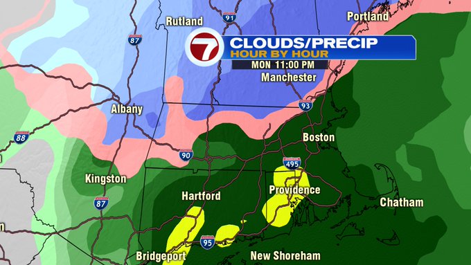
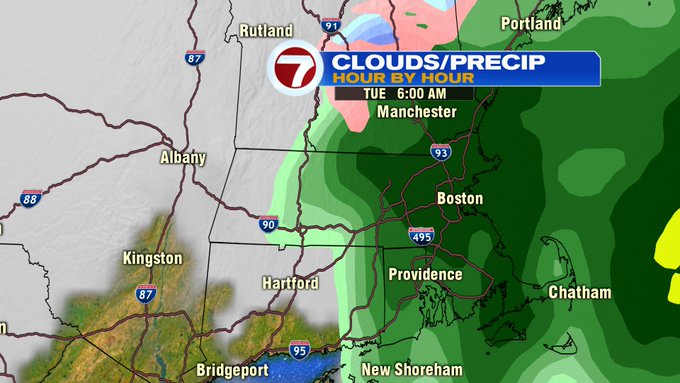
The rain/snow line continues to wobble northward by 11PM, still snowing southern VT, southern NH, and portions of the Berkshires, where the higher snowfall totals will likely emerge with this system.
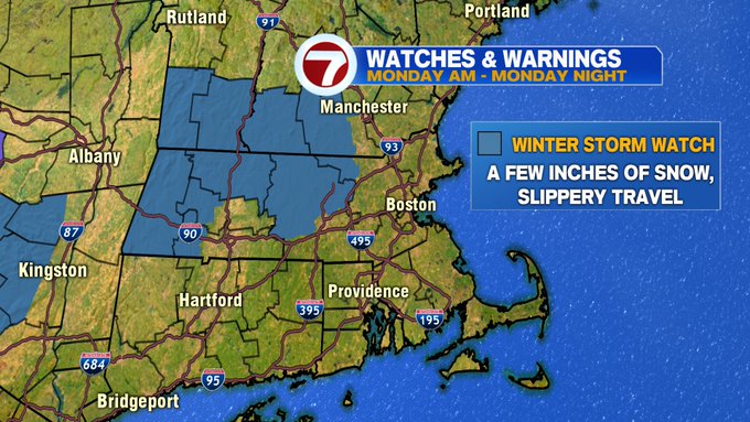
A Winter Storm Watch has been issued for these areas, including northern Worcester Co. through Monday night.

As far as accumulation, 4-6″ of snow is expected along the Berkshires, northern Worcester Co. southern VT and southern NH, 2-4″ for southern Worcester Co., and a coating to 2″ along 495 and areas just west of 95. Coastal towns, expect rain.

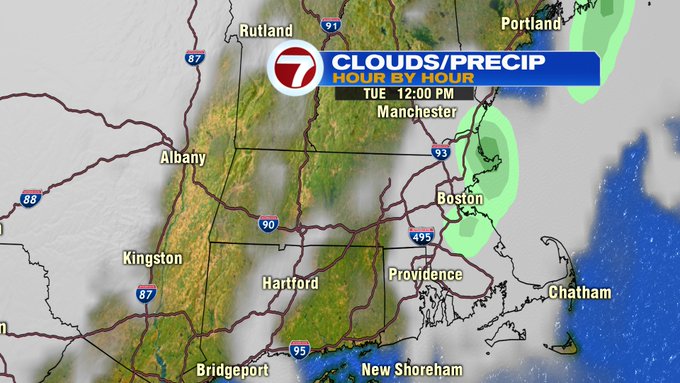
The system exits Tuesday morning, with some rain showers lingering before departing by midday. Highs on Tuesday reach into the low 50s as partly sun-filled skies return for the afternoon.
Wednesday afternoon features another similar system to Monday, snow for the interior to rain at the coast. There is still some uncertainty with that system, but after Monday’s storm moves out, we’ll get a better picture of what Wednesday’s storm will bring.
A few lingering showers early Thursday before drier conditions move in for the rest of the Thursday and into Friday. Friday, the highlight of the week, featuring highs into the mid-50s under partly sunny skies.