7Weather- It’s bright and cooler today. Clouds move in tonight and they will stick around all weekend.
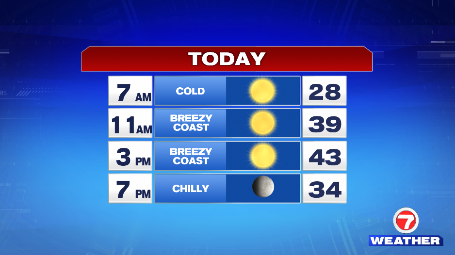
It’s a cold start to the day with temperatures in the upper 20s and low 30s. We get into the upper 30s by lunch time with highs hitting in the low 40s in the early afternoon. It will be breezy to windy along the coast. This will make it feel chilly throughout the day.
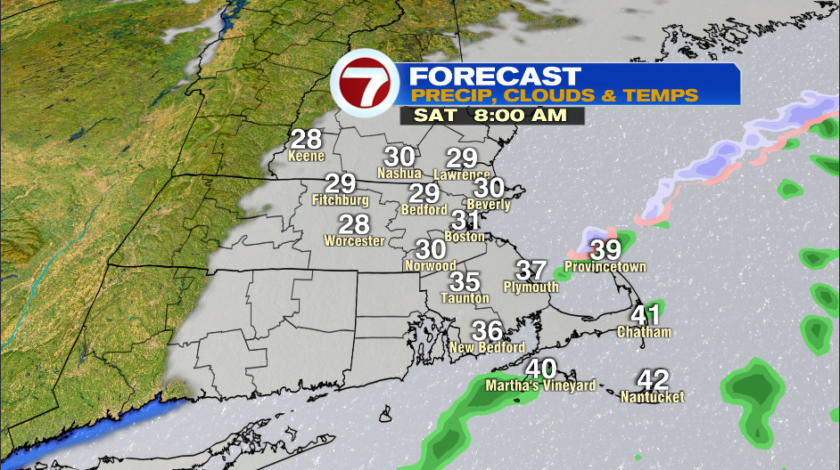
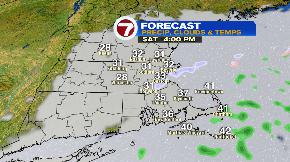
Clouds arrive early Saturday morning and they are here to stay. The day starts near 30º and we only get into the mid 30s in the afternoon. If you live along the coast you’ll have breezy to windy conditions with sprinkles/flurries. If you live inland it’ll be cloudy with an occasional breeze.
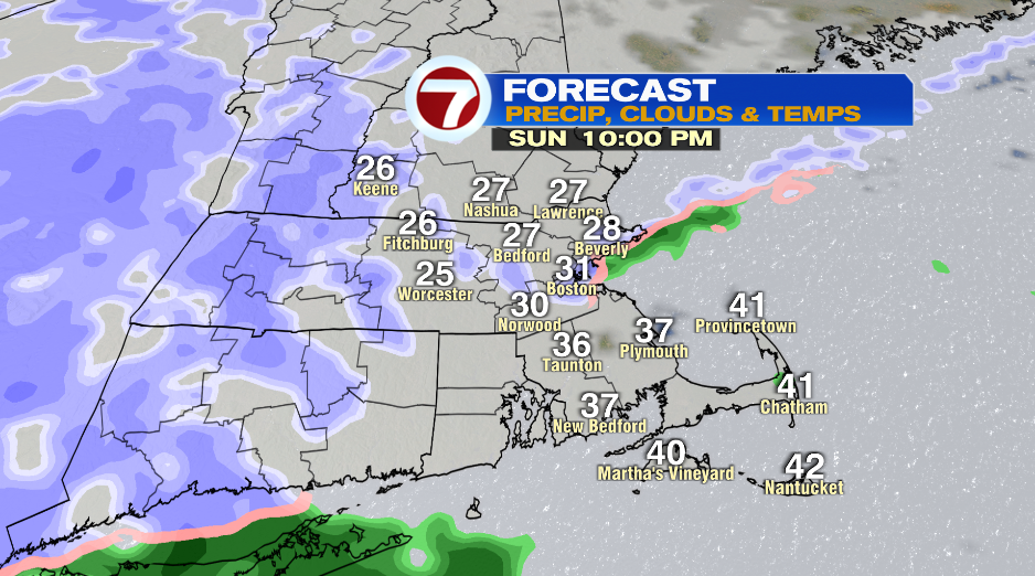
You can almost copy and paste the forecast into Sunday (at least throughout the daylight hours). The day starts close to 30º and highs are in the low and mid 30s. It remains breezy to windy and the coast with sprinkles/flurries. Inland spots have a cloudy and cold day.
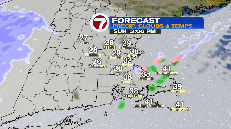
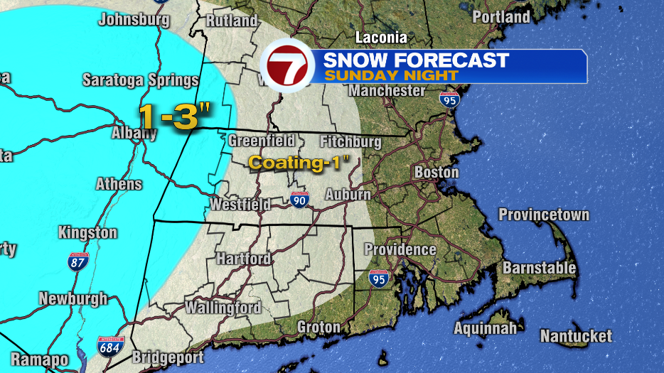
Light snow moves in late in the evening Sunday. Expect light snow showers for areas away from the coast starting between 6-9PM. Light snow is more likely to stick around outside of I-495 because of the location of this weak system. Light snow will be on and off in these areas Sunday night into early Monday morning.
We’re not expecting much accumulation with parts of Worcester County and southern NH getting a coating -1″ of snow.