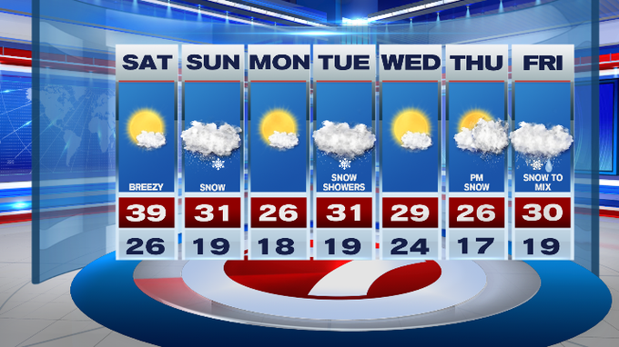
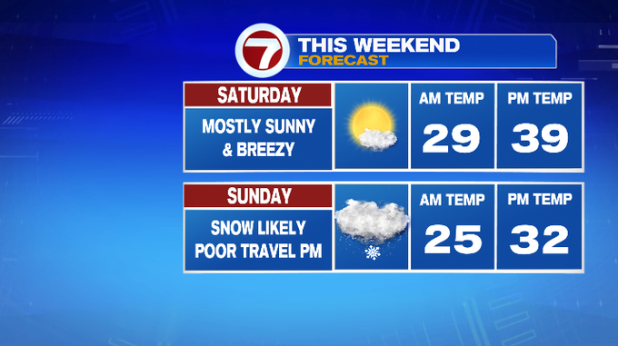
Mostly sunny today with highs in the upper 30s, the calm before our Sunday snow storm.
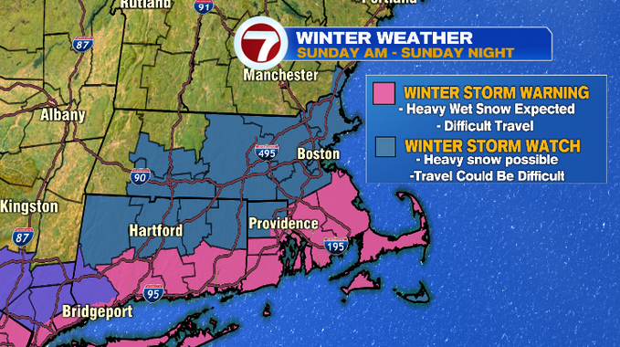
A Winter Storm Warning has been issued for SE MA, the Cape and Martha’s Vineyard where heavy wet snow is expected, which will make for difficult travel. A Winter Storm Watch has been expanded to include Worcester Co., Boston and areas north to the NH stateline, with the NH seacoast also included in the watch where heavy snow is possible, which could make travel difficult at times.

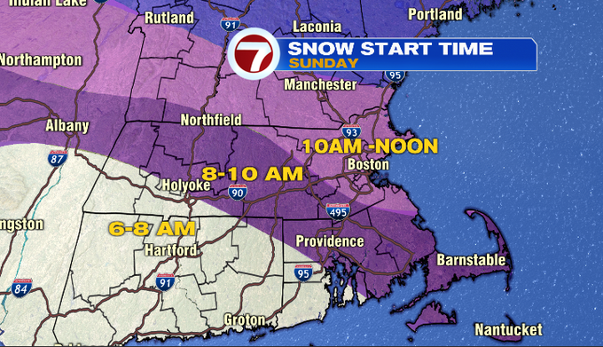
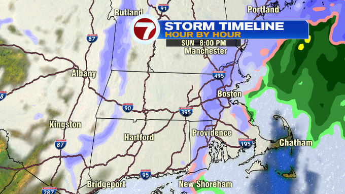
As far as timing, the leading edge of the snow moves in mid-late morning from the southwest and spreading to the northeast.
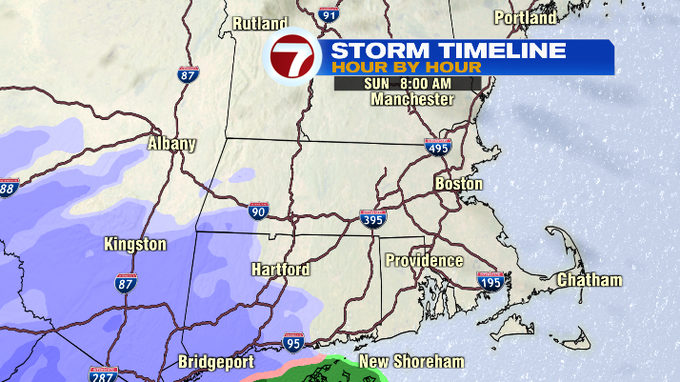
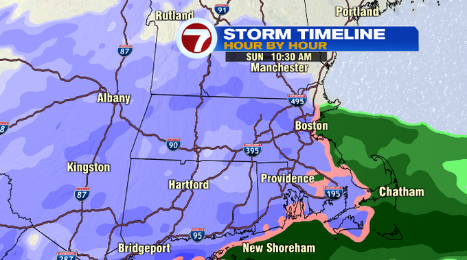
For a timeframe, 8-10AM first flakes are flying in central MA to SE MA, 10AM to Noon for Boston, NE MA and southern NH.
The snow is widespread across the region through midday, with the snow ramping up by midday, with a few bands reaching 1 to 2″ per hour snow rates, which will not only make for accumulation, but also reduced visibility.
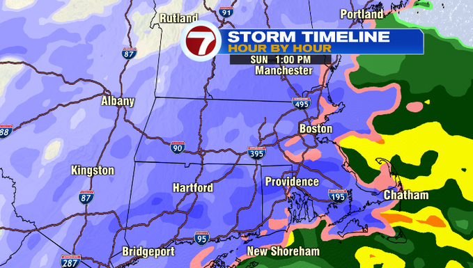
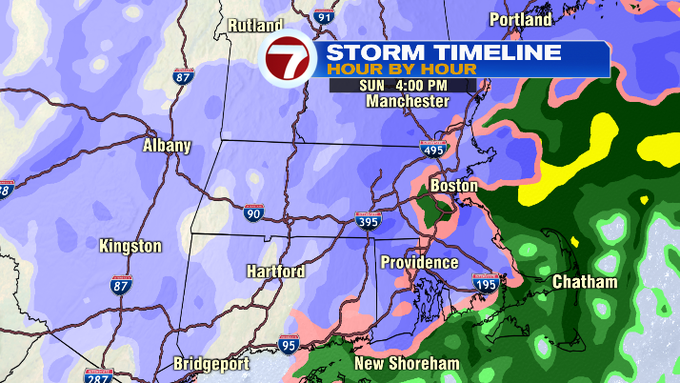
The afternoon will be the toughest for travel so be sure to plan ahead as better driving conditions are expected later in the evening after the snow has moved out.
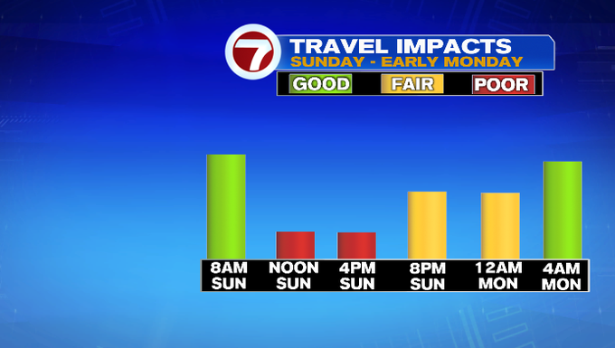
The snow starts to taper around sunset (just after 5PM), with a few lingering snow showers through 8PM.
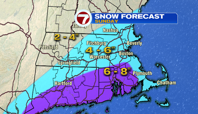
There is still uncertainty as of Saturday morning with the snowfall forecast (depending on if rain were to limit snowfall for the Cape, and the northern extent of the heavy snow). Overall, keeping a widespread 4-6″ of for most of our area, with higher totals for interior SE MA. These numbers could change slightly, so be sure to stay tuned with 7News today and early tomorrow for the very latest.
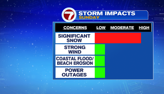
The good news is that Sunday’s storm main impact is the snow, wind gusts could top out at 40MPH over the Outer Cape, but overall it will not be nearly as strong as previous storms. Plus, Sunday’s storm is a quick-moving system, only impacting Sunday itself as Monday will bring high pressure back to the area, highs in the upper 20s under mostly sunny skies.
More chances for snow this week will be Tuesday, then Thursday afternoon/evening and Friday with Friday being a snow to mix set-up, but this could change as we get closer.