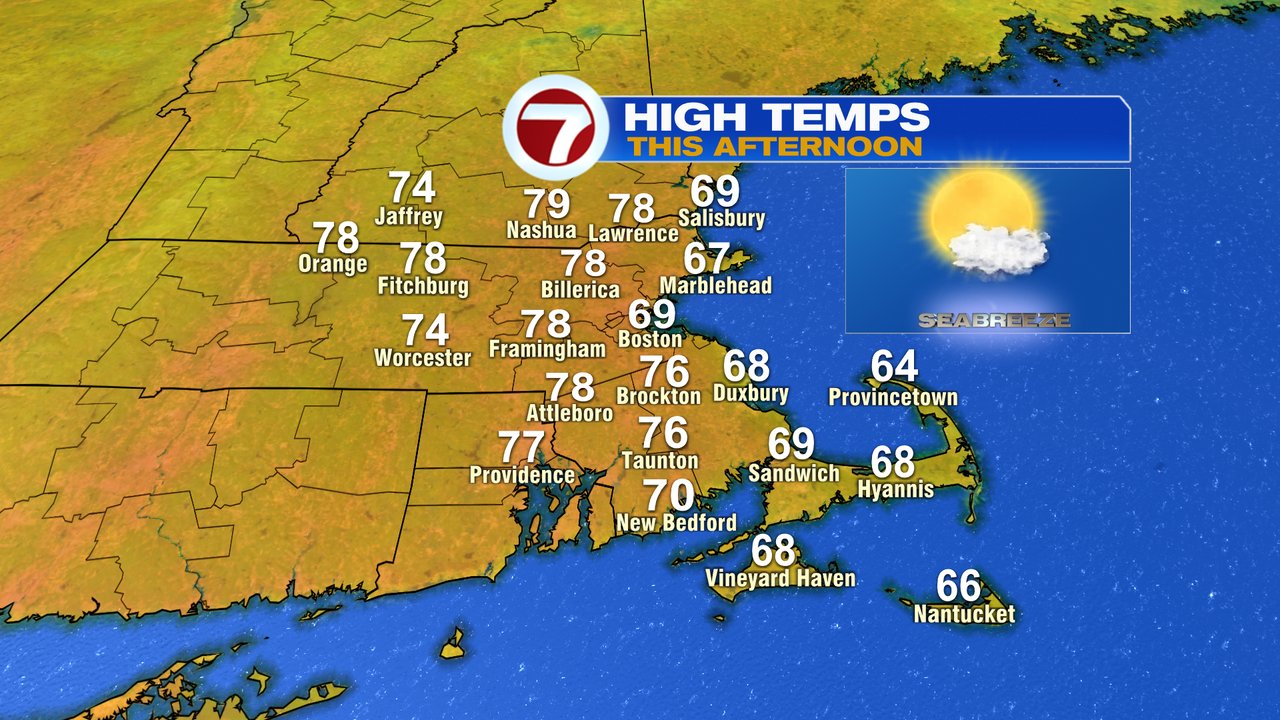
After a weekend filled with cool air and a lot of clouds, the sunshine is back today, and will hold on through the day. Despite the cool start, temps rebound nicely, into the mid to upper 70s for most locations away from the coast. At the coast, temps near 70, then drop back into the mid to upper 60s with sea breezes kicking in. So if you are heading to the beach, it’ll be a nice day, just a bit cool with the ocean air pushing in.
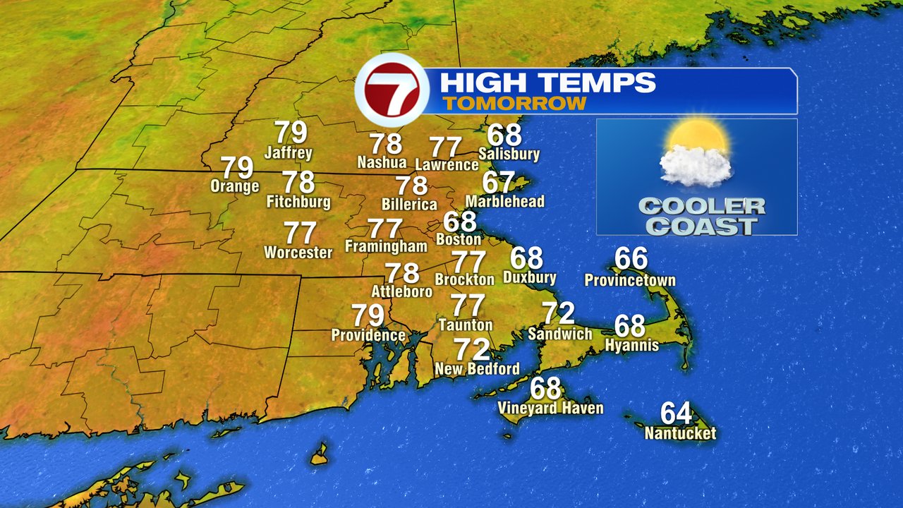
Tonight will be cool again, 40s and 50s. Tomorrow, almost a copy/paste forecast to what we’ll have this afternoon for temps. Although, more mid to high level clouds spill in during the afternoon, especially inland.
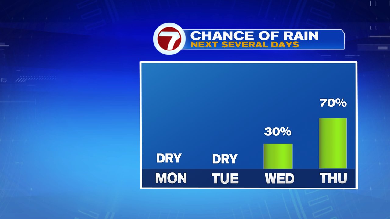
A warm front will increase the shower chance Wednesday PM into Thursday, especially Wednesday night-Thursday midday. Humidity starts to go up too, especially by Thursday.
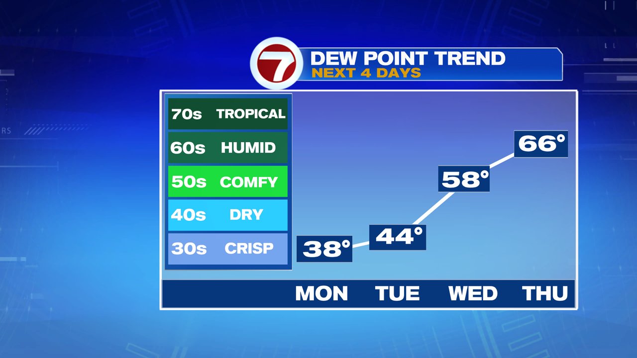
The higher humidity, with dew points running into the 60s, will linger into the weekend. With air temps running in the low to mid 80s inland, 70s at the coast, it’ll be seasonable warm for early summer. The Summer Solstice is tomorrow at 5:13am.
Have a great week!