

After a seasonably chilly start to the day, the bounce back will be nice this afternoon with highs running in the low to mid 40s. From time to time, some mid to high level clouds filter the sun, but expect a dry day from start to finish.
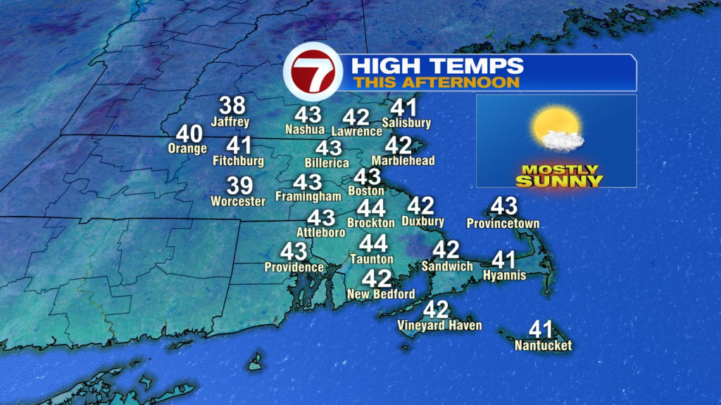
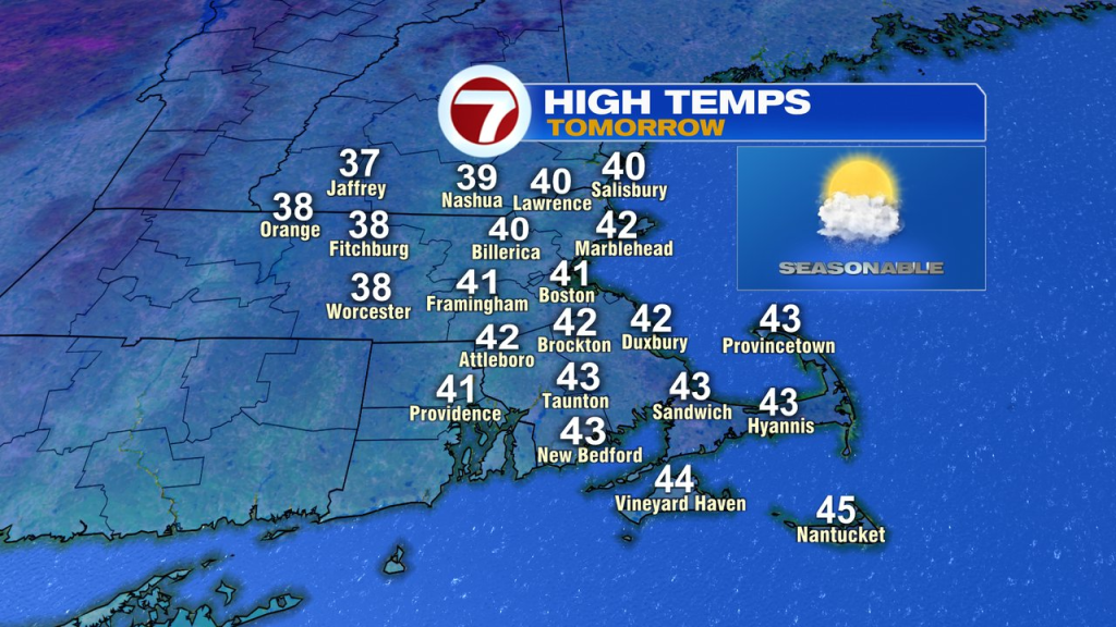
Tomorrow, highs will run up near 40s with clouds, breaks of sun and a spot rain/snow shower thanks to a front crossing the region. On the other side of that front, we’ll watch colder air fill back in, holding temps in the 30s on Friday, and through the weekend.
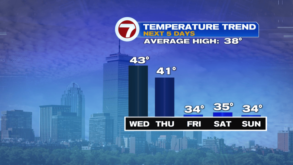
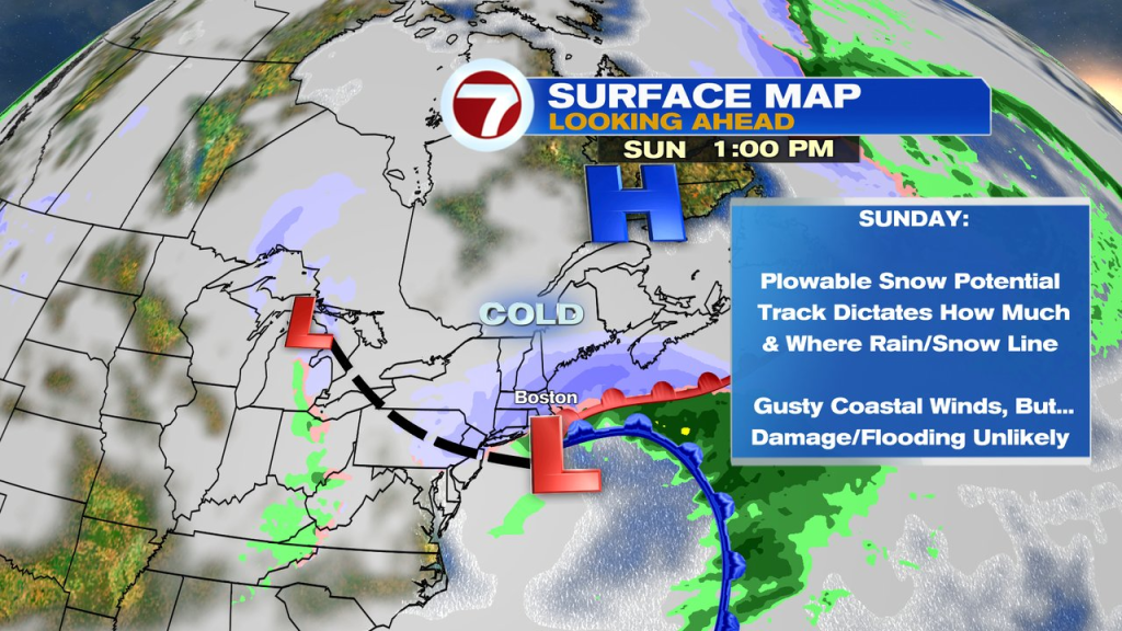
That’s where the forecast gets interesting to say the least. As an area of low pressure moves toward us from the southwest, moisture will get thrown into the colder air in place.
That’ll allow for some snow to break out across the region after midnight Saturday night/Sunday morning and continue through the day. With ocean temps running in the low to mid 40s, initially, some rain may mix in along the coast, especially near/east of Route 3/down through the Cape and Islands.
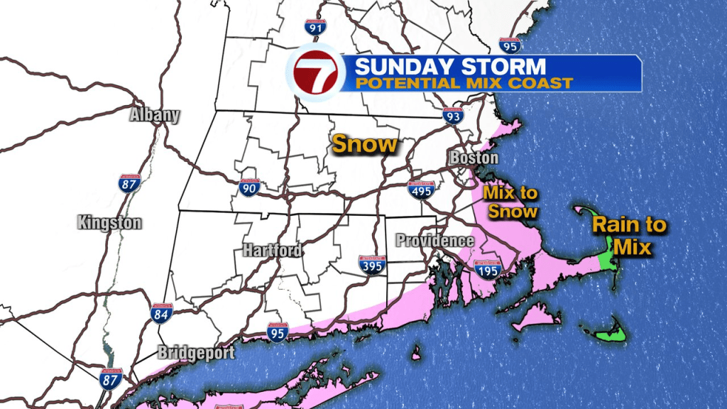
The set-up is a bit complex and stretched out, as one low will be just south of New England, and one lingering back into the Great Lakes. The coastal low for us will dictate the rain/snow line and how much falls. The stronger the low, the more precip that falls Sunday.
The weaker the low, the more modest (lighter) the snow/rain is.
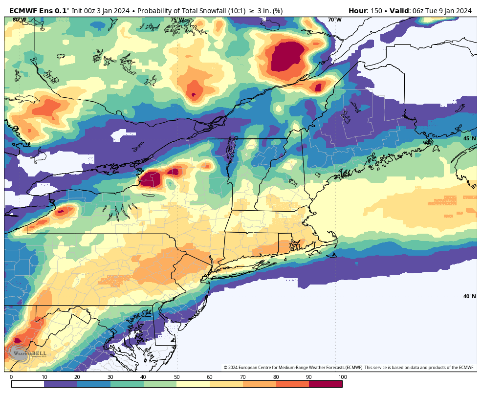
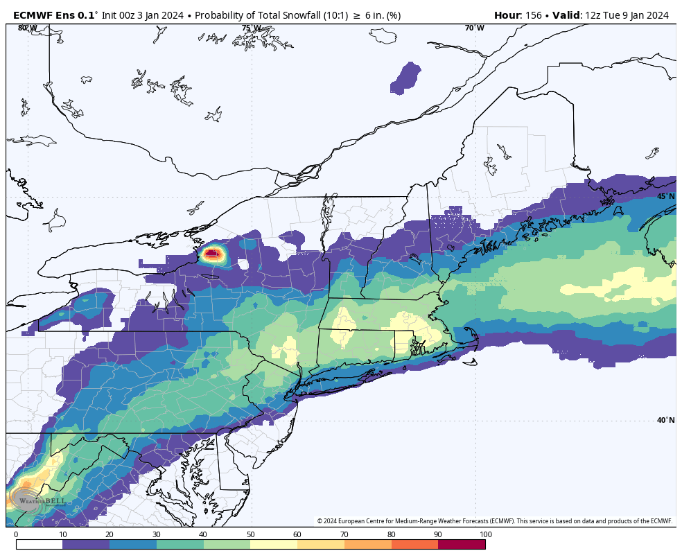
Probabilities of a plowable snow are moderate to high. The European ensemble output comes in with about 60-80% chance of at least 3″ for much the the region. That drops to 30-60% for over 6″, with lowest chances over the Cape.
It is likely that the winds get gusty along the coast with this storm Sunday too. However, even if we catch some gusts 40+mph, coastal impacts look limited.
Tides are astronomically on the lower side and wind levels should stay below the threshold for widespread damage/power outage levels. It also helps that it’s a Sunday storm and will be long gone by the Monday morning commute.