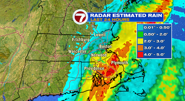
The rain we had overnight and through the day today was really feast or famine. I don’t have a rain totals list because, well, it’s still raining so those numbers continue to climb! That said, here’s a radar estimate of what fell and where.

Areas south of Boston coming out on top with this one. That orange stripe from Cohasset to Plymouth to Bridgewater and Narragansett Bay is a swath of 3-4″!! And even better than that… those pockets are close to, if not over 5″ of rain! As of this writing (6pm on Thursday) the highest report I’ve seen has been 5.07″ in Lakeville. But then totals dropped off dramatically! Worcester, for example, picked up just 0.18″ since midnight.

Tonight we’ll gradually clear things out and the sunshine will be back tomorrow! A few of us may see patchy fog early tomorrow morning, but once that lifts we’ll be into the sunshine all afternoon.
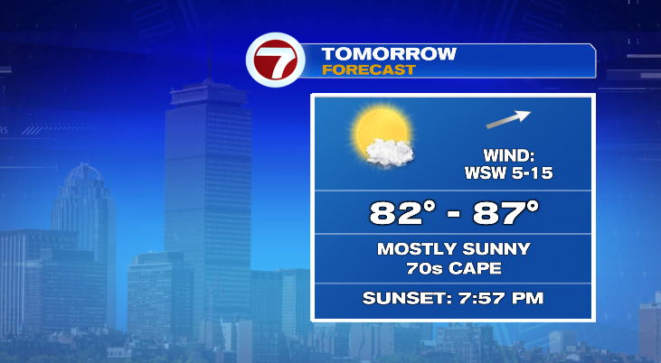
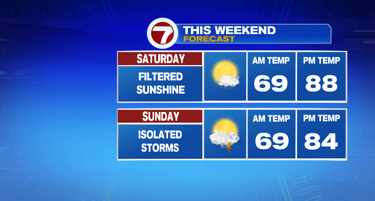
Tomorrow really is a great day! Sunshine and temperatures in the 80s for most of and just slightly cooler on the Cape. I think the weekend forecast may not be AS GREAT as tomorrow but it’s still pretty good. Saturday will be hot with temperatures in the upper 80s. It’ll technically be a “cloudy” day but it’s deceiving because it’s the high level clouds so it’s more of a filtered sunshine look to the day rather than thick gray overcast clouds. Sunday is still warm but we’ll have to watch for a few pop up storms in the afternoon and evening.