Quite a few spots woke up to a wet start, but thankfully this year is not nearly as cold as last year (Thanksgiving 2018 the high temperature was just 24°…that just send shivers down my spine).
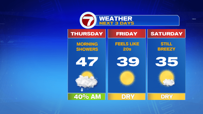
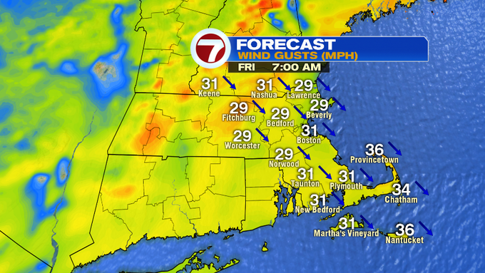
High temperatures today will be in the 40s, but with a gusty northwest wind, expect wind chills to be slightly colder than those actual air temperatures.
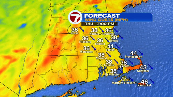
A Wind Advisory has been posted for portions of the Massachusetts coastline through 2AM Friday as gusts could top out at 45 mph.

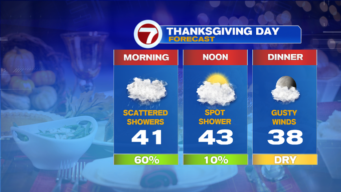
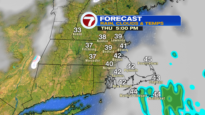
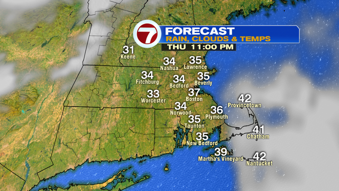
Just in time for your Thanksgiving feast, we’ll see a gradual clearing of the skies which will give way to cooler temperatures through this evening.
Heading out tonight after your Thanksgiving feast? Be sure to bundle up as winds will be howling through the overnight into Friday morning – making it feel like it’s in the teens Friday morning.

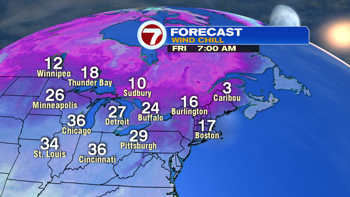
The sunshine returns Friday and Saturday, but it will still be quite breezy and chilly with highs into the 30s both days.

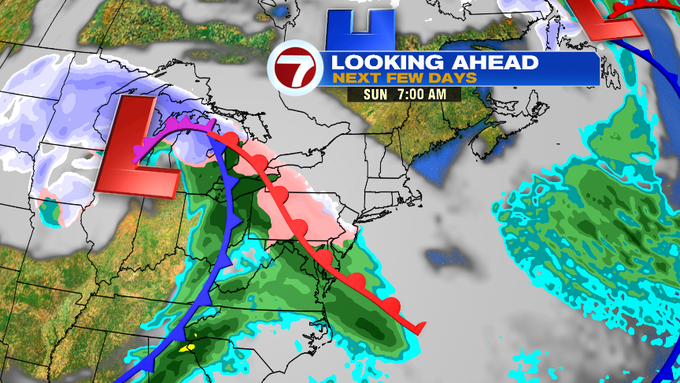
There is still uncertainty with the system for Sunday. We start off dry on Sunday, but by the afternoon, clouds start to thicken ahead of our next system slated for Sunday evening. We could first see a burst of snow before changing to a mix, or that rain/snow line could be more north. We will continue to keep an eye on the latest timing and track for Sunday into Monday as everyone tries to get back into the swing of things after the Thanksgiving holiday weekend.

A few flurries early Tuesday, otherwise drier conditions prevail by midweek.
