Brrr… chilly stuff this morning with temperatures running in the single digits and teens and wind chills running in the single digits above and below zero. Below is a graphic of the 6am wind chills across the area this morning.

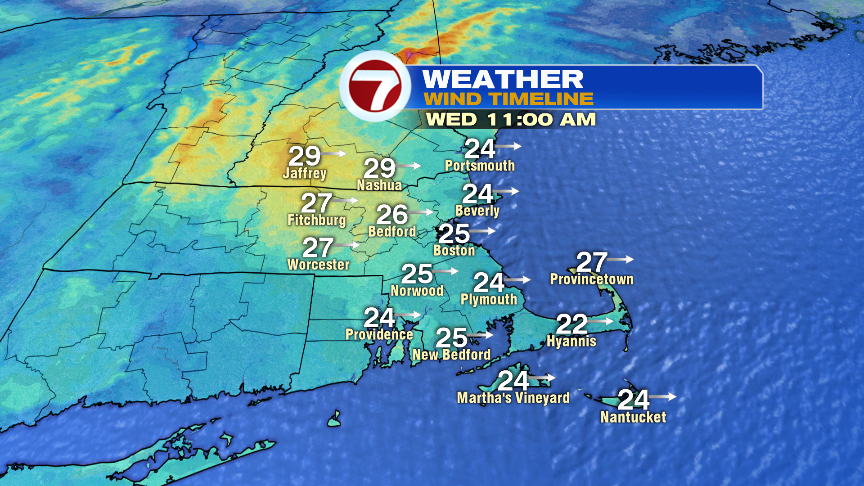
Wind chills only recover into the single digits and lower teens as winds continue to be active this afternoon. Gusts 20-30mph today will provide the bite in the air as highs top off in the mid to upper 20s. Much of the day is quiet with a mix of sun and clouds, favoring clouds at times this afternoon, along with a passing flurry or snow shower in spots.
The next few days are rather quiet with cold air holding on and the risk for a passing flurry or snow shower today and tomorrow afternoon. The next 2 days will be the coldest before we moderate a bit Friday and Saturday.


Saturday is the pick of the weekend. By Sunday, we’ll track a mix of snow and ice going over to rain. Minor snow accumulations are possible, especially inland, but even across the interior, we’ll likely go over to rain.

Have a good day and stay warm!
https://twitter.com/clamberton7?lang=en