We saw a glimpse of the heat today with highs swelling into the mid to upper 80s at the coast, while just a few locations skimmed 90 degrees today. That will be a different story tomorrow as many spots across southern New England stretch into the low to mid 90s.

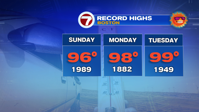
Sunday begins a stretch of near record heat, along with three days into the 90s ahead of a cold front that will swing in Tuesday late afternoon as the leading edge of some cooler and comfortable air for the middle of the week.

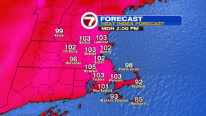
The peak of the heat arrives Monday afternoon, when we see highs stretch into the upper 90s, with heat index values swelling into the triple digits.

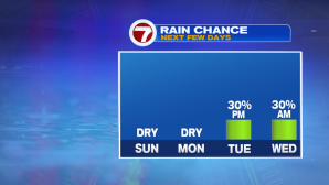
Tuesday’s highs are also in the mid to upper 90s ahead of the cold front that will spark off showers and storms by Tuesday evening’s commute. Depending on how long the front takes to move across New England, we could have a few lingering showers and storms into early Wednesday morning.
Drier and closer to seasonable conditions return for the second half of the week and into next weekend.