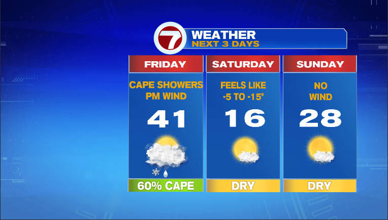
Today was a nice winter treat! Temps reaching the 40s and no wind! Granted, temps in the 40s in November and April are anything but a treat but considering where we came from (bitter temps Tuesday) and where we are headed (bitter temps Saturday). Friday, we watch an ocean storm pass well east of New England but unfortunately close enough tp produce strong winds, especially on the Cape/Islands from about 4pm to midnight.


Even in metro Boston, you’ll notice more wind on Friday compared to Saturday with occasional gusts upwards of 40mph. Thankfully, we can eek out one more day with temps near 40 but that wind will make it feel colder, especially after noon.
We’ll also have to watch for rain showers from the ocean storm grazing the Cape during the afternoon. It will possible for some of those rain showers to end as snow showers by early Friday evening. Looks like a coating in spots with a very low chance of 1-2″ on Nantucket. Plan for the possibility of some slick roads on the Cape Friday evening.
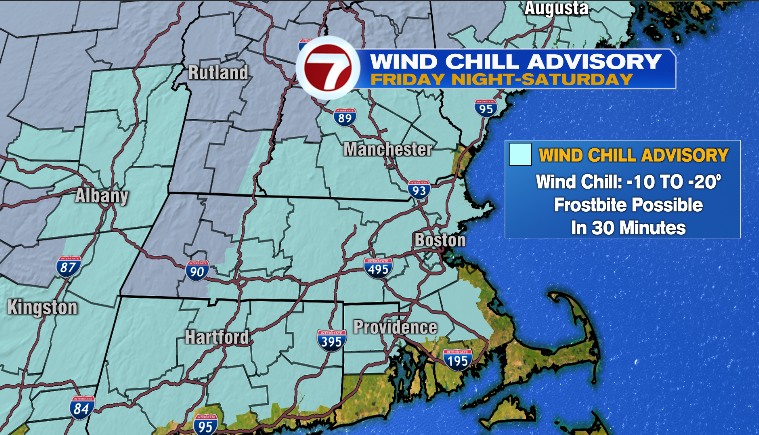
Onto the weekend! Not sure that’s a good thing this go-around as another chunk of arctic air is expected to blast into southern New England Friday evening and be with us throughout Saturday. We do have a Wind Chill Advisory in effect for much of the region late Friday night and Saturday with wind chills expected to drop well below zero late Friday night and remain below zero on Saturday.
Hard pass. On Sunday, we shake the bitter wind but still seasonably cold with sunshine and temps in the 20s
As we get to the MLK Holiday, we’re still likely to see a disruptive storm with snow, sleet, freezing rain and rain along with some strong wind along the coast. The track of the storm is coming into better focus and it looks like the storm will pass right across southern New England early Monday morning. A track like that means the heaviest snow probably occurs across western and northern New England, while the I-95 corridor sees limited snow (perhaps not even enough to shovel/plow) with mainly rain.
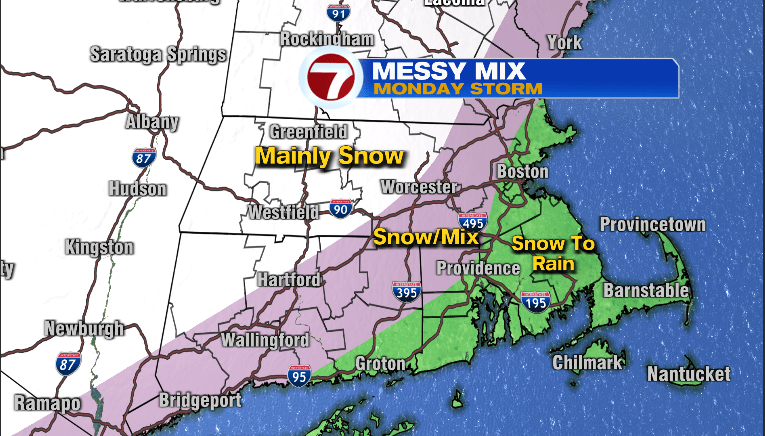
More on this Messy Mix in the coming days!
~JR