It was a humid Wednesday, although the temperatures were not nearly as high as the last several.

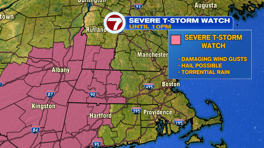
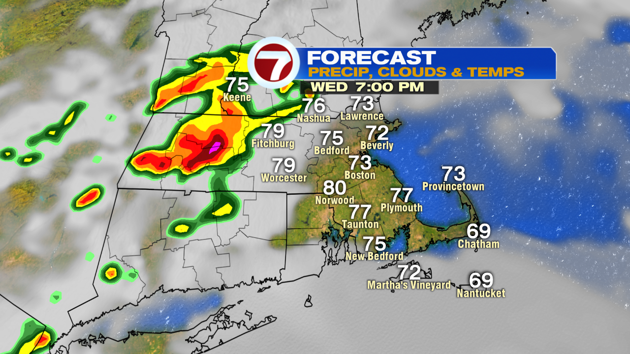
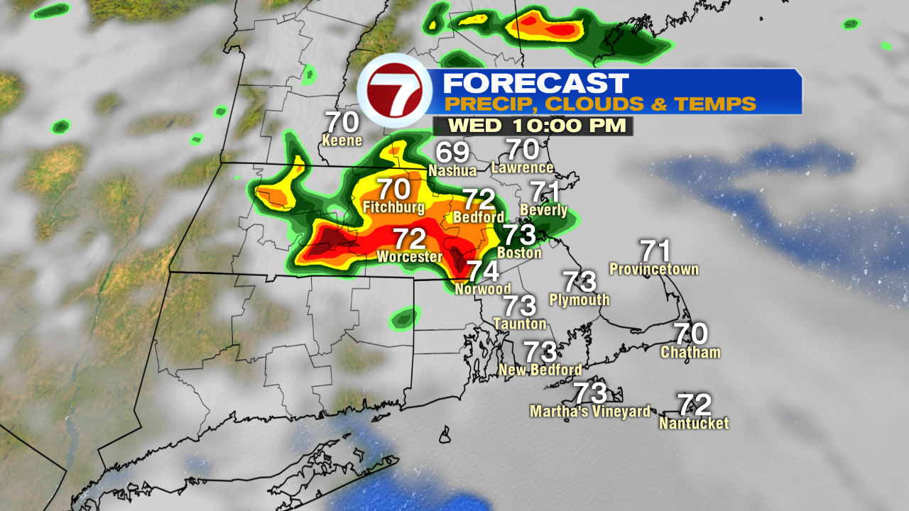
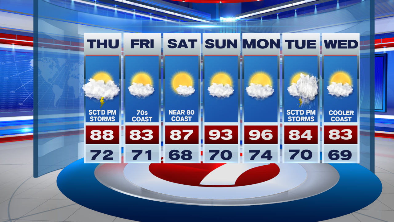
As a warm front bumps into southern New England, we’ll see a few thunderstorms later this evening. Some of these could be on the stronger side, mainly west, between 7pm to 10pm.
A Severe Thunderstorm Watch has been issued for western MA, southern VT and portions of CT until 10pm, with the main threat being damaging gusts.

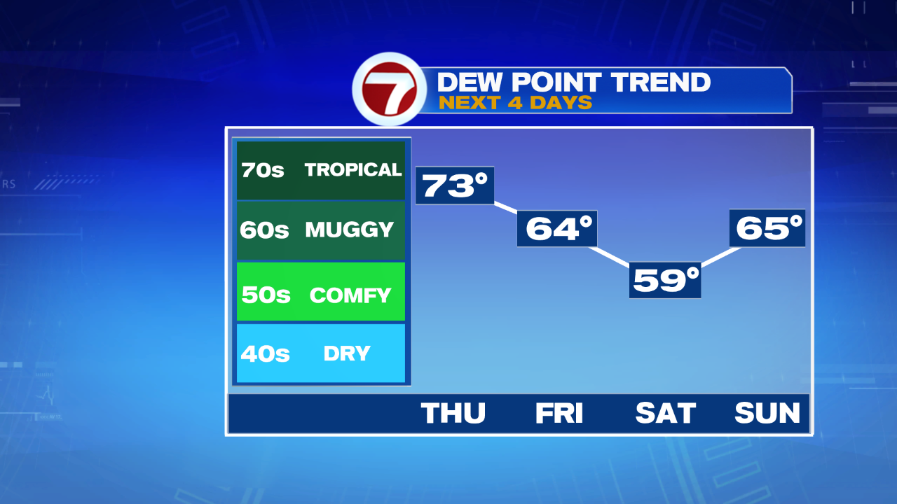
Overnight, the showers and storms move out by midnight, but the humidity sticks around. Plus, temperatures remain in the upper 60s to low 70s.

It’s another cloudy start tomorrow morning with some sunny breaks by the afternoon, allowing temperatures to rise into the upper 80s to low 90s inland, slightly cooler for the Cape and Islands from the southwesterly breeze. A few thunderstorms pop-up by late afternoon, but overall, most locations remain dry for Thursday.

Friday brings some more sunshine and a slight cool down with highs nearly seasonable, in the low 80s.
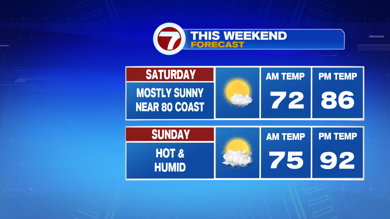
For your weekend plans, we’re tracking a warm-up with Saturday featuring highs into the upper 80s and Sunday jumps into the low 90s.
The heat doesn’t stop by weekend’s end either. Monday features highs into the mid to upper 90s, with Tuesday and Wednesday settling to seasonable highs – in the low to mid 80s with some thunderstorm chances.
As for the tropics, we have our 7th named storm of the hurricane season, it’s Tropical Storm Gonzalo and this is the earliest we’ve had a 7th named storm in the Atlantic. The storm continues to churn over a 1000 miles east of the southern Windward Islands and is expected to strengthen to a Category 1 Hurricane Thursday (which would also make it the first hurricane of the 2020 Atlantic Hurricane Season).
