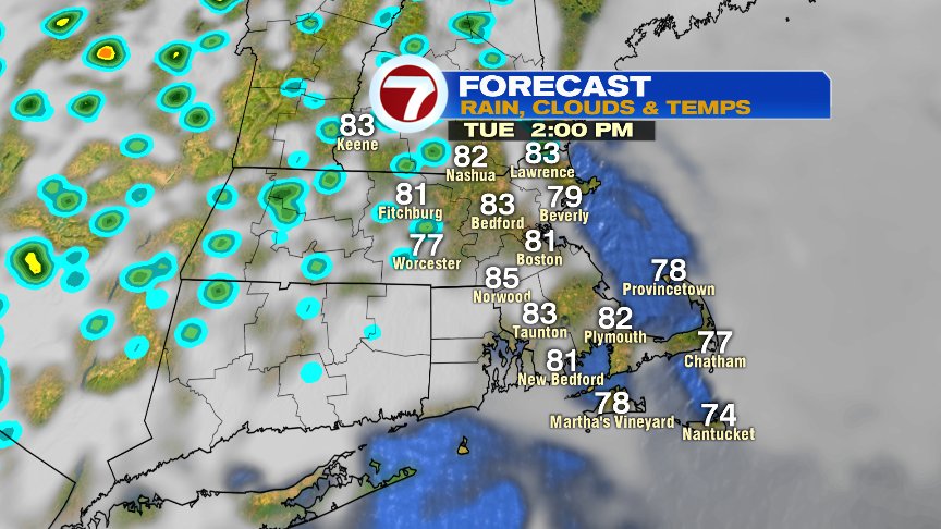
Summer’s soup is certainly in place this morning with sky high humidity, yielding to the tropical feel to the air in place. With that tropical air, comes tropical showers at times as a few spotty downpours are mixed in today amid a sky that features clouds and breaks of sun.
 Despite the chance of a few showers, it’s not a washout type day, and the highest rain risk starts to shift to the interior of New England later this afternoon and this evening. That rain risk remains highest deep inland through Wednesday midday. By late Wednesday afternoon and Wednesday night, more widespread showers and storms with locally heavy rain works back across the eastern half of New England.
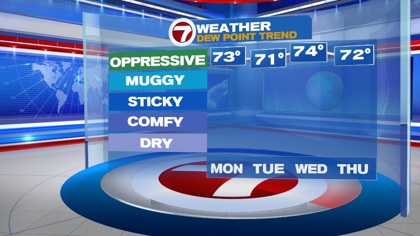
The high humidity is not going anywhere anytime soon. In fact, the next time we dip those dew points significantly below 70 won’t be until Sunday.
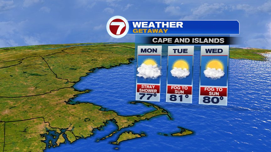
With high humidity, the Cape likely starts many days with low clouds/fog, but some sun breaks out in the afternoons and we’ll catch a lot of dry hours too.
With such a surge of tropical moisture & humidity in place this week, there will be a concern of localized flash flooding once showers/storms do become more widespread again late Wednesday and Wednesday night. For the most part this week though, the highest risk of flash flooding will extend from the western edges of New England, down through the mid-Atlantic.
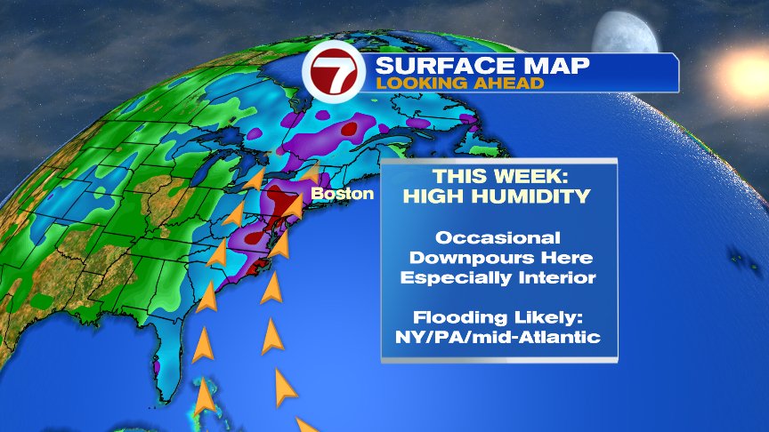
Check out some of the expected rain totals this week to our west… 4-7″ expected to be widespread with locally higher amounts likely.

Have a good day and stay cool!
@clamberton7 – twitter