It has certainly been an active week with two messy mix storms in the book, but we still have one more to go and that is tomorrow. While we’ve had two bigger storms lately, they’ve been part of what’s been a very active January. All but five days so far this month have recorded some type of precipitation in Boston, whether rain or snow. Sometimes both. And before today, you would have to go back two weeks to find our last dry day!
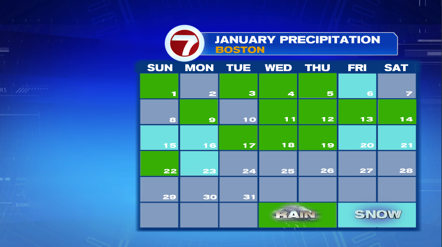
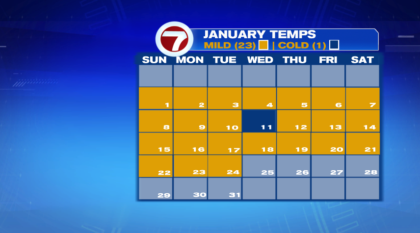
It’s certainly been wet, but we won’t sleep on the fact that it’s also been warm! Of course a toasty January is not really the set up we need for good snow storms to develop and why many of ours have been of the “messy mix” variety. Only one day this entire month has been below average. The month as a whole is running over 7° above average!
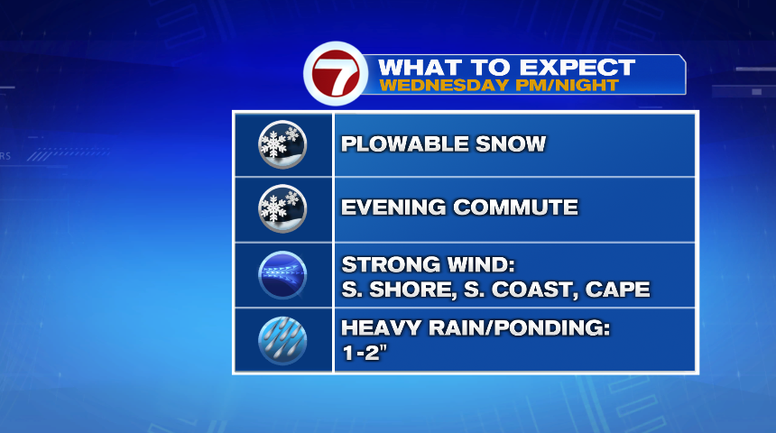
Hopefully you enjoyed today’s dry and technically mild day because wet weather is back for Wednesday. It will again be a storm of the “messy mix” variety, starting as snow before flipping over to rain. Throughout the storm, we will see accumulating snow, strong wind for some, and heavy rain. I’ll break it down one impact at a time below.
SNOW:
Keep the shovels on standby because we once again will have accumulating snow on the way tomorrow. Notice above, the snow impact I have listed twice. One impact is just an accumulating snow that many of us will have to dig out of again. Thankfully numbers for most of us will be less than Sunday/Monday’s storm. Then there’s the timing. Once again, snow will be falling during your evening commute Wednesday.
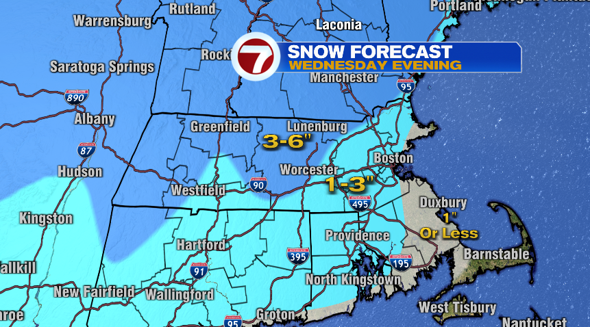
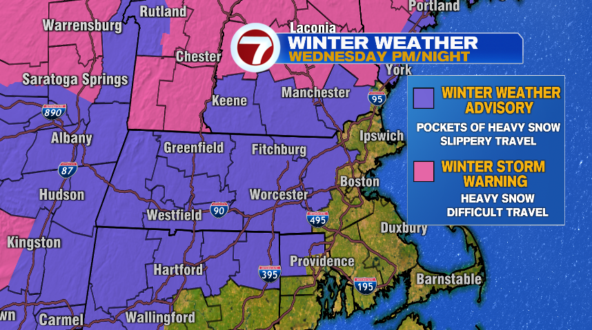
A winter weather advisory is in effect for areas outside of 128 for tomorrow afternoon, evening, and overnight. For perspective, Sunday night/Monday’s storm was a winter storm warning in some places (northern Worcester County and Southern New Hampshire) with the rest of us under a winter weather advisory. The reason I point that out is the winter storm warning is issued for high snowfall accumulations (we saw 8″ in spots) along with difficult to near impossible travel. The winter weather advisory is issued for some accumulating snow and difficult travel. That is what we have in effect for Wednesday. If you need to drive Wednesday just take it slow and know there will be some rough patches out there.
WIND:
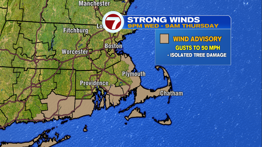
Wind will pick up with the storm as it moves in Wednesday and it will stay breezy through the day on Thursday. While we all feel the wind, it has the potential to produce isolated pockets of damage in areas shaded in tan. That’s a wind advisory for gusts from the southeast up to 50 mph.
RAIN:
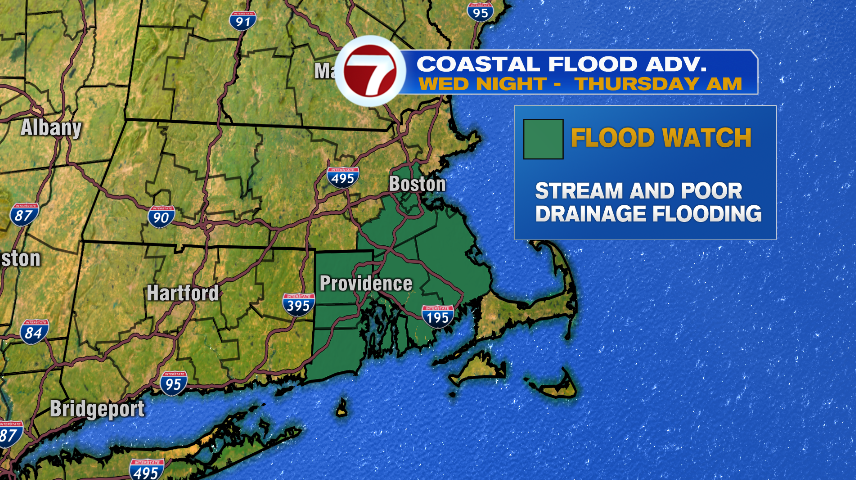
Don’t sleep on the rain with this storm either. The storm is loaded up with moisture as it moves in from the south. The changeover from snow to rain will happen south to north. And as that rain line surges north, some heavy rain will come along with it. But the heavy rain is only half of the problem. The snow that’s on the ground is also a wet, waterlogged snow and as it rains on top of that and melts it, that will add even more water for storm drains and streams to move away. To add insult to injury, go back to that first graphic about how wet January as been. There’s not much room in an already saturated soil for this water to go. A flood watch is in effect for areas inside 128 and in SE Massachusetts for stream and poor drainage flooding, especially in low lying areas.
TIMING:
Now for the timing of it all.
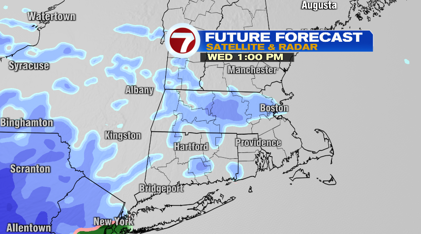
– Wednesday morning commute: dry
– Noon Wednesday: a few snow showers develop
– 4pm Wednesday: Snow becomes steadier and heavier, just in time for evening commute. Precipitation initially starts as snow for everyone.
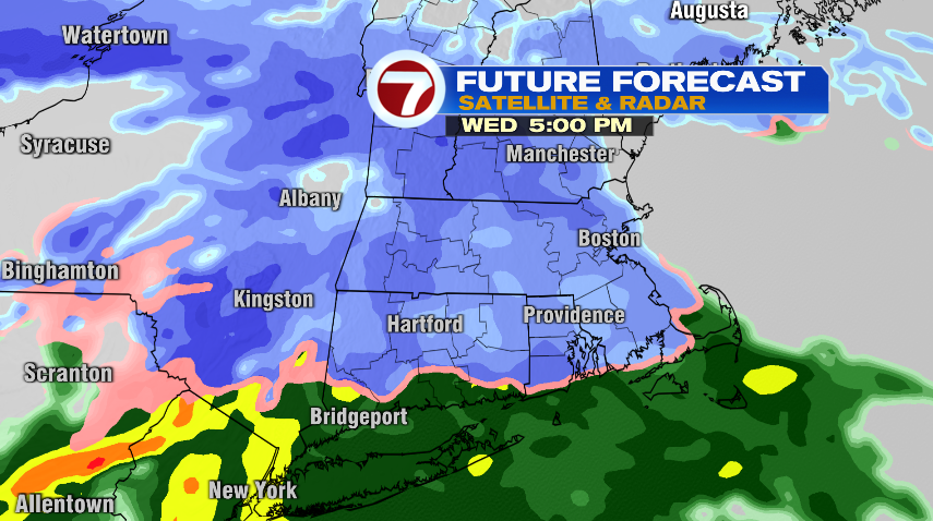
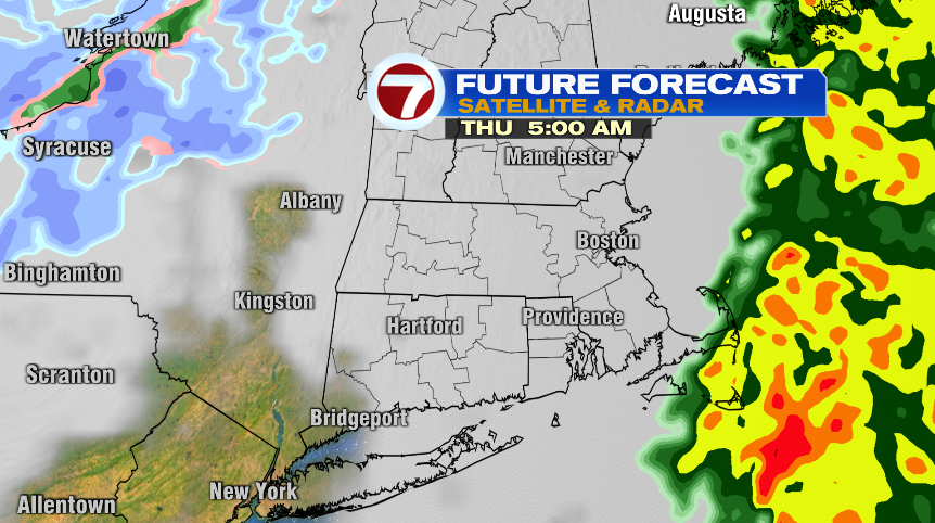
-8pm Wednesday: Rain/snow line pushes up to the Mass Pike. Areas north of that continue with snow and some heavier pockets of snow, while areas south transition to rain and pockets of heavy rain.

-10pm Wednesday: most areas have flipped entirely to rain (and heavy rain).
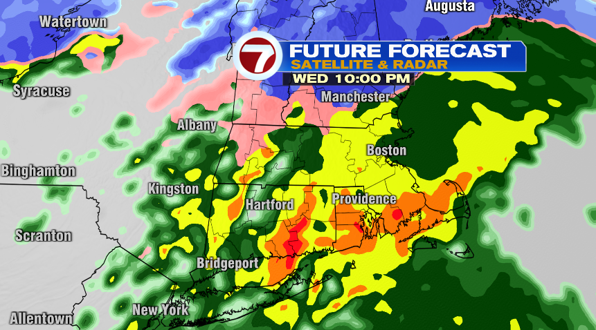
-5am Thursday: Rain continues steady and heavy overnight exiting before the morning commute Thursday. The rain will end west to east, exiting Worcester county in the overnight with the last of the showers moving off the Cape by 5am.