The unsettled pattern that we’ve seem to be stuck in again this week will continue through Friday, but the good news is that this pattern breaks as we head into the weekend.
Tonight, expect some clouds and a spot shower. It will be muggy with some areas of patchy fog with low temperatures only slipping to 60°.
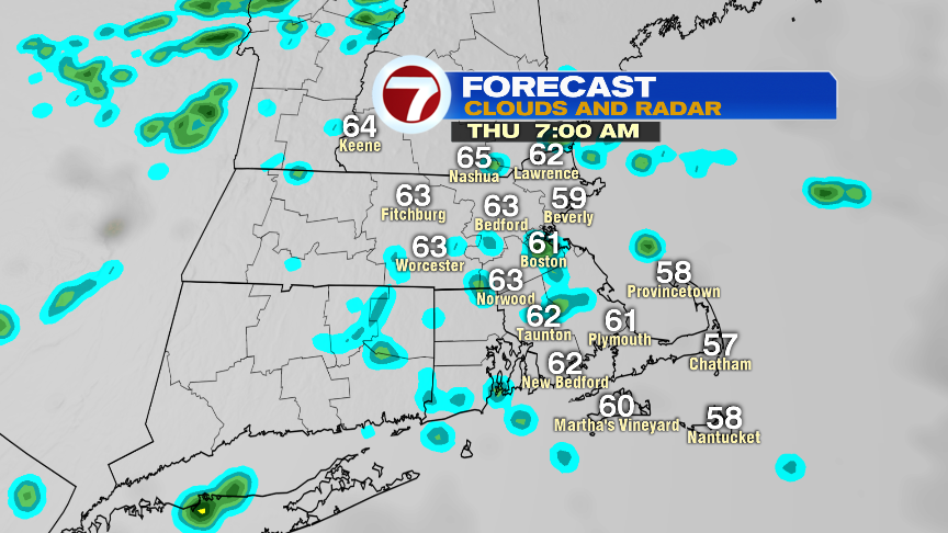
Thursday features a few scattered showers, especially in the midday – afternoon, before dispersing to isolated showers by 7PM. We could see some embedded downpours/t’storms around 3PM tomorrow, so if you have any outdoor plans, be sure to keep your eyes to the skies.


We start off Friday under mainly cloudy skies and a few scattered showers, but we should see some sunshine emerge late in the day as the clouds and the showers depart.

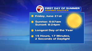
Speaking of Friday, it’s the Summer Solstice, the first day of summer in the Northern Hemisphere!
Looking ahead to the weekend, as previously mentioned, we will be breaking the cloudy, wet, unsettled pattern that we’ve been dealing with for most of this week. Saturday features partly cloudy skies with highs into the mid 70s, 80s return Sunday, but expect slightly cooler conditions at the coast.
We’re still dry to kick off the next work week, but it will be hot, with highs into the mid 80s. Thunderstorm threat returns Tuesday and Wednesday.
