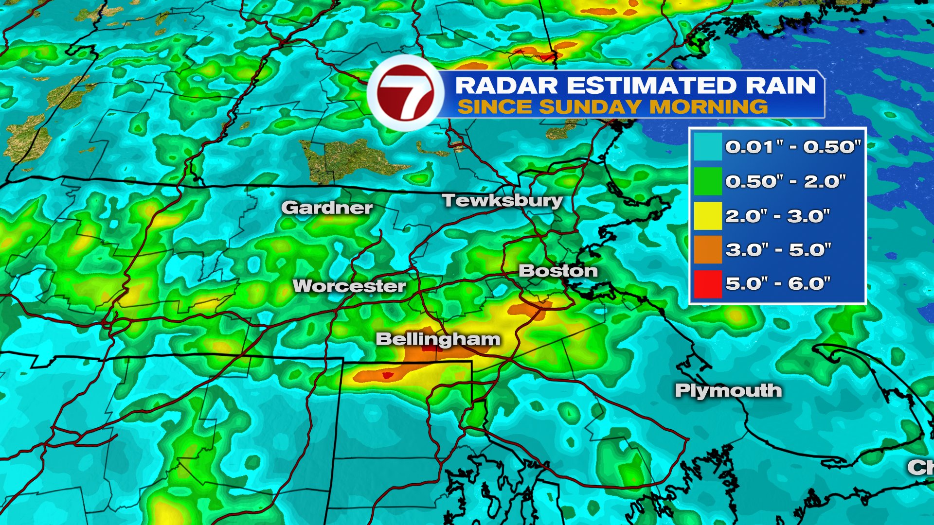
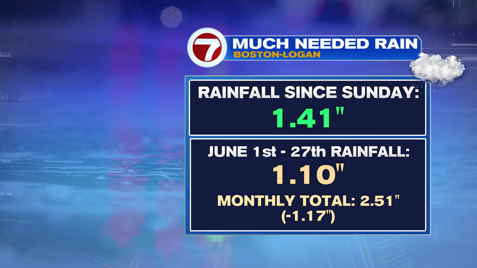
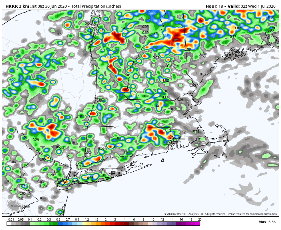
While storms can be feast or famine this time of year, they have been developing often enough, that many towns and cities have seen beneficial rain the last few days. Of course, too much, too fast can create flash flood problems like we saw Sunday, where some towns south of the Pike, picked up 3-5″ within an hour or two. It’s a fine line we walk in the summer months. In the city of Boston, we’ve picked up about 1.5″ of water the last couple days, besting what the first 27 days of June offered.
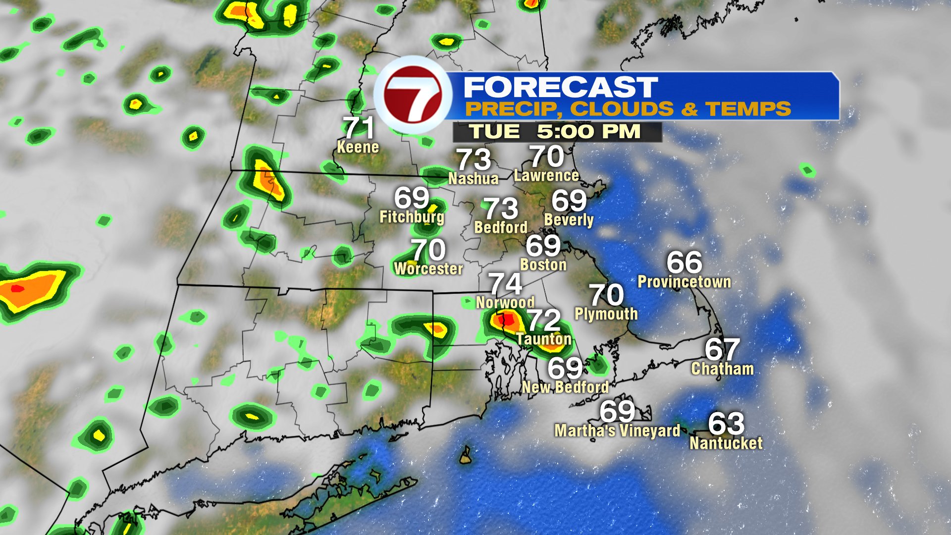
Today and tomorrow, more scattered downpours fire up. They tend to favor interior locations near/west of 495 as the best instability with the warmest air tends to favor those locations thanks to the northeast wind that’ll keep it coolest near the coast. A quick 1-2″ or rain and small hail is possible in the strongest storms, but those strong storms will be more isolated vs. widespread, and again, focused inland.
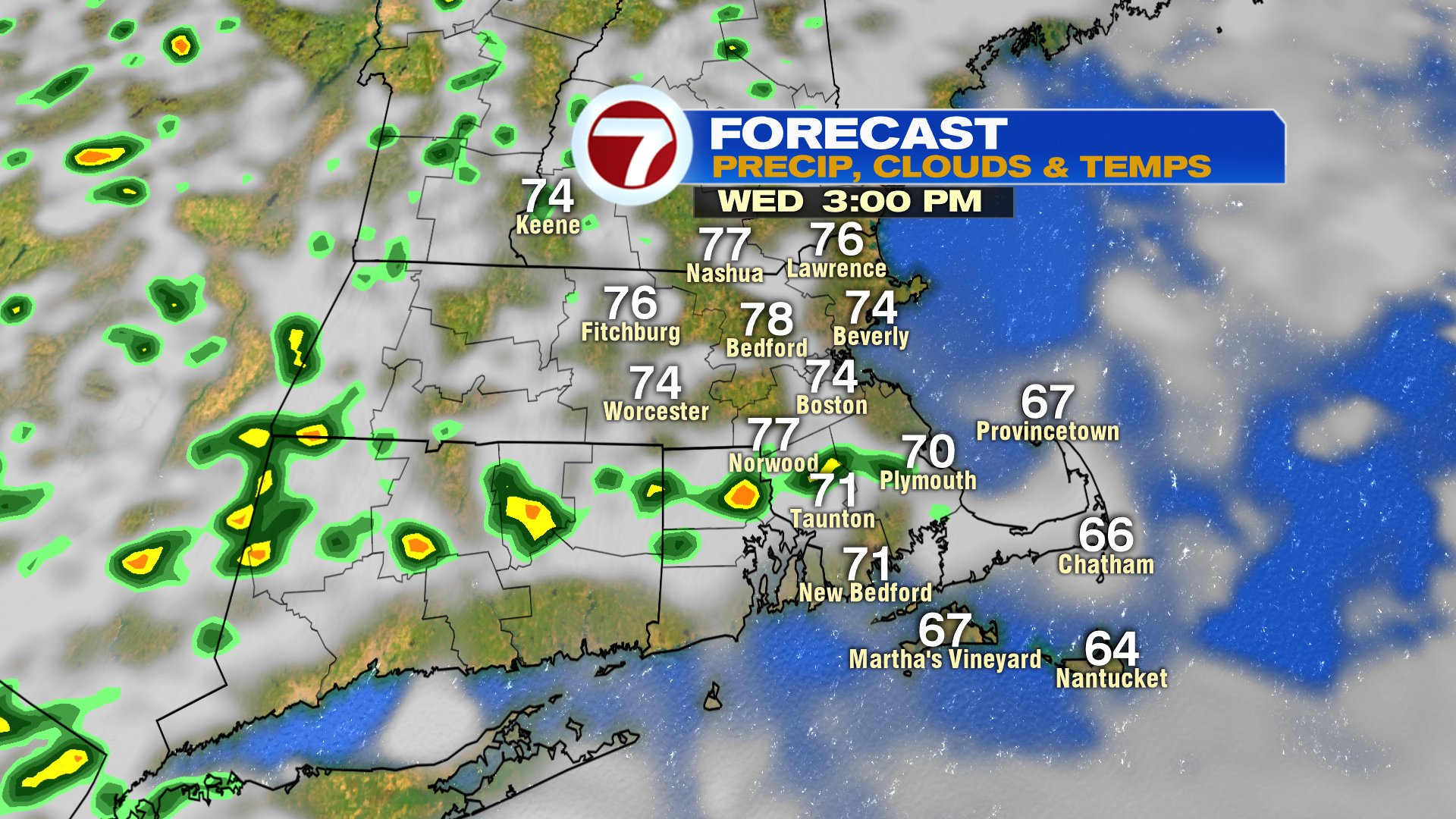
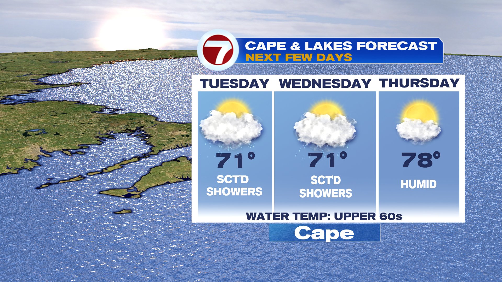
Thursday turns warmer for all of us. Upper 70s across the Cape, mid 80s inland.