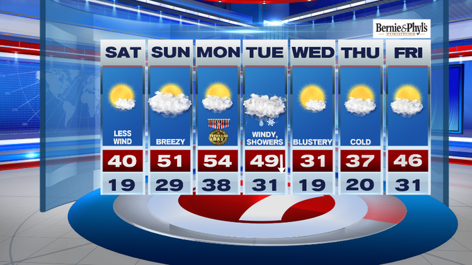
Typically, high temperatures are in the 50s and lows are in the upper 30s this time of the year.
This morning was one of those mornings where you had to bundle up since we have not seen such a cold airmass since March, over 230 days ago!


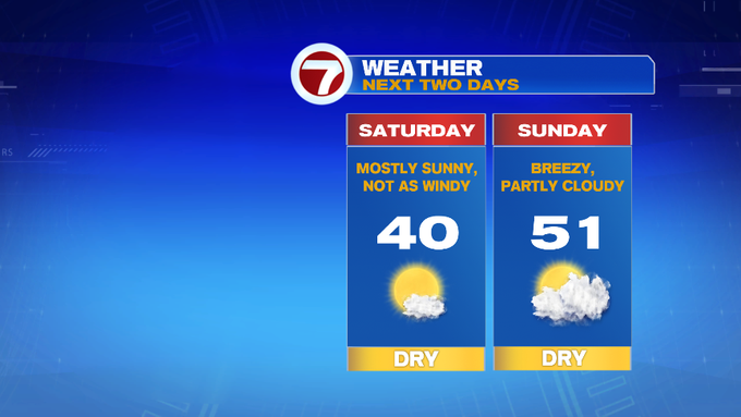
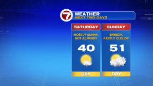
Today, we’ll likely see high temperatures in the upper 30s to low 40s under mainly sun-filled skies. Thankfully, the wind will not be nearly as strong as yesterday.
Tonight, expect a few more clouds to stroll in, keeping us slightly warmer than last night. Overnight lows are expected in the upper 20s to low 30s (around seasonable conditions).
Sunday features highs in the low 50s with increasing clouds into the afternoon ahead of a front to our north. We will remain dry both today and tomorrow.
Looking ahead to Veterans Day, expect seasonable conditions with highs into the low 50s under partly to mainly cloudy skies.
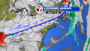
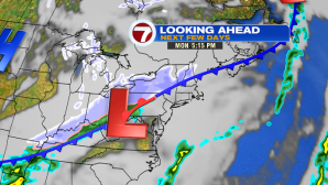
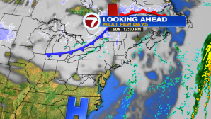
Tuesday is when we are tracking our next system that will bring rain, wind, and on the backside of the system – snow.
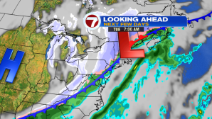
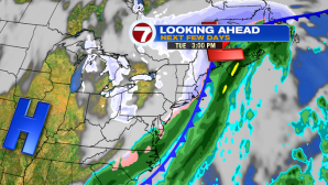
As far as timing on Tuesday, a few isolated rain showers in the morning, highs in the upper 40s before taking a nose dive as the cold front swings in by the afternoon. That rain/snow line will continue to march from west to east. With rain changing to snow by Tuesday evening, it could get quite slick since we’re also looking at bitter wind chills through Wednesday. High temperatures on Wednesday will likely stay below the freezing mark with wind gusts up to 35 mph.