
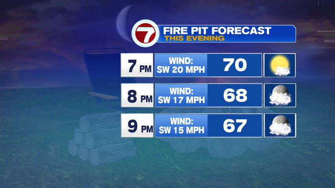
Through this evening, temperatures will remain mild, but it will still be breezy so you may need that light sweatshirt if you’re going for a walk after sunset or spending some time by the fire pit tonight.
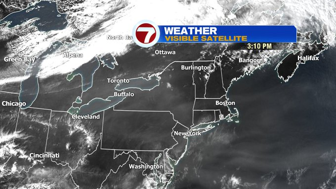
You’ve also probably noticed milky hue to the sky today, which is still the smoke from the western wildfires that has been carried by the upper atmosphere across the United States and into southern New England, which we can see on visible satellite imagery.
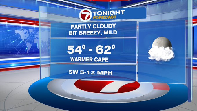
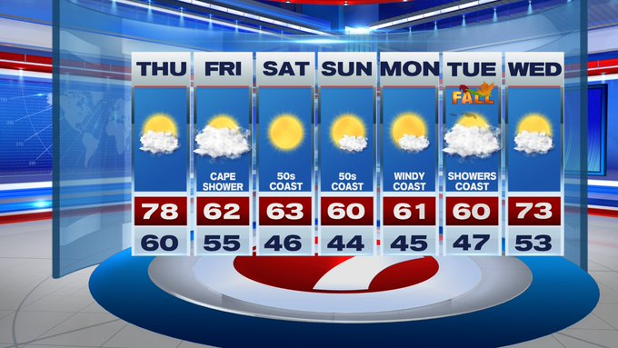
Tonight, expect partly cloudy skies and mild conditions compared to the previous few nights which were on the chillier side.
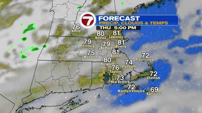
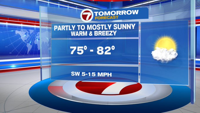
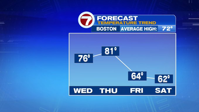
For Thursday, temperatures will be slightly warmer than the day today, making it feel more summer-like with highs grazing the low 80s for quite a few locations. There is a chance for a few showers early on the Cape and Islands, otherwise Thursday is dry.
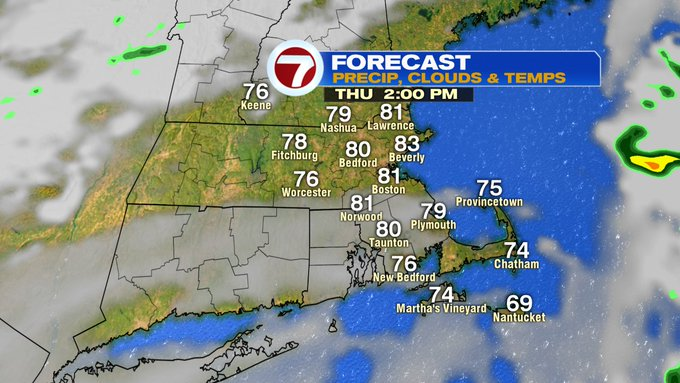
We will still have that southwesterly wind, comfortable humidity and sunshine (with the haze moving out).
Friday turns cooler after a col front clears the area late Thursday night into early Friday morning which could result in a few showers. Highs on Friday only stretch into the 60s, and the fall-air sticks around for the weekend.
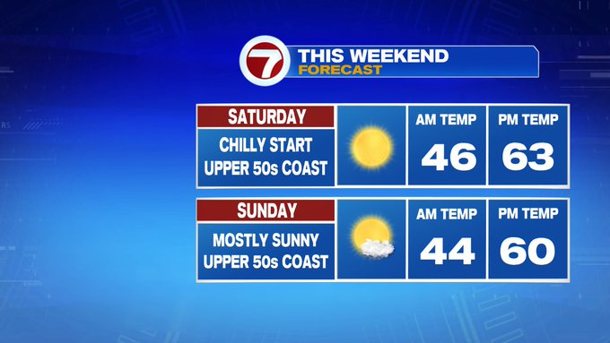
Both Saturday and Sunday have northeast winds which will keep temperatures slightly cooler at the coast AND could result in rough surf.
Now, let’s talk tropics. We just passed the peak of hurricane season and the Atlantic is still very active with several areas to watch.
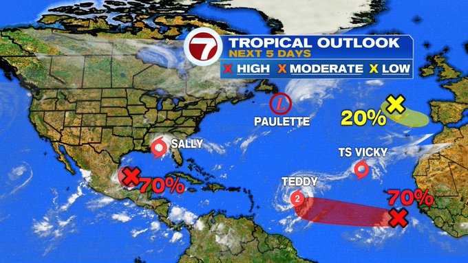
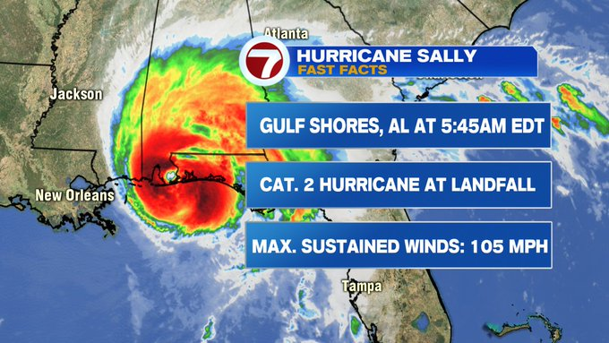
Sally made landfall earlier this morning along the Alabama Gulf Coast as a Category 2 Hurricane with maximum sustained winds of 105 MPH. It continues to bring flooding rainfall to portions of the Gulf Coast, especially along the Alabama coast and Florida panhandle.
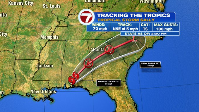
Sally continues to weaken over land and is now a tropical storm.
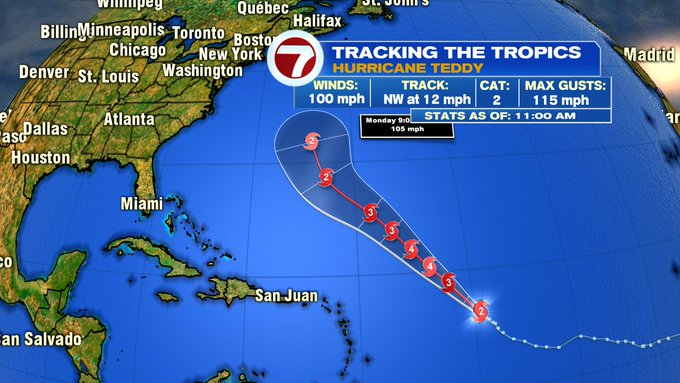
Teddy, currently a Cat. 2 Hurricane, is expected to become a major hurricane (Cat. 3 or higher) over the next 24-48 hours. It’s currently over the open ocean and is projected to move north towards Bermuda, and could bring some swells to southern New England. We will certainly keep an eye on this one over the next several days.
As for our forecast through the rest of the 7-day, feel like fall as we get closer to the Fall Equinox (the first day of fall), which is less than a week away!
— Jackie Layer