
The ying and the yang of the atmosphere had to catch up with us at some point. Meaning, May was such a great month for us with a lot of sunny days, cool nights, mild afternoons; and of course limited rainfall. This is not to say that June is already a lost cause but rather, sooner or later we were bound to find a stretch of less than ideal days. These types of patterns are typical in spring/early summer tho…
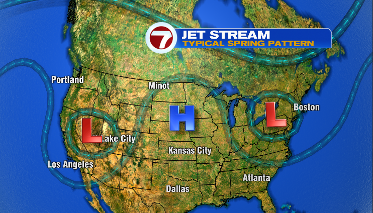
In May, we were under the influence of a slow moving High Pressure system and at least for this week, we’ll be under the influence of a Low Pressure system. The reason these systems move slow is due to the fact that the fast-moving winter jet stream has retreated (and slowed) up into northern Canada and will reside there until September-October.

The good news is that even within an unsettled pattern, one can eek out a decent day…I think that happens for a lot of us Tuesday.
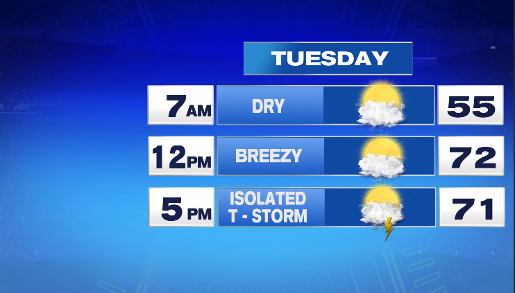
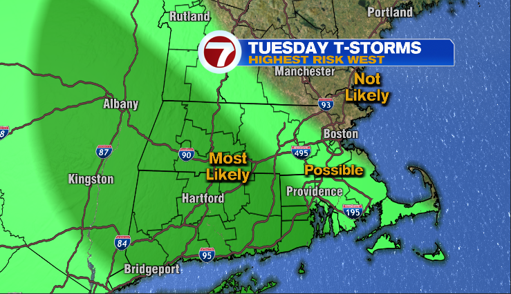
We’ll still be under the influence of Low Pressure centered up in the Canadian Maritimes but the air will be drier than these past three days. Plan on partly to mostly sunny skies (hazy sunshine as another Canada Wildfire smoke plume drifts into our skies through the day) for Tuesday morning and into the early afternoon hours. By mid afternoon, a few thunderstorms will pop and move through the area. As I type (Monday evening), I think western New England has the highest chance of the afternoon thunderstorms while areas closer to the coast may not see any thunderstorm activity…
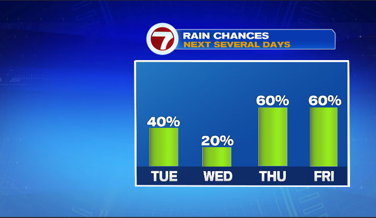
Tuesday is warmer for all of us (regardless of storm chance) as afternoon temps will bounce into the 70s….normal for this time of year! The remainder of the week is unsettled as you’ll see on the 7-day forecast but no day is a complete washout as the chance of rain for each day never gets to 100% for any location…

Enjoy what’s left of your Monday!
~JR