Remember the drought we dealt with all summer? Well that has been wiped out with a wet end to 2020. And it looks like the active and wet pattern will take us into early 2021 as well. But before we get there, let’s talk about today first.
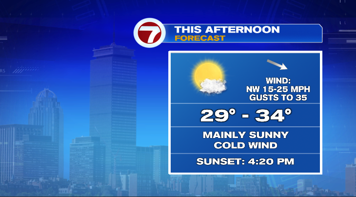
In a word, cold. Air temperatures this morning actually aren’t bad for a December morning. In fact wind chills aren’t bad for a late December morning. The problem is there’s no improvement through the day today. Temperatures will basically flat line until about 1pm and then start to decline from there. Factor in a gusty wind that will also develop later today and that will drive feels like temperatures down to the 20s and even teens after sunet.
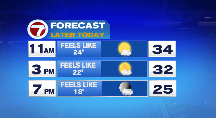
So this afternoon, we’ll actually look for colder temperatures than what we have this morning. So maybe go with the heavier jacket… not because you need it now, but because you’ll need it later.
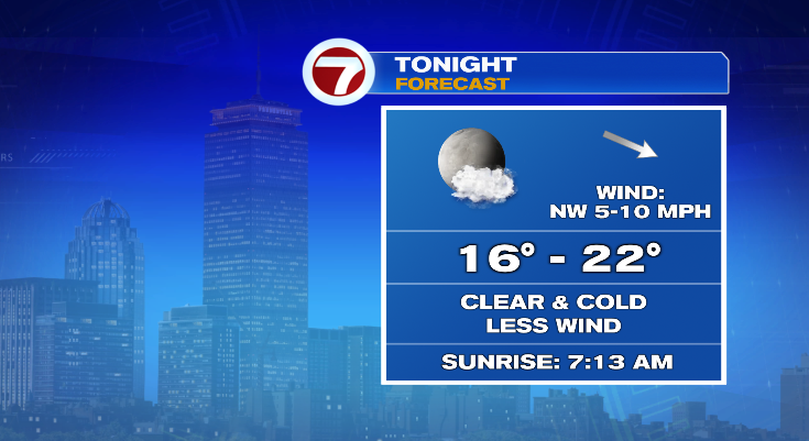
Tonight will continue with the cold and quiet trend. Winds will settle a bit. That combined with clear skies will allow temperatures to dip into the teens for most of us Wednesday morning.
Now let’s talk about the unsettled pattern ahead. There’s a train of storm moving through the area that will bring several rain chances. Today and tomorrow are dry. With the first round of scattered, light rain on Thursday morning.
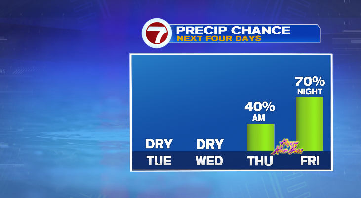
The good news is our rain chances will book-end New Year’s Eve so that forecast looks dry.
Now let’s try to break down the storms. We’ll go day by day:
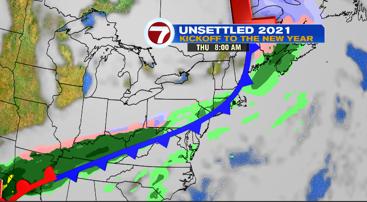
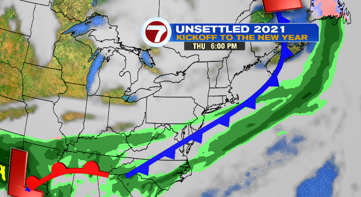
Thursday:
Thursday morning starts with light, scattered showers and is not a washout. We’ll have a dry afternoon — except those of us on the Cape where showers cold linger until early afternoon. Below are snapshots from 8am and 6pm on Thursday.
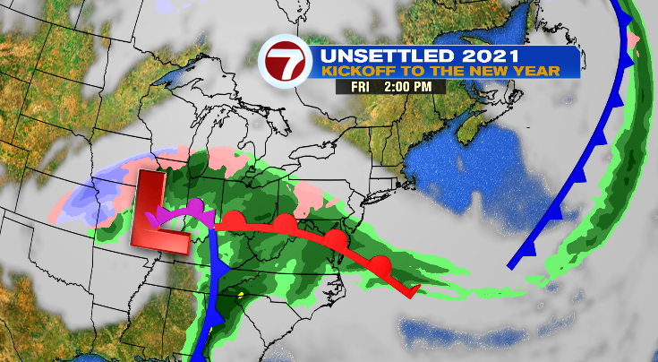
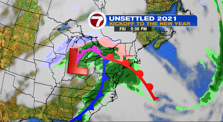
The bigger system is on the way for Friday.
Friday:
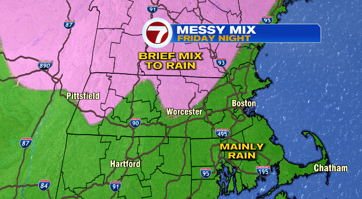
Friday is a dry day. Rain doesn’t move in until after sunset and likely after dinner time. There is enough cold air in place where areas northwest of 495 could see a messy mix Friday night and possibly some icing. Everyone else will see rain. Below are snapshots from 2pm and 9:30pm on Friday.
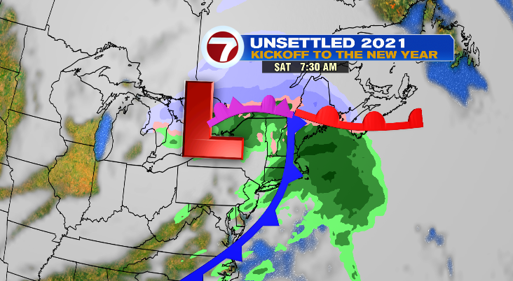
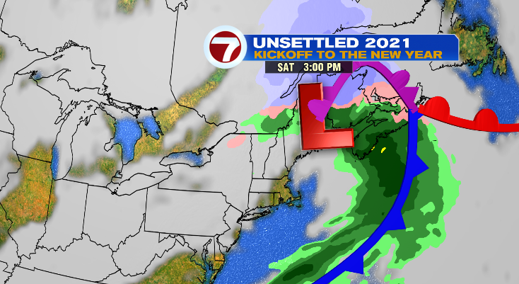
Saturday:
The rain showers will linger into early Saturday morning but that looks to move out early, leaving us plenty of time to not only enjoy a dry Saturday, but developing sunshine as well. Below are snapshots from 7:30am and 3pm on Saturday.
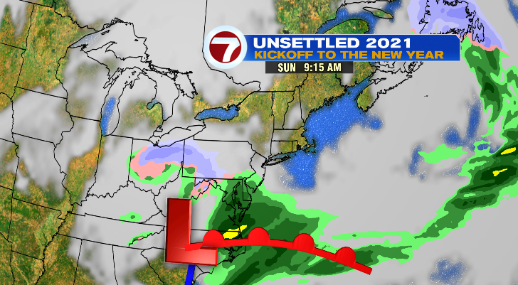
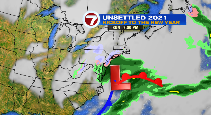
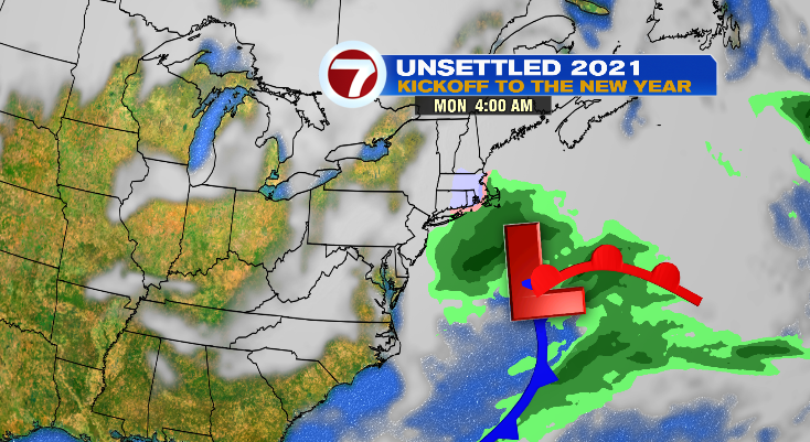
Sunday’s storm is a little more uncertain — so here’s what it looks like as the writing of this blog (Tuesday morning). It is likely to change over the next week.
Sunday/Sunday Night:
Again, Sunday is a dry day. The storm is off shore from us, but may just graze us. There is enough cold air in place where this would likely start as a rain/snow mix and go over to snow. A few miles here is going to make a huge difference. If it moves further off shore, we’d be looking at a dry forecast. If it moves back west, our rain/snow chances would increase. Again. This is one to just keep an eye on as of now. Below are snapshots from 9:15am, 7pm, and 4am Monday morning.