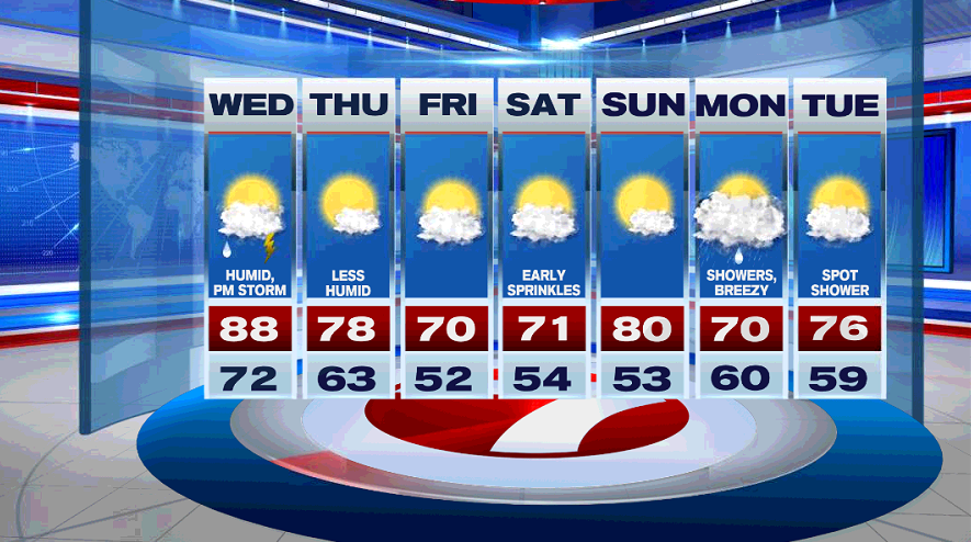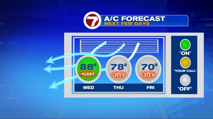
It is warm and humid Wednesday, and then we get relief from the heat and tropical-like air by the end of the week.
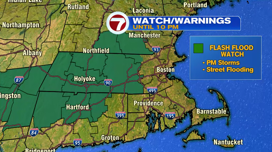
We’ll start the forecast with this evening and tonight. There will be slow moving thunderstorms capable of producing locally heavy rain across the region this evening. A Flash Flood Watch in effect for portions of the area until 10 PM. After 10 PM, there will be spotty showers overnight. You may hear rumbles of thunder.
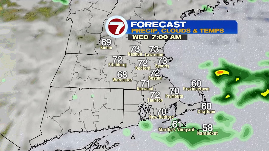
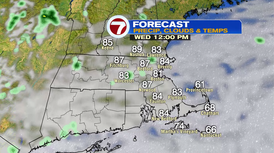
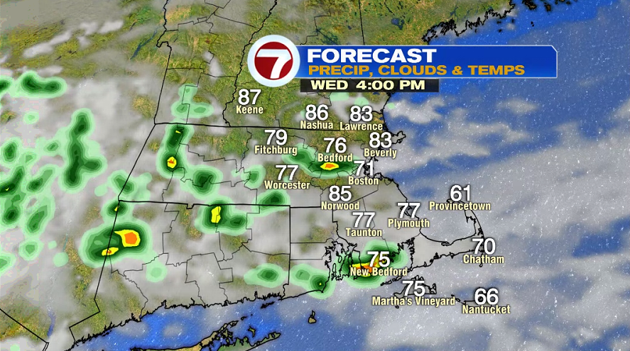
There could be a spot shower very early Wednesday morning and temperatures are in the low 70s. It will feel tropical around lunch time and this will be the warmest part of the day with temperatures between 85-90º. The day starts mainly cloudy, and then skies gradually clear throughout the afternoon. A cold front will likely spark up a few afternoon storms. Temperatures drop into the 70s by 4-5 PM.
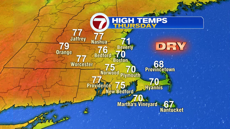
There will finally be relief from the heat and humidity on Thursday. Inland areas will make it into the mid and upper 70s. An onshore breeze will keep the coast cooler with highs near 70º. Skies will be mainly sunny.
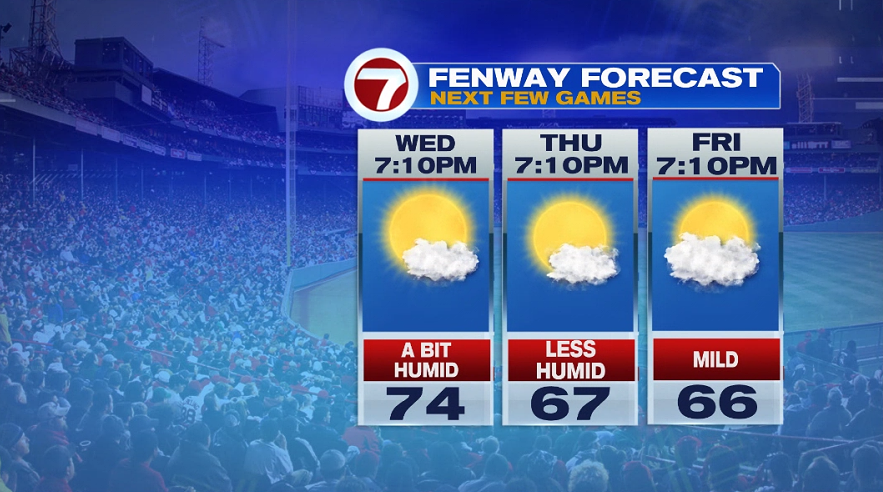
The next three games at Fenway will have great weather. It might still feel a bit humid for tomorrow’s first pitch and it will be in the mid 70s. Thursday’s game will have mainly clear skies, low humidity and it is mild in the 60s. Friday at Fenway will be partly cloudy and in the mid 60s.
The milder weather continues into Saturday with highs in the low 70s. Saturday morning will have sprinkles early in the morning, and then the afternoon is dry and partly sunny. Sunday is warmer, but don’t worry, the 90s are not back. As of now, it looks like we kick off next week with showers on Monday.