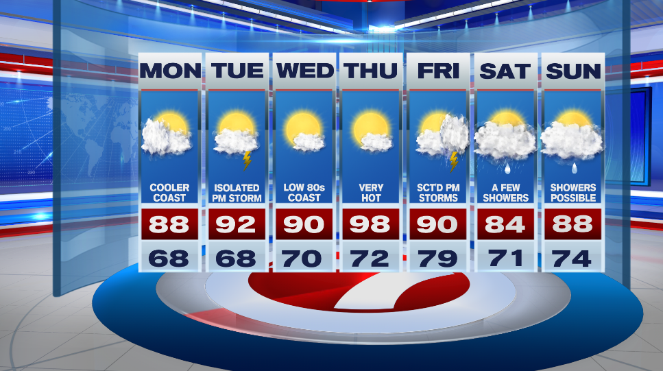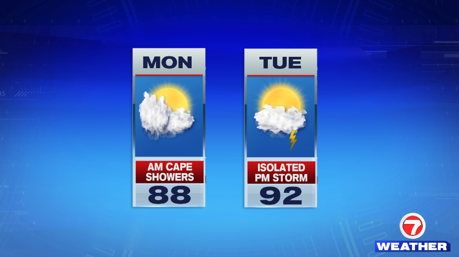
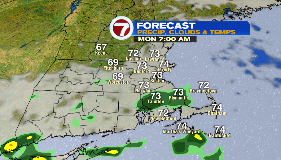
7Weather- A low pressure system moves by south of the area on Monday, bringing in clouds and spotty showers.
The chance of showers starts very early Monday morning and goes through the morning commute. Most location will only see a few sprinkles, but SE Mass could get light rain. What falls won’t amount to much.
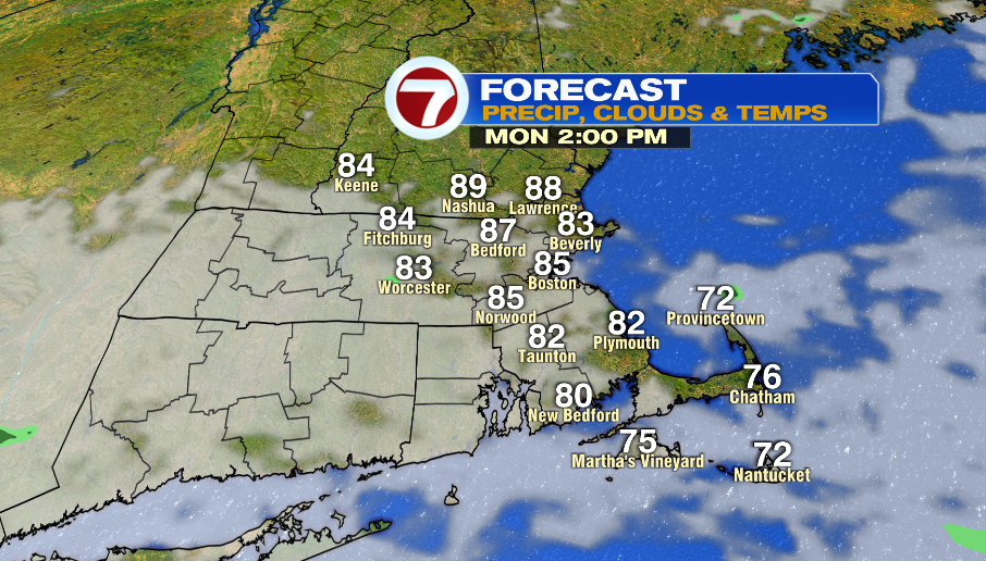
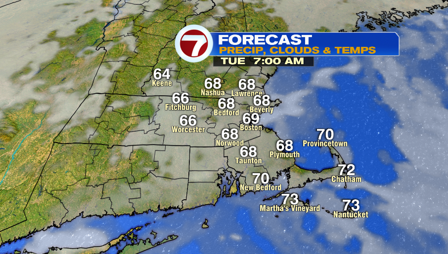
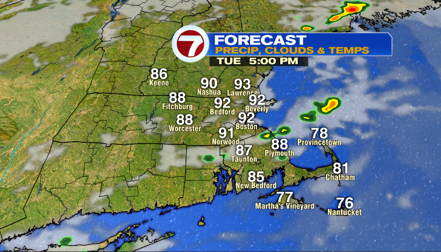
Temperatures will be in the upper 60s and low 70s to start the day and then we get into the mid and upper 80s in the afternoon.

Tuesday starts will low clouds and patchy fog, but that quickly burns off and then rest of the day has a mix of clouds and sun. We start in the upper 60s and get into the low 90s in the afternoon. Humidity increases making it will feel a bit muggy.
A weak front approaches the area in the afternoon. A couple of locations could get a thunderstorm.
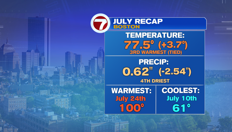
The average temperature for July that is shown below does not include today, but we will still likely end up in the top 5 warmest Julys on record.
JULY PRECIP:
-23 dry days, 8 wet days, 4th driest July on record
1. 0.52″ (1952)
2. 0.55 (1968)
3. 0.55 (1965)
4. 0.62″ (2022)
Wednesday has highs in the low 90s inland and in the low 80s along the coast. Thursday is very hot with highs near 100º. Overall, a hot start to August.