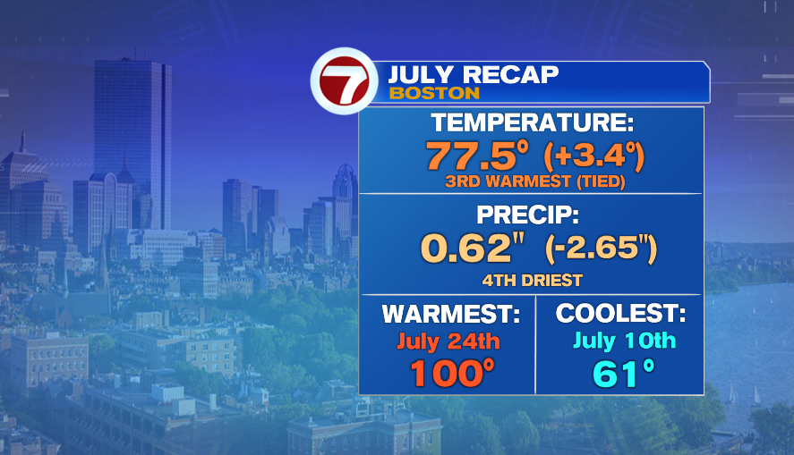
7Weather- It was a hot and dry July. We all know it, but here are the official numbers for the month.
Boston tied for the 3rd warmest July on record, and we had the 4th driest. Boston only received 0.62″ of rain, really putting us behind for summer rainfall.
We all remember the hottest day when Boston hit 100º on July 24th.
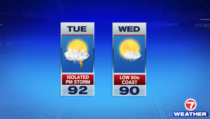
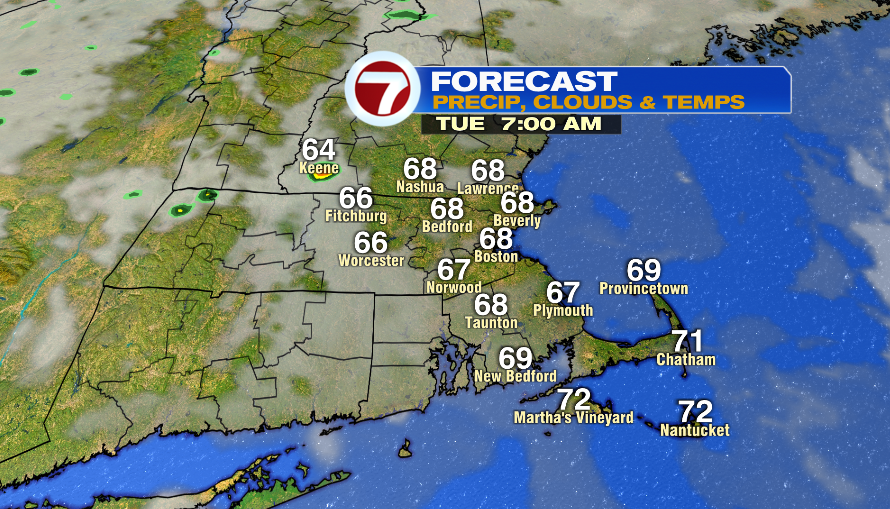
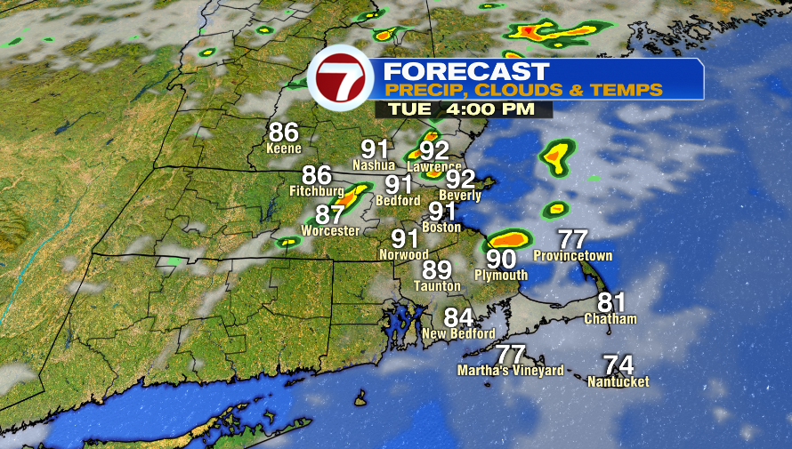
Tuesday could have patchy fog in the morning and then a mix of clouds and sun in the afternoon. Temperatures start in the upper 60s and then we hit highs in in the low 90s.
A cold front moves through the area in the afternoon and it could spark up a few storms. Only a few towns/cities will get lucky this time around as this line of storms likely falls apart as it gets to us. It will feel a bit sticky.
Highs are in the low and mid 90s inland on Wednesday, but an onshore breeze will keep the coast in the low and mid 80s. Humidity is low.
Thursday is very hot, but at least we’ll be dealing with a dry heat. Humidity will be low-moderate.
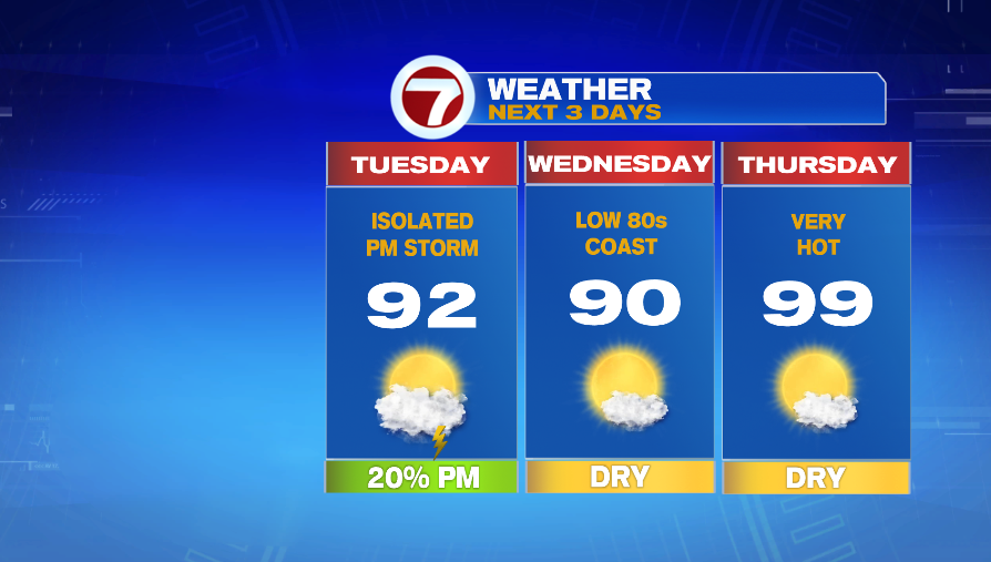
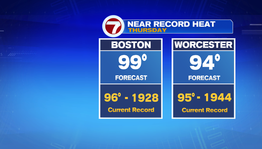
It’s likely that Boston breaks the record high temp on Thursday. The forecast is 99º and the current record is 96º set back in 1928.
Friday is not as hot, but it will be humid. Highs are in the low 90s and we could get beneficial rain from scattered afternoon storms. A cold front gives us the chance for rain on Friday. It’s possible it stalls over us and brings in a few showers on Saturday.
