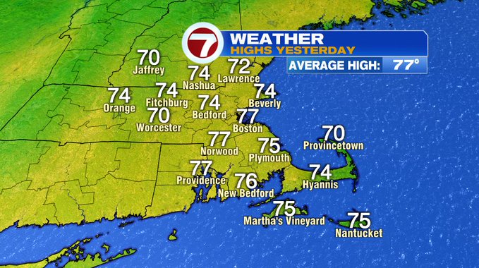
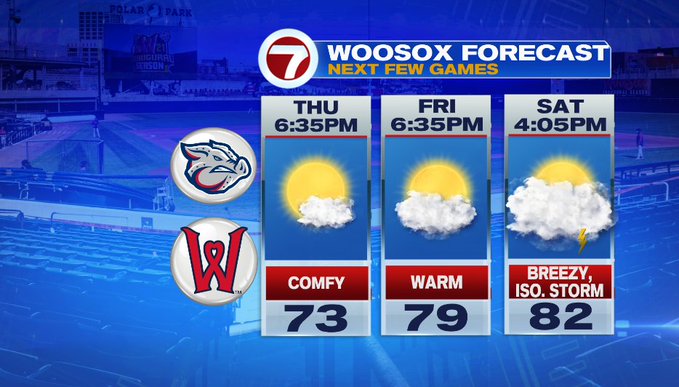
After two seasonable days in a row along with mostly sunny skies and low humidity, a warm-up is on the way to round out the week and it will continue into the holiday weekend.
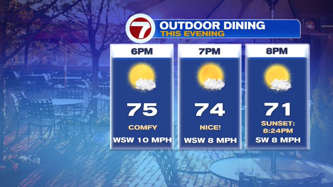
This evening will still be beautiful for any of your outdoor plans — great for outdoor dining or catching a WooSox game.
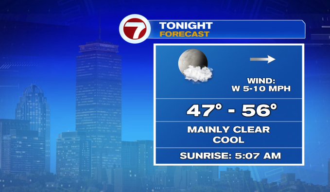
Tonight, similar to last night, overnight lows will dip into the upper 40s to mid 50s under mainly clear skies.
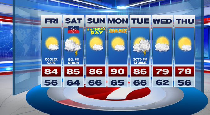
Tomorrow, highs will jump into the low 80s under mostly sunny skies. The humidity will still be comfortable, but it will be on the rise into Saturday.
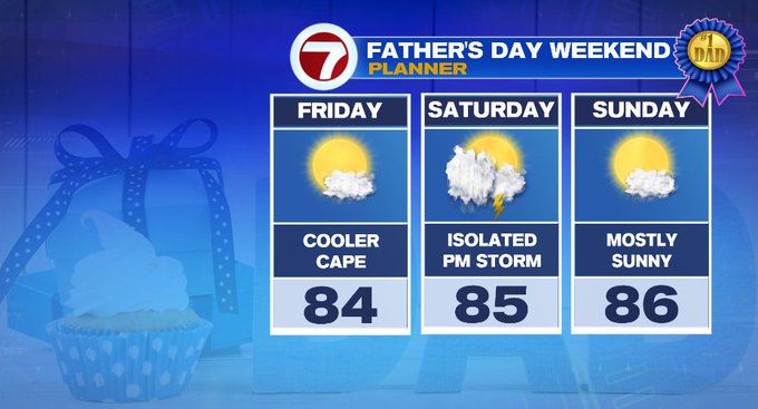
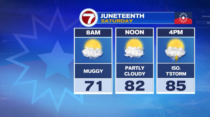
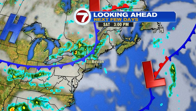
For Juneteenth on Saturday, be weather aware during the late afternoon / early evening. A cold front will move in, bringing a chance for isolated thunderstorms.
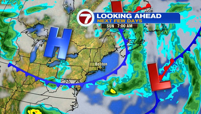
That cold front clears the area pre-dawn Sunday, providing mostly sunny skies for Father’s Day and highs into the mid 80s, with a slight dip in the humidity.
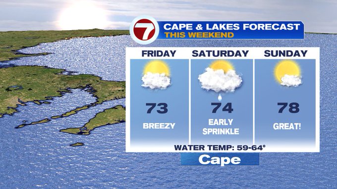
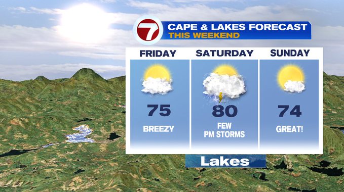
For your weekend plans, whether they take you to the Cape or the Lakes region, here’s a look at your forecast:
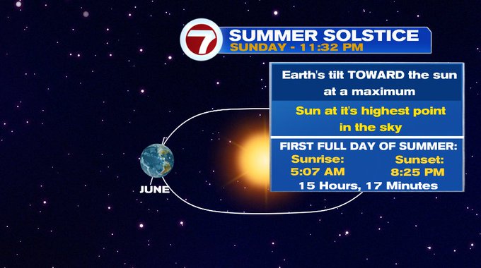
The summer solstice is Sunday, with summer officially beginning at 11:32PM Sunday night, so for the first full day of summer on Monday, the longest day of the year, we’re tracking summer-like heat with highs topping out around 90°.
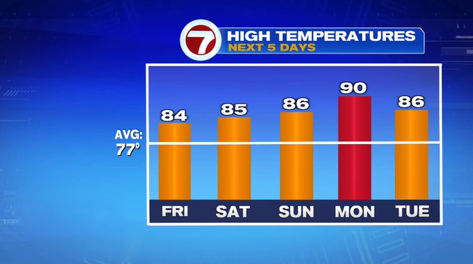
Our next front pushes in Tuesday afternoon/evening, giving us a chance for scattered thunderstorms. That clears the region by Wednesday and leaves much more comfortable air in it’s wake for Wednesday and Thursday with highs in the upper 70s under mostly sunny skies.