I hope everyone was able to enjoy the beautiful weather on the 4th of July. We started off cloudy and foggy, then the sun emerged and warmed temperatures into the low to mid 80s inland, while an afternoon seabreeze cooled temperatures into the upper 60s to low 70s at the coast.
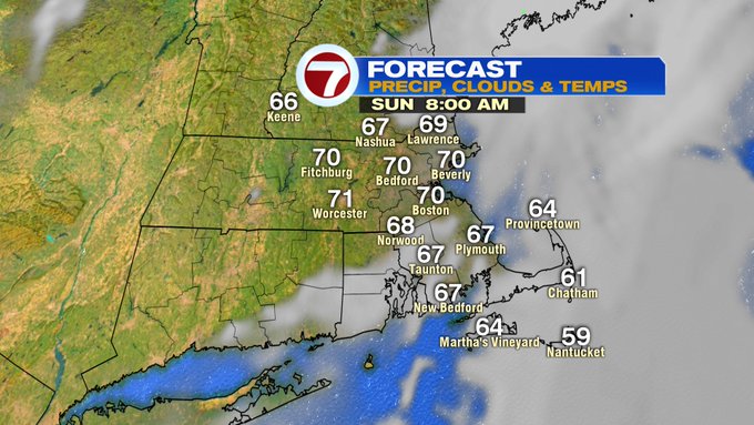
Tonight, we’ll see some areas of patchy fog and partly cloudy skies with lows only into the 60s with an east-southeast wind.
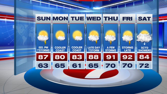
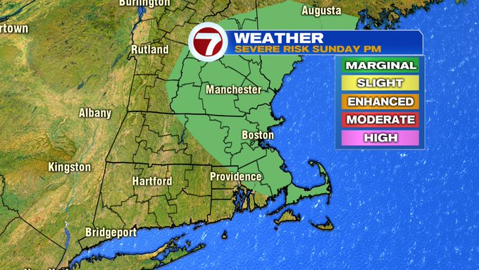
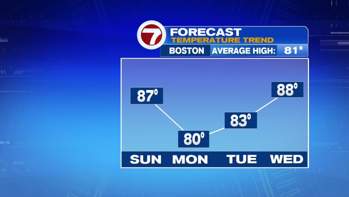
Tomorrow, the second half of the holiday weekend is warmer with highs into the mid to upper 80s (a touch cooler at the coast with a seabreeze that develops in the afternoon).
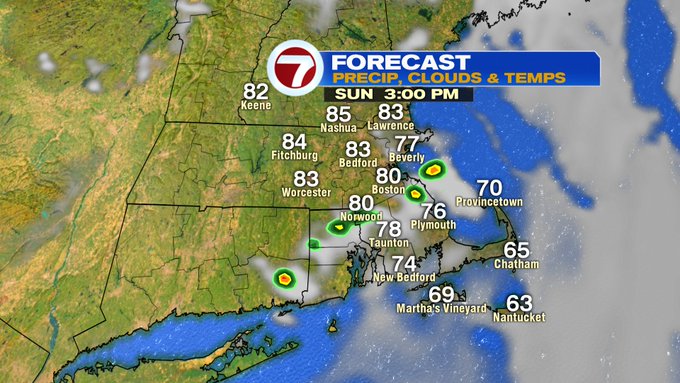
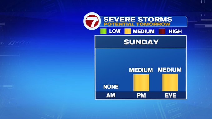
We also see the potential for some thunderstorms developing by mid to late afternoon and continuing into the evening. Not everyone will be seeing these, but a few of these could be on the strong to severe side, with damaging gusts being the main concern.


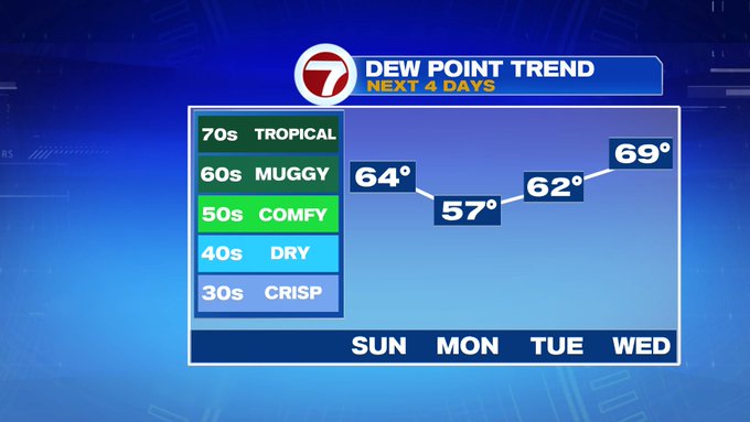
Monday and Tuesday feature more seasonable highs into the low 80s (and lower dewpoints) before we turn towards the heat and humidity to end the week.
90s are slated to return Thursday and Friday, along with some scattered afternoon storms. Next Saturday looks wet with scattered showers and highs into the low to mid 80s.