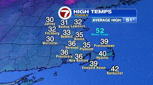
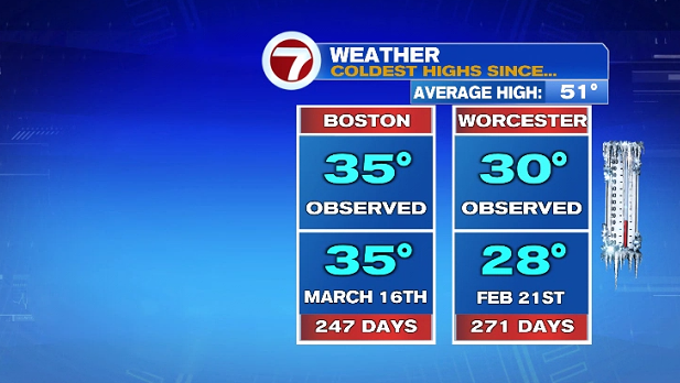
Today felt more like February than November with highs only in the 30s, coupled up with the northwest winds, the wind chills were in the 20s for most of the day. Today’s highs were the coldest since late February and mid-March, over 200 days ago.
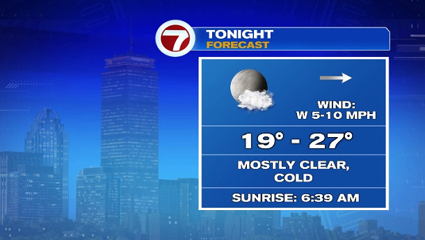
This evening, winds will continue to weaken, and under a mainly clear sky, temperatures will fall after sunset. Overnight lows will slip into the upper teens to low 20s in the suburbs, with areas closer to the coast and the cities will be in the mid 20s.
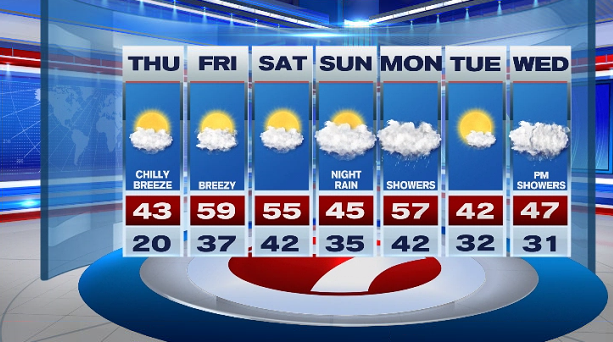
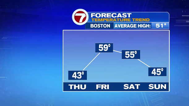
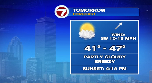
Although tomorrow will be slightly warmer than today, it will still be unseasonably cool (our average high this time of year is in the low 50s). It will be breezy Thursday with a southwest wind at 10-15 MPH under partly cloudy skies.
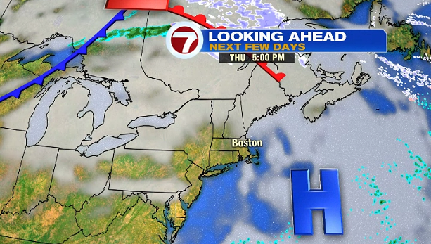
Friday will be the warmest out of the next 7-days with highs nearing 60°! The weekend looks great with highs in the mid-50s Saturday, slightly cooler Sunday due to an onshore breeze and more clouds.

Showers move in late Sunday night and continue into Monday. Tuesday is dry, followed by some afternoon showers and coastal wind on Wednesday.