Boston added another 70°+ day for November, tying the old record of 70°+ days set back in 1990 of 6. Worcester tied their record for the number of 70°+ days yesterday at 5.

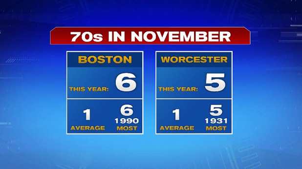
Plus, both cities broke their daily high record for November 11th.
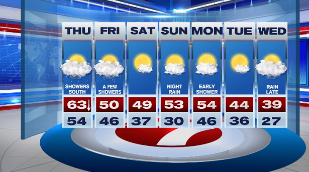
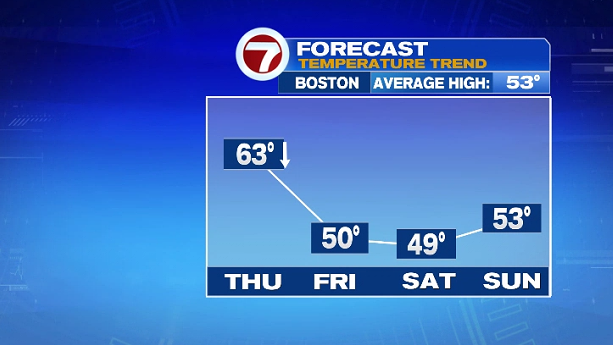
The record breaking warmth is on it’s way out as a cold front swings in tonight, ushering in falling temperatures for Thursday and below normal highs for Friday and Saturday.
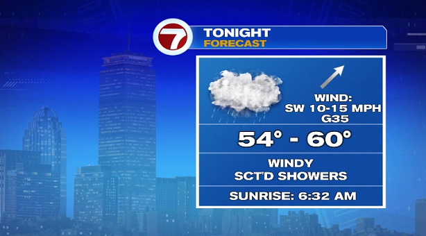
With this cold front, we’re also tracking a wet and windy night ahead. The rain will fill-in from 8PM through 10PM and linger into Thursday morning.

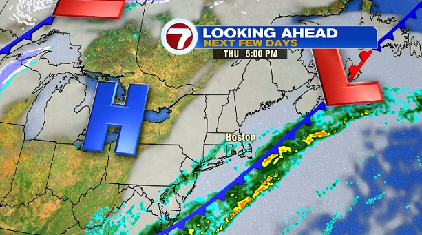
The bulk of the showers remain along the South Coast and the Cape and Islands through midday Thursday. The clouds will remain across the area for Thursday and even Friday.

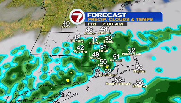
Friday brings another round of scattered showers. It will not be a washout, but you’ll need the rain gear on hand for your outdoor plans.

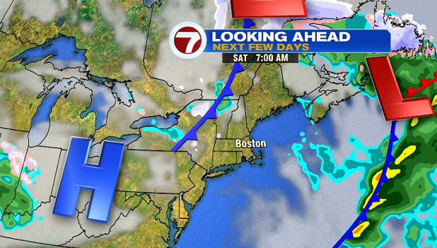
Saturday is dry but noticeably cooler than last weekend with highs around 50°. Sunday starts off dry with a few showers by late evening — do not worry, we’re not tracking a washout for the second half of the weekend.
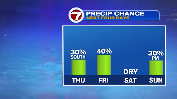
A few of the showers late Sunday will linger into early Monday, with a cool down through midweek with highs in the upper 30s by Wednesday.