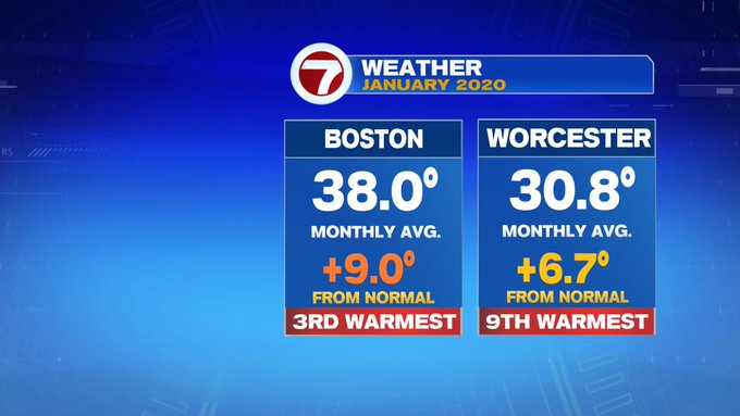
January 2020 was one for the record books. Not only did we see two days back to back in the 70s in Boston in early January (first time since records began), we ended the month the 3rd warmest, while Worcester finished 9th warmest January on record. Will February follow in January’s footsteps?
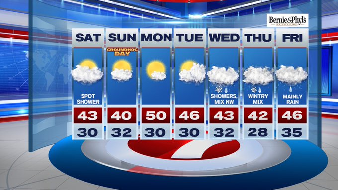
Looks like at least the first week will (but no 70s are in the forecast). For the first weekend of February (today and tomorrow), expect the cloud cover to linger for our Saturday. We started off with a few light showers and even a light dusting of snow for some spots, making for some slick travel. Thankfully, drier conditions and with temperatures now above freezing, slick spots are no longer an issue into this afternoon. Expect highs to be in the upper 30s to low 40s under cloudy skies.

Tonight, still under a blanket of clouds, temperatures only slip into the 20s for most locations.
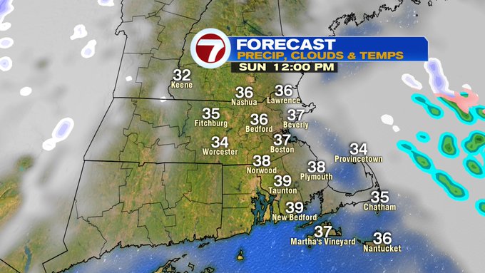
Sunday features some clouds in the morning, before we see emerging sunshine into the afternoon with highs around 40. Sunday night, as a front moves in, there is a chance for a spot flurry.

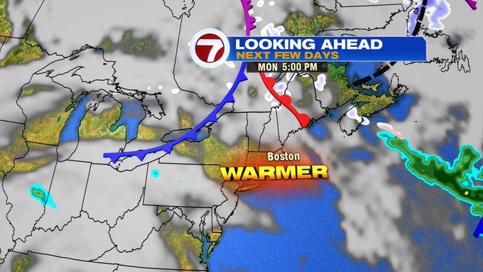
Monday, as the front lifts north, sunshine prevails along with warmer temperatures with highs around 50°. This warm-up is short-lived as more clouds stroll in for Tuesday and then another system moves in for midweek, bringing a messy wintry mix to the area Wednesday and Thursday, with mainly rain showers by Friday.
Overall, it looks like Monday will be the best day out of the first full week of February.