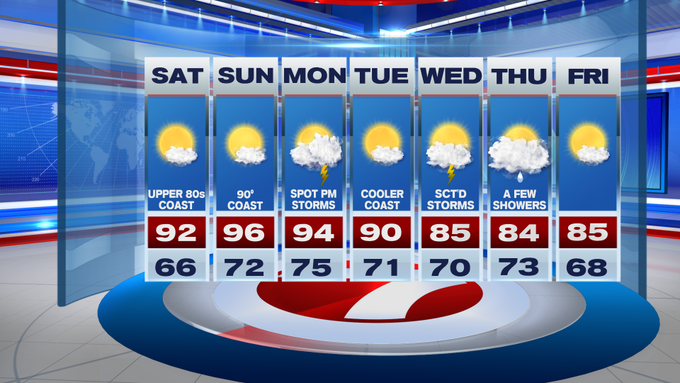
We’re tracking a weekend scorcher after unseasonably cool conditions for the second half of the last work week, so the 90+ degree heat may seem as a shock to those with outdoor plans this weekend.
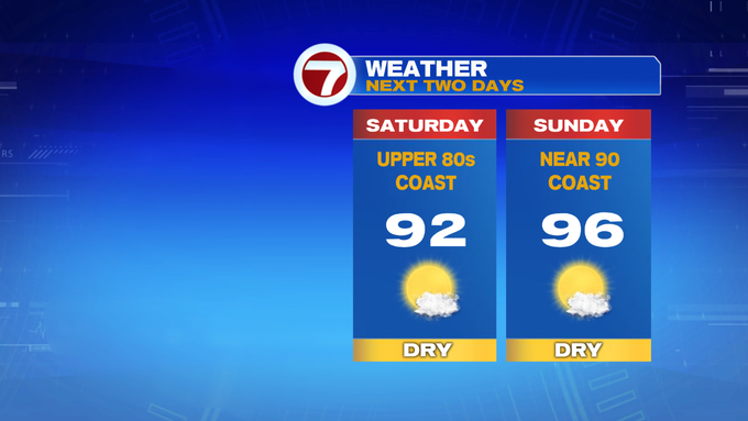
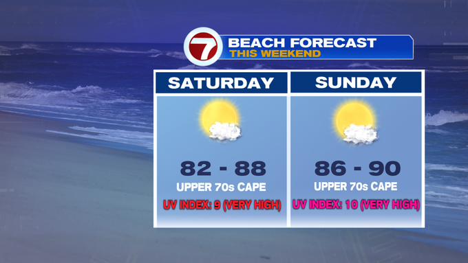
For your Saturday, an onshore breeze will keep temperatures slightly below 90 at the coast, while inland will stretch into the low 90s under mainly sunny skies.
Tonight, under mainly clear skies, temperatures only slide back into the mid to upper 60s to low 70s with the humidity also sticking around.
Sunday is the hottest over the next several days with highs into the mid to upper 90s inland, low 90s from the NH seacoast to Boston and the South Shore. The South Coast and the Cape and Islands will remain in the 80s.

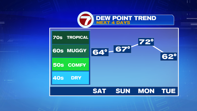
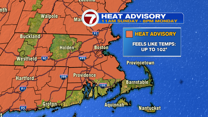
With the heat and humidity Sunday and Monday, a Heat Advisory has been issued for the 495-corridor and portions of SE MA away from the South Coast for heat index values in the triple digits. For some spots, it will feel like it’s 102°.

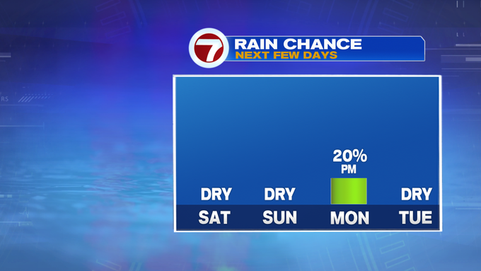
Both weekend days are dry, but Monday features our next chance for some afternoon thunderstorms with an approaching cold front. With the clashing air masses, there is a chance for some thunderstorms to become strong to severe. Tuesday is dry and still hot with highs near 90 (but not nearly as warm as Sunday and Monday).

The rest of the week, highs only stretch into the mid 80s with a few scattered showers and storms Wednesday and Thursday, while Friday brings drier conditions to end the week.